Warming Up Slightly Today
Warming Up Slightly Today
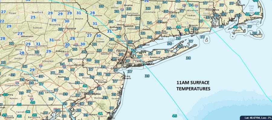
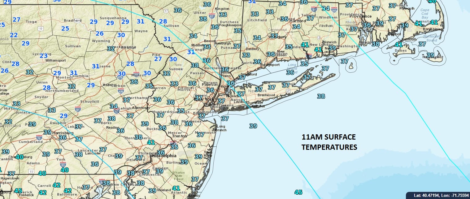
We are seeing a temperature recovery today as readings are in the mid to upper 30s as we approach the lunchtime our. We have some sunshine through some high clouds that have moved in this morning. The clouds will probably put a cap on how high temperatures get today. Low to middle 40s should just about do it.
The satellite loop shows a disturbance approaching the Western Great Lakes as the next cold front makes its way toward us on Thursday. Radars are quiet today and should remain so into Thursday morning.


Looking ahead to Thursday we will see some clouds and when the front comes through around mid morning there could be a few showers or some snow showers in colder northern areas. This should be in and out quick and weather conditions will improve in the afternoon. Highs should reach the 40s. Friday looks dry with some sunshine and highs in the 40s. There are no travel issues through Friday.

Christmas Eve sees precipitation moving in and since there isn’t cold air around it appears to be mainly rain. Yesterday it appeared this would hold off until late in the day Saturday as colder air was about to return however everything is moving faster. Inland areas well north and west might see a mix or some freezing rain early on as it might be cold enough in those areas Friday night into Saturday morning. The precipitation will be ending by late morning or early afternoon so it should be dry Saturday evening for all church services with no travel issues. Christmas day looks nice with some sunshine but it will be chilly with highs just into the 40s.
SNOW REMOVAL COMPANIES FOR YOUR WINTER NEEDS
LONG ISLAND ROCKLAND COUNTY Connecticut

![]()

FiOS1 News Weather Forecast For Long Island
FiOS1 News Weather Forecast For New Jersey
FiOS1 News Weather Forecast For Hudson Valley
NATIONAL WEATHER SERVICE SNOW FORECASTS
LATEST JOESTRADAMUS ON THE LONG RANGE
Weather App

Don’t be without Meteorologist Joe Cioffi’s weather app. It is really a meteorologist app because you get my forecasts and my analysis and not some automated computer generated forecast based on the GFS model. This is why your app forecast changes every 6 hours. It is model driven with no human input at all. It gives you an icon, a temperature and no insight whatsoever.
It is a complete weather app to suit your forecast needs. All the weather information you need is right on your phone. Android or I-phone, use it to keep track of all the latest weather information and forecasts. This weather app is also free of advertising so you don’t have to worry about security issues with your device. An accurate forecast and no worries that your device is being compromised.
Use it in conjunction with my website and my facebook and twitter and you have complete weather coverage of all the latest weather and the long range outlook. The website has been redone and upgraded. Its easy to use and everything is archived so you can see how well Joe does or doesn’t do when it comes to forecasts and outlooks.
Just click on the google play button or the apple store button on the sidebar for my app which is on My Weather Concierge. Download the app for free. Subscribe to my forecasts on an ad free environment for just 99 cents a month.
Get my forecasts in the palm of your hand for less than the cost of a cup of Joe!


