Warmer More Humid Right Through Fathers Day Summer Arrives Saturday
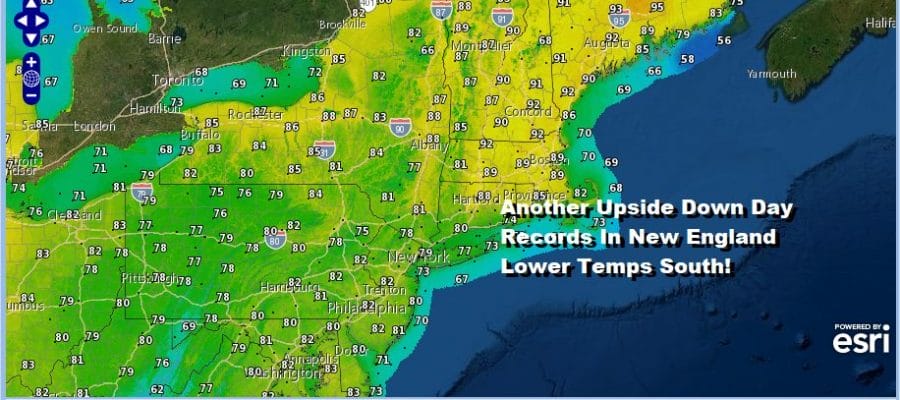
We continue to progress into a warmer and more humid air mass. The upper low to our south that has been sitting in the Middle Atlantic states for the last several days has helped to create what I refer to as upside down conditions with 90s in New England and 60s and 70s in the Carolinas and Georgia. The upper low is weakening and the atmosphere along the east coast will slowly normalize through the weekend. This means increasingly warmer and more humid conditions. Today we will see some sunshine and most areas will see highs climb back into the 80s. We will be watching for pop up showers and thunderstorms that will be scattered around mainly inland. Most of you won’t see any showers.
SATELLITE

REGIONAL RADAR

Other than the low clouds and fog that is around, we aren’t seeing much regarding rain or showers on the radar this morning. Some scattered pop up showers and thunderstorms will develop later today but they should be few and far between. Most of you won’t see anything.
LOCAL RADAR NEW YORK CITY

LOCAL RADAR PHILADELPHIA


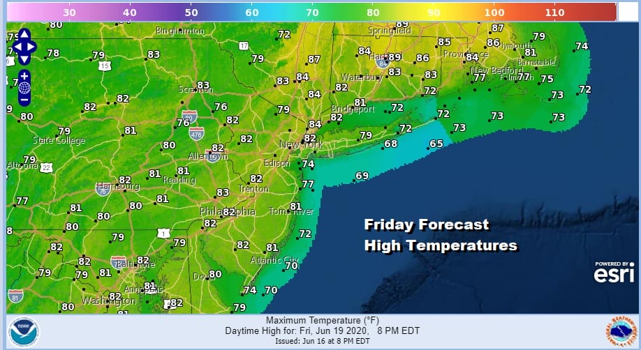
Tonight looks to be warm and humid with some patchy dense fog around. Most lows will be in the 60s to near 70. Then it is on the weekend with summer arriving Saturday with weather to match. Sunshine and some clouds along with very warm and humid conditions will dominate the weather scene. Highs will reach the mid to upper 80s inland with 70s along the shore. A few scattered pop up showers and thunderstorms will be around but again they will be scattered and most of you won’t see any.

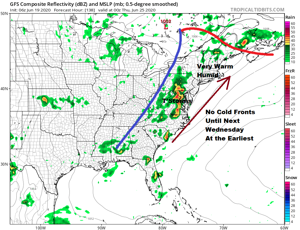
The jet stream pattern is a summery one for the east through the weekend and into next week. You can see the weak upper low leftover in the East on Saturday getting kicked out of the way. Then it is a southwest flow until midweek bringing a cold front close on Wednesday.
Until then it is very warm to hot and humid which is what Father’s day will be. Highs will be in the mid to upper 80s and a little cooler at the shore. Again there is the chance for a pop up scattered shower or thunderstorm. Monday will be hot with highs reaching close to or even over 90 in some places.

Next Tuesday is the same; very warm to hot and humid with highs in the mid 80s to near 90 and the chance for a pop up shower or thunderstorm. Wednesday brings an approaching cold front as mentioned earlier. It is unknown whether that front ever makes it through here in which case not much in the way of relief lies ahead. HELLO SUMMER!
BE SURE TO DOWNLOAD THE FREE METEOROLOGIST JOE CIOFFI WEATHER APP &
ANGRY BEN’S FREE WEATHER APP “THE ANGRY WEATHERMAN!
MANY THANKS TO TROPICAL TIDBITS FOR THE USE OF MAPS
Please note that with regards to any severe weather, tropical storms, or hurricanes, should a storm be threatening, please consult your local National Weather Service office or your local government officials about what action you should be taking to protect life and property.


