Warmer More Humid Conditions Pop Up Showers Next Several Days
We are transitioning to a warmer and more humid air mass and we certainly saw the results of that this morning with many areas sitting in low clouds and patchy fog. The satellite today is still showing the swirl of clouds to the south over the Mid Atlantic states. This is the same upper low that has been basically sitting in the same spot for the last several days. To the north in New England we have another hot day with highs in the mid 80s to near or over 90 degrees in spots while temperatures will be lower from areas around NYC south and west where clouds and an ocean wind will likely keep temperatures in the 70s to some lower 80s in the warm spots. 60s will be dominating areas along the immediate shore.
SATELLITE

REGIONAL RADAR

The upper low has weakened somewhat today from the last few days and the regional radar is showing only some scattered showers at the moment. The arc of the upper low has moved far enough north so that a few scattered showers are coming in from the southeast off the New Jersey coast and headed northwest so if you run into a shower or downpour don’t be surprised. It should be brief.
LOCAL RADAR NEW YORK CITY

LOCAL RADAR PHILADELPHIA


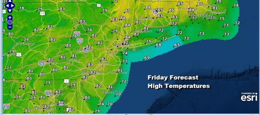
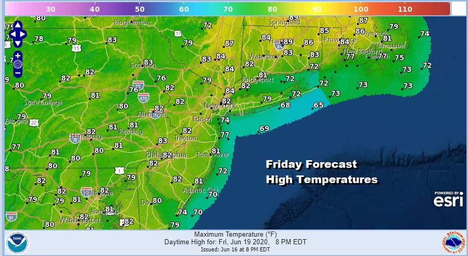
Nothing much has changed in the forecast logic right through the weekend and into early next week. It will be increasingly warmer and more humid each day. Each day will offer the chance for some pop up scattered showers or a thunderstorm. Some days more and some less. Temperatures will be edging higher each day. Friday’s highs should reach into the 80s.
Nights will be warm and humid as showers will tend to disappear and we will be left with some low clouds and in some areas some patchy fog will develop before sunrise. The weekend looks warm and summery with some sunshine and the chance for the odd downpour or thunderstorm popping up. Again it will be more misses than hits and they don’t last long.

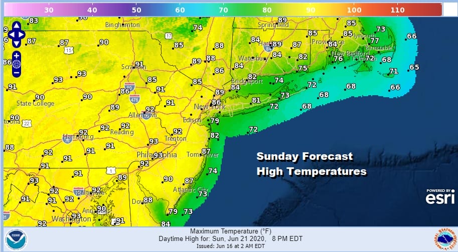
Saturday we will start pushing the temperatures to the mid and upper 80s. With the upper low gone the upside down nature of warmer temperatures north and cooler south will disappear. Sunday Father’s Day will be very warm to borderline hot in spots with sunshine and high humidity. Again there is the chance for a pop up shower or thunderstorm. Highs will be in the 80s to near 90 in the hot spots and 70s at the beaches.
Summer officially arrives Saturday so the weekend will indeed be summery and the temperatures will be in the mid 80s to near 90 degrees Monday and Tuesday. Hot and humid conditions could trigger off a scattered shower or thunderstorm. it looks as if the next cold front will arrive late Wednesday which means hot and humid ahead of it and a good chance for thunderstorms late in the day. No doubt about it folks summer is here!
BE SURE TO DOWNLOAD THE FREE METEOROLOGIST JOE CIOFFI WEATHER APP &
ANGRY BEN’S FREE WEATHER APP “THE ANGRY WEATHERMAN!
MANY THANKS TO TROPICAL TIDBITS FOR THE USE OF MAPS
Please note that with regards to any severe weather, tropical storms, or hurricanes, should a storm be threatening, please consult your local National Weather Service office or your local government officials about what action you should be taking to protect life and property.


