Warmer But Still Comfortable Hot Humid 90S Friday
Showers Thunderstorms Start July 4th Weekend

Warmer But Still Comfortable Hot Humid 90S Friday
Showers Thunderstorms Start July 4th Weekend
We continue to march along in the same wash rinse repeat pattern we have been in. We get a couple of days of reasonable temperatures and humidity followed by a day or two of hot and more humid weather and then it comes to an end with a cold front and the risk for showers and thunderstorms. We are still in the middle of the good part of this stretch and we have a nice sunny Wednesday with just a few patchy clouds coming into the mix.
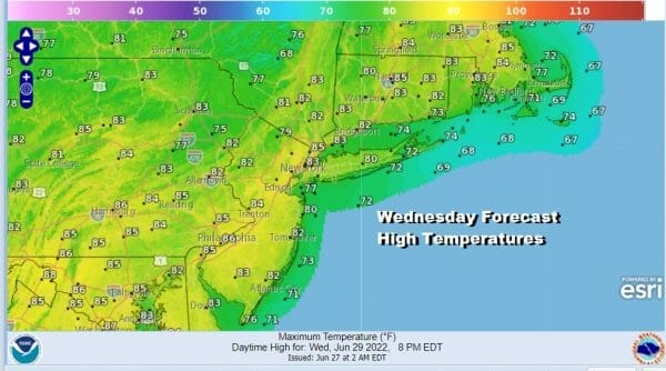 Temperatures will be headed a little higher than yesterday and we should top out in the low to mid 80s. Other than a few clouds, we don’t see any issues. An upper trough will be moving through upstate NY and Northern New England and there could be a few showers there but we don’t see any issues showing up on the radar today nor do we see any through Friday. Humidity levels will remain subdued today.
SATELLITE

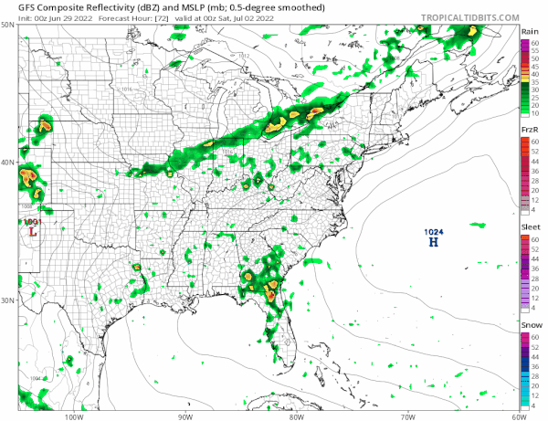
WEATHER RADAR

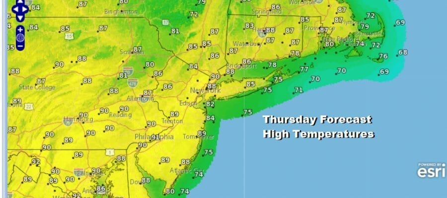
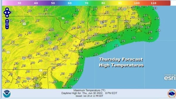
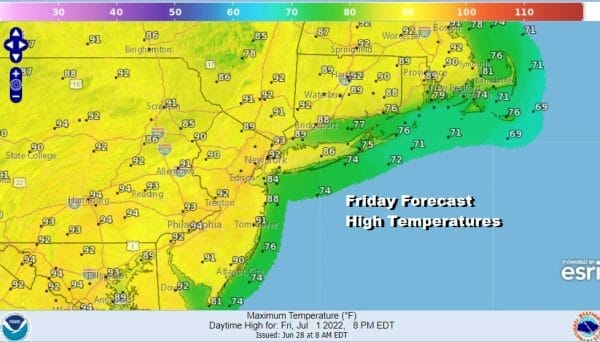
The trend to higher temperatures continues Thursday and while the dew points will come up, they should still be borderline reasonable. However you will start to notice the changes. Sunshine Thursday will take highs to the mid to upper 80s with warm spots close to 90. Friday we will see the hottest temperatures of the week with highs reaching the low to mid 90s with sunshine. No rain is forecast either day.. It will be noticeably more humid though come Friday.
Let’s move on to the weekend. We are going to start the 4th of July weekend very warm and humid and a cold front will be approaching and moving through. There will be showers and thunderstorms running around in the afternoon and evening. Highs will be in the mid to upper 80s. The forecast dilemma was whether the front would get hung up for a short time extending clouds at least into Sunday.
It does seem as if the front wants to keep on moving so I will continue to go with the idea of some morning clouds giving way to sunshine Sunday along with lower humidity. Highs will be in the low to mid 80s. High pressure moves overhead Sunday night into Monday morning leaving us with a 4th of July of sunshine and highs in the low to mid 80s. I think the humidity should be reasonable Sunday and Monday. Next Tuesday we will warm up again and turn more humid ahead of another cold front and the chance for thunderstorms late Tuesday. That will be followed by another dry cooler air mass. It is a wash rinse repeat pattern with no signs of breaking down anytime soon.
BE SURE TO DOWNLOAD THE FREE METEOROLOGIST JOE CIOFFI WEATHER APP &
ANGRY BEN’S FREE WEATHER APP “THE ANGRY WEATHERMAN!
MANY THANKS TO TROPICAL TIDBITS & F5 WEATHER FOR THE USE OF MAPS
Please note that with regards to any severe weather, tropical storms, or hurricanes, should a storm be threatening, please consult your local National Weather Service office or your local government officials about what action you should be taking to protect life and property.


