Warmer Air Racing Eastward Dry Monday
Chance For Rain Late Tonight Before Temps Rise

Warmer Air Racing Eastward Dry Monday
Chance For Rain Late Tonight Before Temps Rise
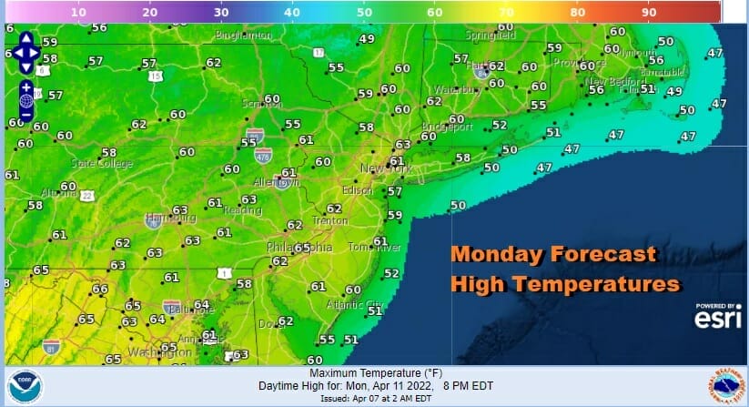
The weekend upper trough has finally moved out of the Eastern US and we are seeing the start of a big ridge building along the East Coast. The satellite shows mostly cloud free conditions to start the day from Maine to Florida. We also see clouds in a narrow north south band from north of Lake Erie south west into Ohio and Indiana. Radars aren’t showing much at the moment. As long as that remains the case sunshine should be able to take highs into the 60s in most places.
SATELLITE

WEATHER RADAR

A warm front will move through later tonight and when it goes by, we could see a brief period of rain into Tuesday morning. Temperatures overnight will likely hold up in the 40s. Once the rain ends early clouds will give way to sunshine rather quickly Tuesday. That should allow temperatures to reach the low and middle 70s in many locations.

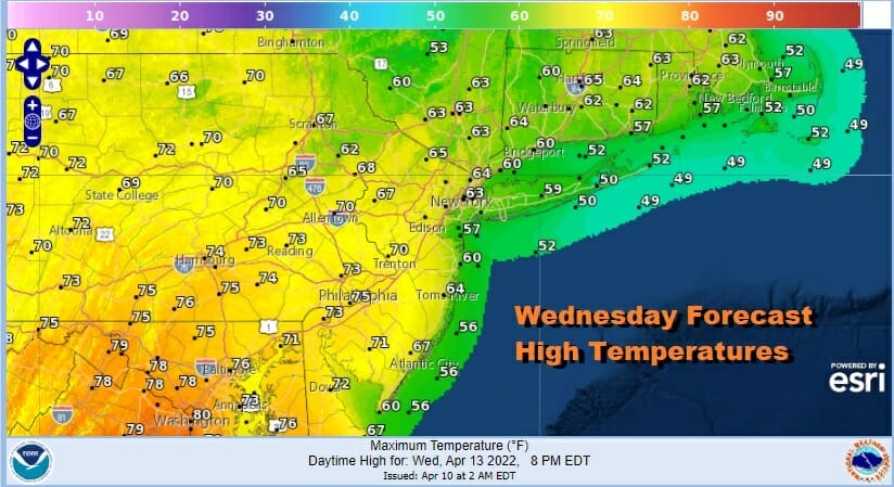
Wind direction will be the driver of temperatures Tuesday through Thursday. Winds Tuesday will be mostly from the west however on Wednesday winds will be more from the south. That and the prospect for some cloud cover will likely hold temperatures down a bit. Highs will reach into the 70s inland but will be in the 60s along the coast especially in areas with south and east facing shorelines.
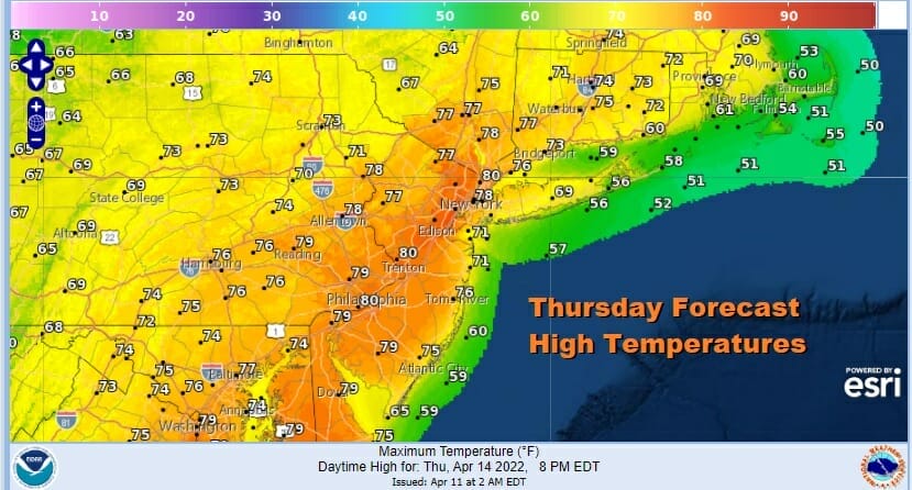
Thursday brings the next cold front and it will be a warm day ahead of the front with some sunshine and highs reaching the 70s with some warm spots reaching 80 degrees.
We will see a few showers late in the day into Thursday night. There could also be a thunderstorm or two in the mix and we will watch to see whether there could be some severe weather risks.

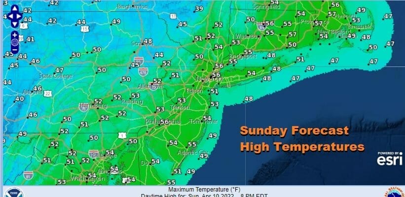
It seems we should be mostly dry Friday through Easter Sunday with one minor interruption late Saturady when a cold front approaches and passes. There could be some showers and thunderstorms when that front goes by Saturday. Easter Sunday looks dry and cool. High temperatures Friday and Saturday will be in the 60s but Sunday right now looks to be cool with highs just in the 50s.
BE SURE TO DOWNLOAD THE FREE METEOROLOGIST JOE CIOFFI WEATHER APP &
ANGRY BEN’S FREE WEATHER APP “THE ANGRY WEATHERMAN!
MANY THANKS TO TROPICAL TIDBITS & F5 WEATHER FOR THE USE OF MAPS
Please note that with regards to any severe weather, tropical storms, or hurricanes, should a storm be threatening, please consult your local National Weather Service office or your local government officials about what action you should be taking to protect life and property.


