Warmer Air Moving In Showers Tonight Into Friday
Warmer Air Moving In Showers Tonight Into Friday
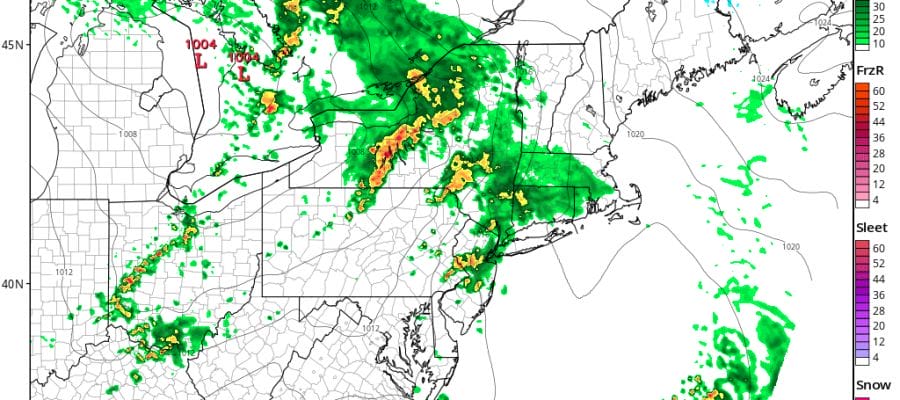
We are seeing some showers moving offshore this morning on the radar and this should be the last batch for awhile today as we wait for the cold front to the west to swing eastward. We will probably spend the rest of the day fighting off cloud cover. The onshore wind has relaxed and with a little luck and some breaks in the cloud cover, some areas today could see the lower 70s though i suspect that most areas will remain in the 60s.
SATELLITE LOOP

You can see the break in the cloud cover as the first system moves out and the second one behind it for tonight into Friday morning moves across the Great Lakes. Showers with that are beginning to come into range of the regional radar. However given the distance between us, I suspect little if any shower activity until after the evening rush hour is done.
REGIONAL RADAR

LOCAL RADAR NEW YORK CITY

LOCAL RADAR PHILADELPHIA


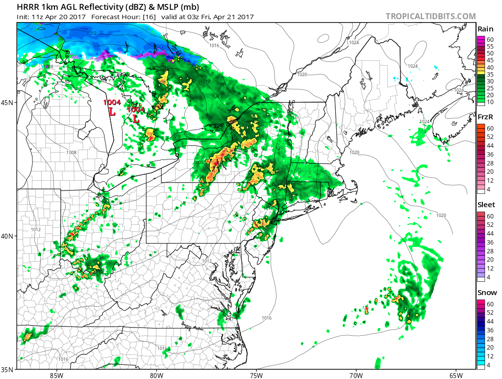
The HRRR model at the moment shows some showers and possibly an thunderstorm rolling through around 9-11pm tonight. A stronger line is northwest of it.
Once the cold front moves through Friday morning we may have clouds to chew through with temperatures in the 60s. Then skies should clear out. The weekend is looking a bit better as the rain system for Sunday continues to evolve weaker and further south and taking longer to play out. It is possible that the low will move offshore first and swing northward bringing some rain to the coast but not until Monday night or Tuesday if that happens. I think we can be more optimistic for the weekend.
 GET JOE A CIGAR IF YOU LIKE

LANDSCAPE COMPANIES FOR YOUR NEEDS
LONG ISLAND ROCKLAND COUNTY Connecticut

![]()

ROCKLAND COUNTY TRI STATE SNOW REMOVAL JOHNSTOWN PA


FiOS1 News Weather Forecast For Long Island
FiOS1 News Weather Forecast For New Jersey
FiOS1 News Weather Forecast For Hudson Valley
NATIONAL WEATHER SERVICE SNOW FORECASTS
LATEST JOESTRADAMUS ON THE LONG RANGE
Weather App

Don’t be without Meteorologist Joe Cioffi’s weather app. It is really a meteorologist app because you get my forecasts and my analysis and not some automated computer generated forecast based on the GFS model. This is why your app forecast changes every 6 hours. It is model driven with no human input at all. It gives you an icon, a temperature and no insight whatsoever.
It is a complete weather app to suit your forecast needs. All the weather information you need is right on your phone. Android or I-phone, use it to keep track of all the latest weather information and forecasts. This weather app is also free of advertising so you don’t have to worry about security issues with your device. An accurate forecast and no worries that your device is being compromised.
Use it in conjunction with my website and my facebook and twitter and you have complete weather coverage of all the latest weather and the long range outlook. The website has been redone and upgraded. Its easy to use and everything is archived so you can see how well Joe does or doesn’t do when it comes to forecasts and outlooks.
Just click on the google play button or the apple store button on the sidebar for my app which is on My Weather Concierge. Download the app for free. Subscribe to my forecasts on an ad free environment for just 99 cents a month.
Get my forecasts in the palm of your hand for less than the cost of a cup of Joe!


