Warm Sunny Friday Showers Saturday Weather Improves Sunday

Warm Sunny Friday Showers Saturday Weather Improves Sunday
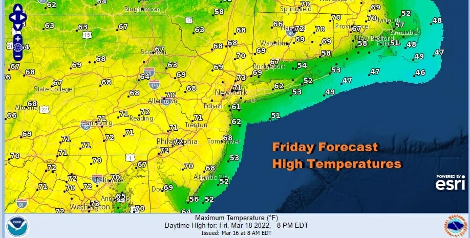
After a night of fog it has burned off to sunshine across the area and that sets us up nicely for a warm afternoon. The satellite shows low clouds still hanging around the coastal waters and a few shore areas but for the most part this afternoon we are going to have sunshine. Highs should reach 70 or better in most inland spots but areas along the coast especially with south and east facing shorelines will be about 10 degrees or so cooler. Radars are nice and quiet but that will change as the next system arrives for Saturday.
SATELLITE

WEATHER RADAR

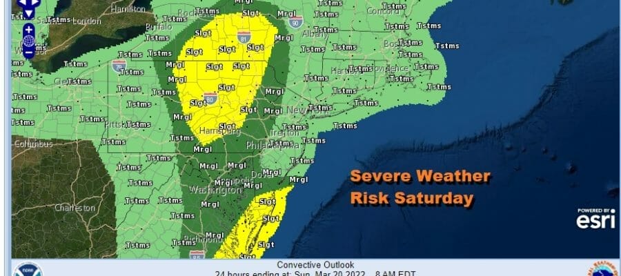
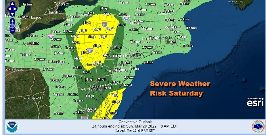
Clouds will increase overnight and showers will move in Saturday morning ahead of a warm front coming up from the south. It is a spring pattern and that means that the warm front likely gets stuck nearby. This is going to impact temperatures on Saturday. It also sets up severe weather risk areas but the coastal areas are going to deal with marine air and that should keep most of the risk area to the west and south. The yellow area is slight risk and the dark green is marginal risk. The lightest green represents general thunderstorm risk that is not expected to be severe.
It will not rain all day and there will be break periods where we just sit in clouds. You can see how the marine flow and the warm front impact the high temperature forecasts. Highs will be in the 50s to near 60 north and east of the warm front and 60s and 70s to the southwest.

We will be watching for the possibility of afternoon and evening thunderstorms as a cold front approaches and moves through. This leads to improving weather conditions for Sunday. We will see sunshine and clouds with the slight chance for an isolated passing afternoon shower. Most highs will be in the 50s to around 60 or so in the warmest locations.

Next week will begin dry and on the chilly side though temperatures will be close to or a little above average. Monday we will see sunshine and some clouds. There is a weak upper air disturbance moving southeast from the Great Lakes and that could trigger a shower in areas mainly north of NYC. Areas to the south will see more sun and fewer clouds. Highs will be in the upper 50s and lower 60s.

It should remain dry Tuesday into Wednesday before the next warm front cold front combination moves our way. Strong low pressure from the Southern Plains will head northeast and probably redevelop off the coast of Southern New England Wednesday night and Thursday. This will bring some rain in Wednesday night into Thursday before weather conditions improve after that. Spring arrives next week officially but though the season changes, the overall pattern looks to be mostly unchanged through next week.
BE SURE TO DOWNLOAD THE FREE METEOROLOGIST JOE CIOFFI WEATHER APP &
ANGRY BEN’S FREE WEATHER APP “THE ANGRY WEATHERMAN!
MANY THANKS TO TROPICAL TIDBITS & F5 WEATHER FOR THE USE OF MAPS
Please note that with regards to any severe weather, tropical storms, or hurricanes, should a storm be threatening, please consult your local National Weather Service office or your local government officials about what action you should be taking to protect life and property.


