Severe Weather Risks Today New Jersey Pennslyvania Hudson Valley Catskills
Severe Weather Risks Today New Jersey Pennslyvania Hudson Valley Catskills
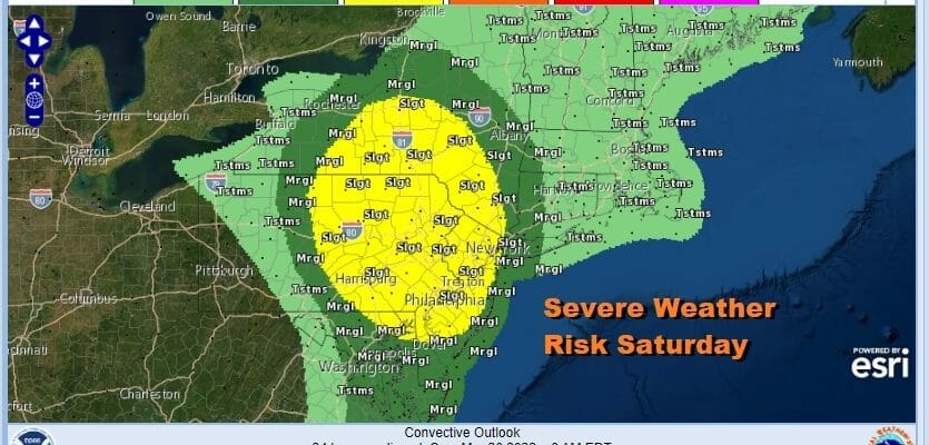
The Storm Prediction Center has expanded the risk zone for today go extend from South Central New York to the Catskills and the Hudson Valley, southward to include the eastern half of Pennsylvania, all of New Jersey to Northeastern Maryland south to Delaware. The marginal risk zone covers Western Connecticut and Long Island to the east side north to Albany and Western Massachusetts.
We also have elevated tornado risk of 2 to 5% across much of the slight risk zone. The risk means that there is the chance for a tornado within 25 miles of any point in the risk zone. This continues the trend of last year where elevated tornado risk was rather common through the summer and fall especially the late fall where we saw two significant tornado outbreaks in the region; one in New Jersey and the other in Long Island and Connecticut.
SATELLITE
WEATHER RADAR
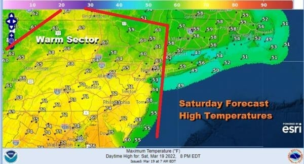
Yesterday it looked as if the warm sector would set up a little further west and inland but we have seen that push to the coast with the warm front lining up from Western Massachusetts and Connecticut southward to off the New Jersey coast. This has pushed the risk zones eastward. High temperatures will reach the mid 60s to lower 70s in the warm sector and 50s to near 60 to the northeast.
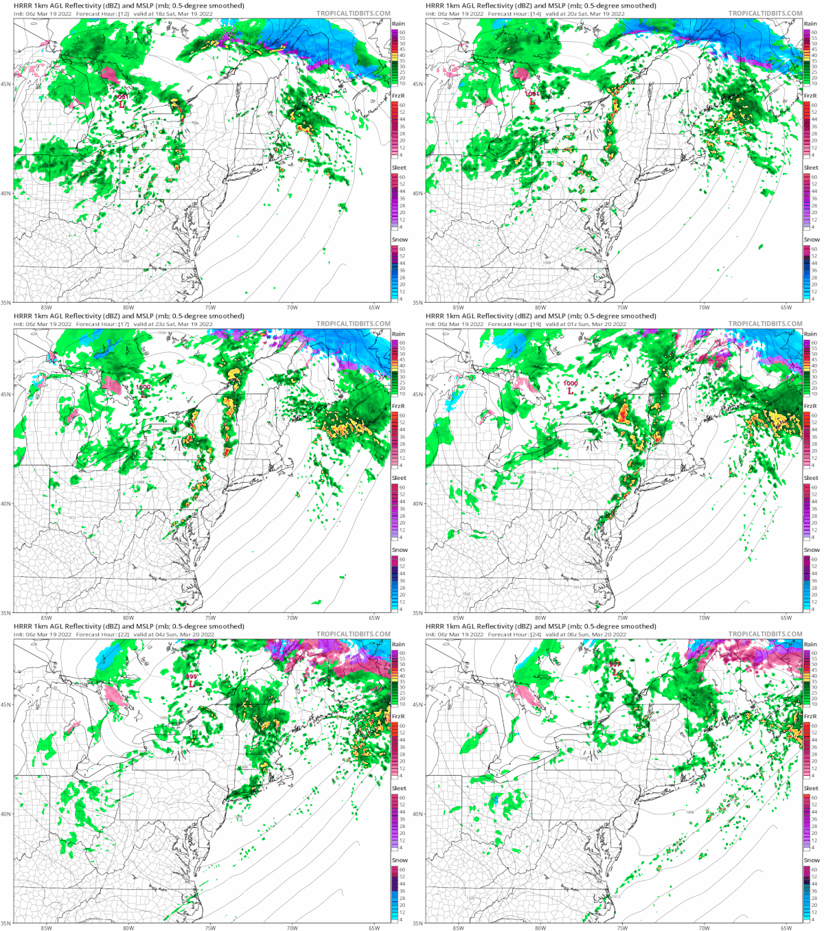
The radars will be quiet until this afternoon when showers and thunderstorms will develop across Pennsylvania and move eastward. There is the chance we could see one or two supercells in the mix as dew points rise up into the 60s and the atmosphere becomes destabilized. The best chances for thunderstorms will be late this afternoon to the west of the coast and this evening to the east. The loop of the HRRR model below is hour by hour from 2pm Saturday to 2am Sunday.
Weather conditions improve Sunday though it will be a windy cooler day with sunshine and clouds and the chance for a passing brief shower. Highs will be in the mid 50s to around 60 degrees. Monday into Wednesday look to be dry other than some clouds in the mix Monday with a weak disturbance. Highs Monday will be in the upper 50s and lower 60s . Tuesday into Wednesday will be colder with sunshine Tuesday and arriving clouds on Wednesday. Highs Tuesday will be in the 50s and in the mid 40s to lower 50s Wednesday. The next weather system will arrive with some rain late Wednesday into early Thursday.
BE SURE TO DOWNLOAD THE FREE METEOROLOGIST JOE CIOFFI WEATHER APP &
ANGRY BEN’S FREE WEATHER APP “THE ANGRY WEATHERMAN!
MANY THANKS TO TROPICAL TIDBITS & F5 WEATHER FOR THE USE OF MAPS
Please note that with regards to any severe weather, tropical storms, or hurricanes, should a storm be threatening, please consult your local National Weather Service office or your local government officials about what action you should be taking to protect life and property.


