Warm Start To New Week Tuesday Storms Pass Well South
Late Week Severe Weather Risks

Warm Start To New Week Tuesday Storms Pass Well South
Late Week Severe Weather Risks
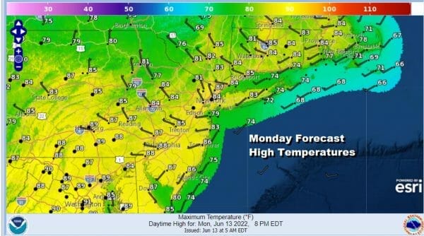
A new week begins and it starts with some lingering clouds and showers on the radar this morning but these will fade away soon. Last night’s cold front came through with not much in the way of shower and thunderstorm activity and now we can settle in with improving weather conditions today with decreasing clouds and increasing sunshine. Highs today will reach the middle to upper 80s. As the atmosphere stabilizes today we will not see much if any activity on the radars.
SATELLITE

WEATHER RADAR

There won’t be much happening tonight other than some passing clouds however we have been speaking over the last few days regarding what is known as a mesoscale convective system. This is a a long lived cluster of thunderstorms that can cover a thousand or more miles of distance and can result in severe weather. It appears that the system is going to track further south into the Mid Atlantic states though there is still some model disagreement here regarding track.
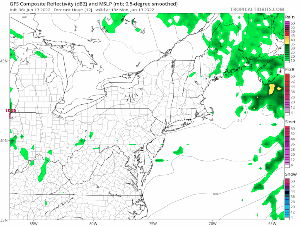
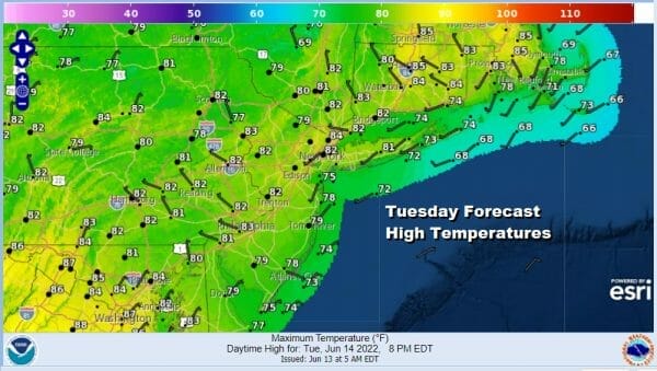
Models are also showing a weakening trend with this as it moves southeastward. For now we are going to go with the idea that Tuesday will be a day of changeable skies to partly sunny. We will include the chance for thunderstorms from Southeast Pennsylvania, Southern New Jersey and points southward. Highs Tuesday will be in the low to middle 80s in most places.
Wednesday we see high pressure building off the New England coast setting up a south wind which has less impact this time of year than say a month or even two weeks ago. Look for sunshine and a few clouds Wednesday with highs into the 80s inland and 70s to near 80 along the coast. Then we turn our attention to Thursday where we start to watch the next cold front (or cold fronts).

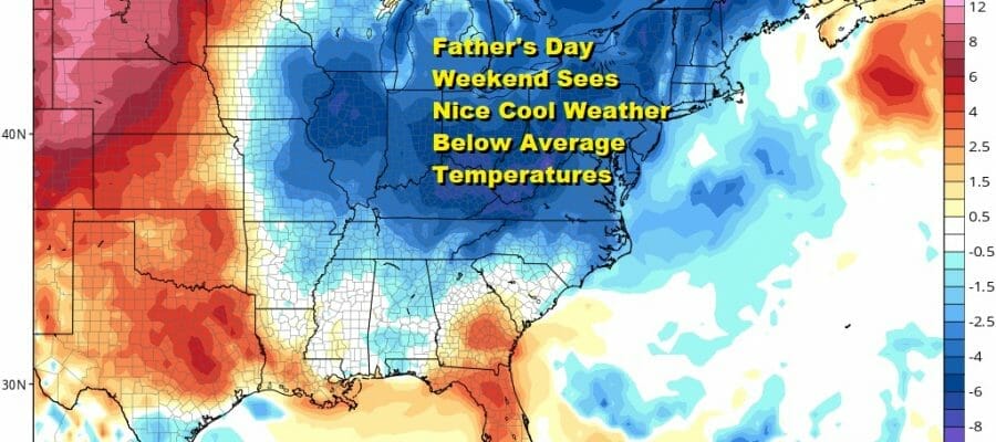
Thursday sees the chance for showers and thunderstorms later in the day as the first of two fronts moves through the east. Highs will be in the 80s. The second front arrives Friday with a chance for thunderstorms. It will also be the warmest day this week with highs in the mid to upper 80s. However that second front will usher in a large cool air mass into the east for all of Father’s Day weekend. We expect sunshine and pleasant conditions for Saturday and for Sunday. Highs both days will be in the 70s and the nights will be in the nice and cool 50s and possibly even some 40s inland.
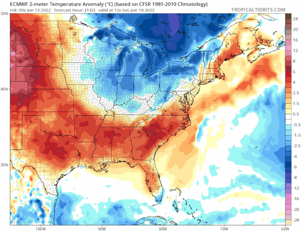
All the models are now lined up and show a strong northwest flow from Eastern Canada that actually pushes below average temperatures all the way south into parts of the Southeast US next weekend. The trough off the East Coast should keep it dry and cool into early next week. Eventually we could see part of that energy separate and drop to the off shore the Middle Atlantic states later next week which may have some doom and gloom complications but it does keep things cooler than average temperature wise for an extended period of time. In other words, there are no long duration or even short duration heatwaves coming anytime soon.
BE SURE TO DOWNLOAD THE FREE METEOROLOGIST JOE CIOFFI WEATHER APP &
ANGRY BEN’S FREE WEATHER APP “THE ANGRY WEATHERMAN!
MANY THANKS TO TROPICAL TIDBITS & F5 WEATHER FOR THE USE OF MAPS
Please note that with regards to any severe weather, tropical storms, or hurricanes, should a storm be threatening, please consult your local National Weather Service office or your local government officials about what action you should be taking to protect life and property.


