Warm Spring Temperatures But Watch The Backdoor Cold Front

Warm Spring Temperatures But Watch The Backdoor Cold Front
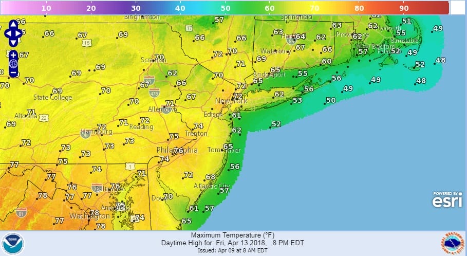
The well advertised warm up is on its way and it will begin on Thursday when temperatures head into the 60s everywhere. That is no small feat considering how the weather pattern has been lately. A weak front goes by and that sets up the west southwest wind and high pressure off the East Coast pumping up warmer air. Friday will be warm with most highs reaching the upper 60s to middle 70s. The sea breeze will be an issue Friday only for the immediate coast of New Jersey and Long Island where temperatures will likely fall back into the 50s later in the afternoon. We should see plenty of sunshine and overall, everyone will feel the nice warmth that has been so lacking this spring so far.
FRIDAY FORECAST HIGH TEMPERATURES
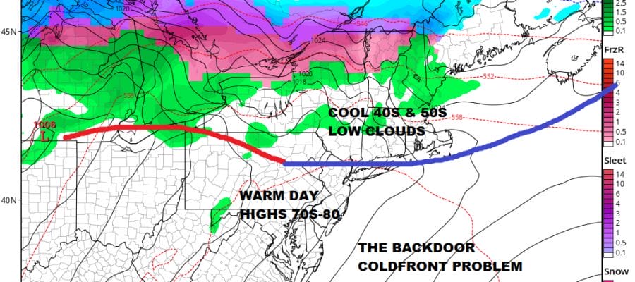
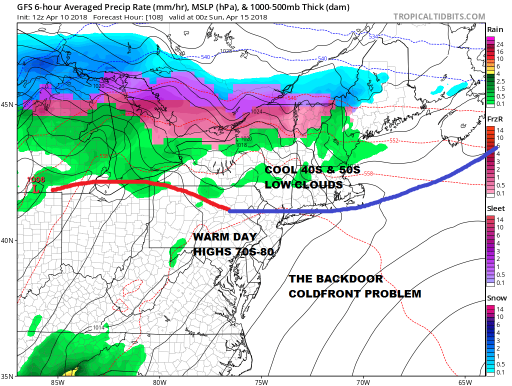
Saturday however brings the inevitable spring time issue of the backdoor cold front. We can say that at least for New Jersey and Eastern Pennsylvania and points southward it is not going to be an issue during the day. Sunshine and a west wind will take temperatures through the 70s and I’m sure someone is going to see 80 for the first time since..well…back in February! However east of New York City, Southern New England & Long Island there could be an issue after mid morning as a cold front slides southwestward from New England or as otherwise known as the backdoor cold front. Weather models of course have a different idea on how fast this front drops southward.
GFS FORECAST 8PM SATURDAY APRIL 14, 2018
GEM FORECAST 8PM SATURDAY APRIL 14, 2018
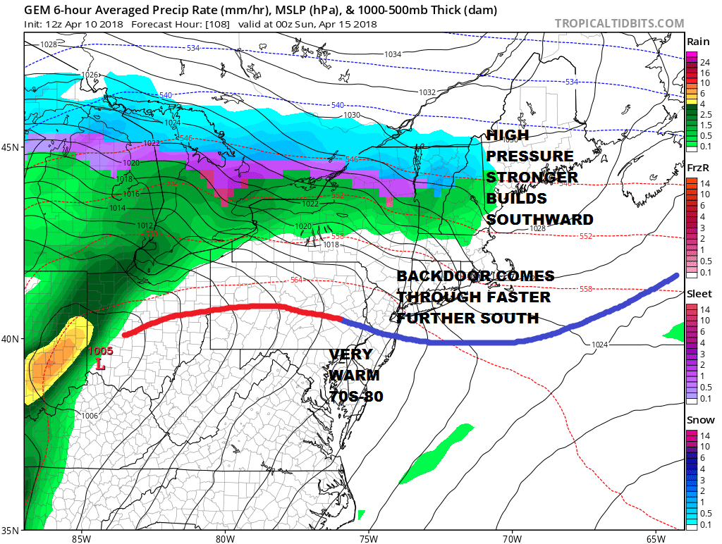
In either case, either the GFS or the Canadian New Jersey & Eastern Pennsylvania southward temperatures will hit the 70s to near 80 with ease. Even if the front is like the Canadian (and a few other models) even North Jersey to NYC, Southern Areas of the Hudson Valley and maybe even western Long Island & Southwest Connecticut reach the 70s before the wind shifts in the afternoon. Those models would bring the front down to Central New Jersey by evening. This is going to make forecasting highs a bit tricky. For now we lean optimistic but watching.
GFS RAINFALL FORECAST THROUGH MONDAY APRIL 16, 2018
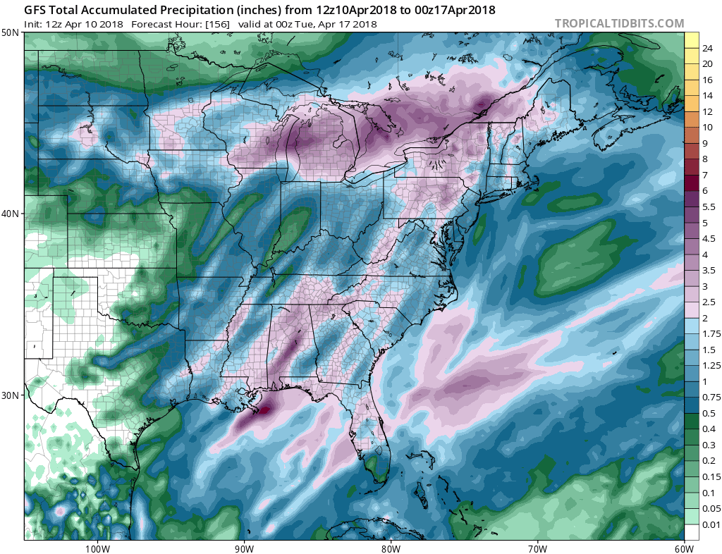
Either way Sunday looks like a mess with an onshore flow, temperatures in the 50s and even the 40s on Long Island. Rain arrives either with the onshore flow or an approaching cold front coming in from a deep storm heading for the Eastern Great Lakes. The Gulf of Mexico and Atlantic Ocean are going to be wide open with moisture and a sold 1 to 3 inches of rain is likely for a wide area of the Eastern US. Throw a few rumbles of thunder in the mix and we have some nasty spring weather coming. Be sure to take advantage of the sunshine while it lasts.
As far as next week is concerned the pattern turns blocky again and JOESTRADAMUS will address this issue later today.
SHOP THE JOESTRADAMUS STORE
MANY THANKS TO TROPICAL TIDBITS FOR THE WONDERFUL USE OF THE MAPS

GET JOE A CIGAR IF YOU LIKE!
FiOS1 News Weather Forecast For Long Island
FiOS1 News Weather Forecast For New Jersey
FiOS1 News Weather Forecast For Hudson Valley
NATIONAL WEATHER SERVICE SNOW FORECASTS
LATEST JOESTRADAMUS ON THE LONG RANGE