Warm Humid Showery Friday Improvement Over the Weekend
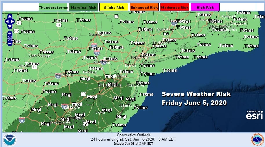
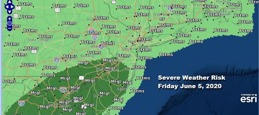
We have made it to another Friday in a week where thunderstorms have been front and center in a warm and humid environment. There is no change to that today though perhaps the magnitude of severe weather could be a bit less today. The Storm Prediction Center has only a marginal risk for severe weather today and tonight from Virginia northeast into Southeast Pennsylvania and Southern New Jersey with general thunderstorms possible elsewhere. We had some thunderstorms overnight and we are sitting in clouds on the satellite picture. We will probably break out into some sunshine in places today. Some will see more than others. Highs will be in the in the upper 70s and lower 80s.
SATELLITE

REGIONAL RADAR

Regional radar shows a belt of showers moving southwest to northeast. Nothing seems especially heavy on the local radars. Note that the NYC radar in Upton NY (Long Island) remains down and will be out of commission for the next few weeks. We will be alternating radars from Albany, Binghamton, and elsewhere as needed and where appropriate.
LOCAL RADAR ALBANY NY

LOCAL RADAR PHILADELPHIA


We are going to be looking for showers and thunderstorms to develop,late this afternoon into this evening from Maryland to Southern New England. Some areas could see heavy rain in these storms. They could last into the first part of tonight before they wind down. Rainfall amounts will have a wide range from as little as a half an inch or less to as much as an inch to an inch and oa half and that will depend totally on how the showers line up.

Saturday brings us to a change in air mass though it may take all day to get it underway. We have a cold front overhead and pushing east and there is a second “dry line” that brings in a lowering of humidity. That will come later in the afternoon. There is an outside chance for a shower or downpour in the afternoon but they should be scattered to isolated in nature. Highs will be mostly in the 80s. Humidity levels will drop off from west to east later Saturday and Saturday night.
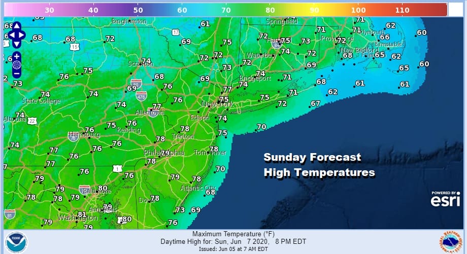
Sunday looks like a great day with mostly sunny skies with highs just in the 70s with low humidity. High pressure builds south from Eastern Canada. It may take until Thursday for it to give way to the next front and a chance for any showers. Get ready for a nice 4 day stretch of weather.
BE SURE TO DOWNLOAD THE FREE METEOROLOGIST JOE CIOFFI WEATHER APP &
ANGRY BEN’S FREE WEATHER APP “THE ANGRY WEATHERMAN!
MANY THANKS TO TROPICAL TIDBITS FOR THE USE OF MAPS
Please note that with regards to any severe weather, tropical storms, or hurricanes, should a storm be threatening, please consult your local National Weather Service office or your local government officials about what action you should be taking to protect life and property.


