
DOWNLOAD MY NEW FREE JOESTRADAMUS WEATHER APP FOR ALL DEVICES
THE APP IS ABSOLUTELY FREE TO ALL BUT CONSIDERING SUBSCRIBING TO PATREON FOR A WEATHER EXPERIENCE FREE OF ADS, EXCLUSIVE VIDEOS FOR MEMBERS ONLY AND MUCH MORE…STARTS AT $2 A MONTH..MESSAGE ME AT ANY TIME
Warm Front Showers Overnight Improving Weather Monday
The nice weekend is now at at an end and we look ahead to some showers overnight. A warm front is approaching as low pressure moves across the Great Lakes and heads toward New England. Showers are beginning to show up on the regional radar in Eastern Pennsylvania and they will be working their way through our area overnight and should be all gone by daybreak in most areas and along the coast about an hour or two afterwards. Temperatures overnight will likely hold in the 50s in most places.
REGIONAL RADAR

On the local radars we are beginning to see some of the showers aloft developing around us. The steadier rain is still to the west and will gradually cover the local radars in the next few hours.
LOCAL RADAR NEW YORK CITY

LOCAL RADAR PHILADELPHIA


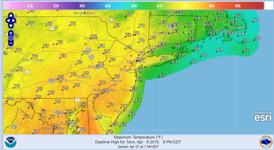
Monday morning with the warm front by us weather conditions will improve and we should see developing sunshine through the clouds. Temperatures will respond by climbing into the 70s just about everywhere with temperatures perhaps a few degrees cooler along the coast and on Long Island and Southern New England though we should make the 60s to near 70 even in these areas. A late afternoon or evening shower or even and isolated thunderstorm can’t be completely ruled out though I think the chances are low. If there is enough sun, the odd 80 degree reading can’t be ruled out in Southern New Jersey or Southeastern Pennsylvania.
Tuesday sees a cold front moving through late in the day which could produce a shower. Otherwise it is a mix of sun and clouds with highs in the 60s. Wednesday and Thursday look dry with some sunshine as high pressure builds from the Great Lakes to the East Coast with highs in the 50s to near 60.
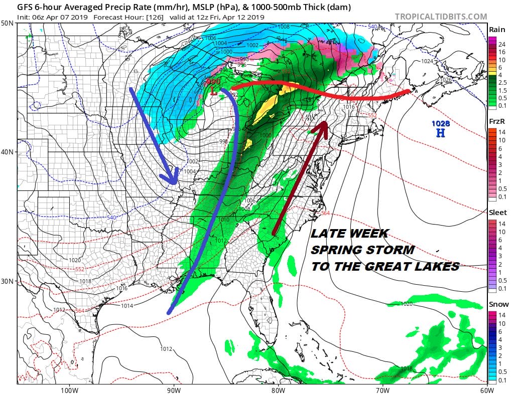
Low pressure heads to the Great Lakes at the end of the week with a southerly flow developing along the East Coast. Thursday’s highs along the coast will be strongly impacted by the south wind with highs in the 50s on Long Island and Southern New England and 60s inland. Clouds will be around along with some sunshine with showers likely Friday as that next front approaches and moves through.
MANY THANKS TO TROPICAL TIDBITS FOR THE USE OF MAPS
Please note that with regards to any tropical storms or hurricanes, should a storm be threatening, please consult your local National Weather Service office or your local government officials about what action you should be taking to protect life and property.


