DOWNLOAD MY NEW FREE JOESTRADAMUS WEATHER APP FOR ALL DEVICES
THE APP IS ABSOLUTELY FREE TO ALL BUT CONSIDERING SUBSCRIBING TO PATREON FOR A WEATHER EXPERIENCE FREE OF ADS, EXCLUSIVE VIDEOS FOR MEMBERS ONLY AND MUCH MORE…STARTS AT $2 A MONTH..MESSAGE ME AT ANY TIME
Beautiful Sunday Showers Monday Morning Warmer Temperatures
After what turned out to be a beautiful Saturday, we get to do it all over again today today. The satellite loop shows dry air covering all of the Northeast US today and the next weather system is going to be a tad slower. This means we will see sunshine pretty much all day long with just some late day arriving high clouds..
SATELLITE

REGIONAL RADAR

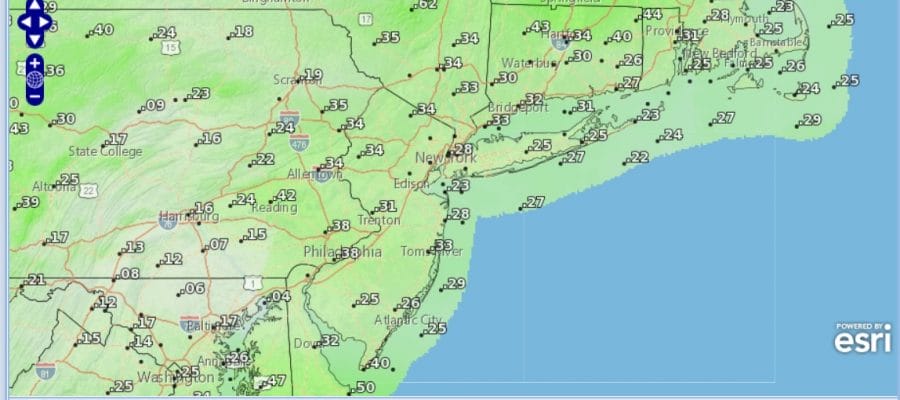
We have no weather issues on the regional radar anywhere close today and we are not expecting showers to develop until after midnight tonight so it is on to highs in the 60s just about everywhere except along south facing shorelines where the spring sea breeze comes in on most early spring afternoons.

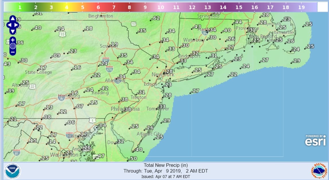
Tonight a warm front approaches from the southwest as low pressure heads east into Canada. That warm front will likely trigger some showers here between midnight and 8am Monday but it will also trigger a widespread snow over Northeast New England where the snow doesn’t want to stop this season. Nonetheless for us the showers will play through.

The NAM model shows the progression of weather from 11am today through 8am Monday and you can see the area of showers that develops to the west tonight. It doesnt develop until after sunset so no issues for the daytime today. Rainfall amounts will be on the order of a quarter to a half inch total.
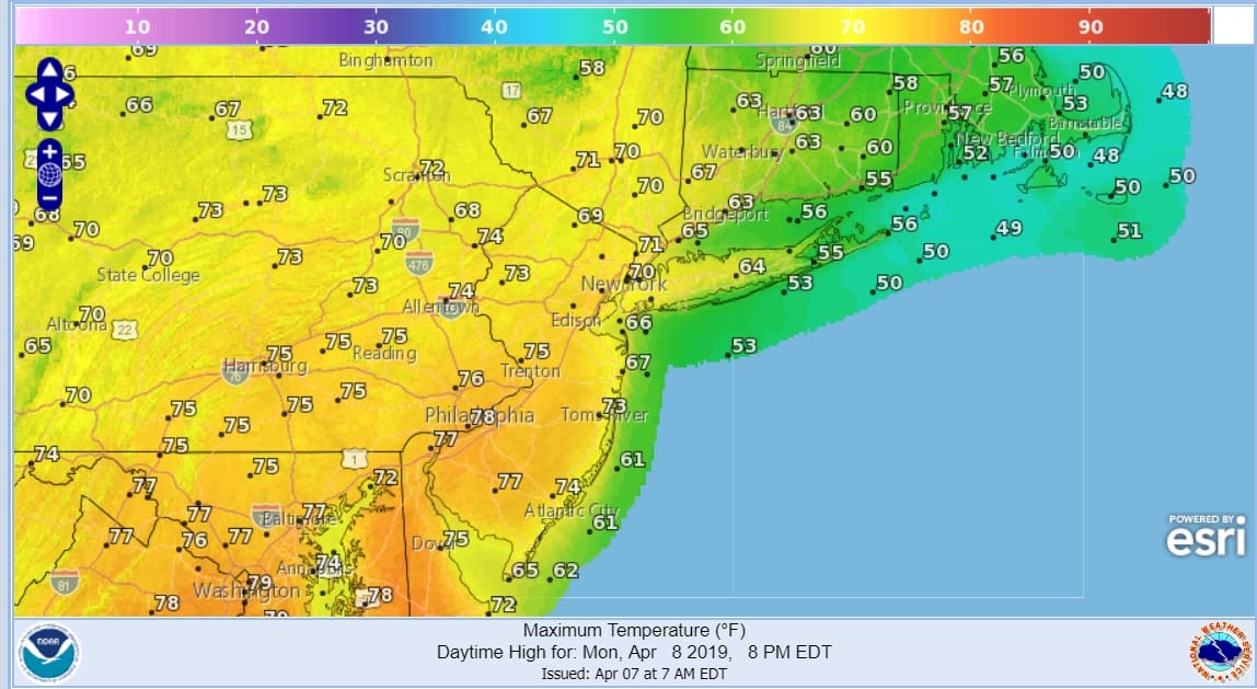
Once the warm front passes Monday morning we should see clouds give way to some sunshine and temperatures should respond. The further west from the coast you are the higher your temperatures will go and most highs from New Jersey westward will be in the 70s to possibly near 80 while along the coast temperatures will be impacted by a wind off the water so highs will be in the cooler 60s.
Tuesday will bring a cold front through here late in the day with the chance for showers or possibly a thunderstorm in the late afternoon. Clouds on Tuesday will likely hold temperatures back somewhat with highs in the mid 60s to lower 70s. Then it is on to chilly but dry weather for Wednesday and Thursday with some sunshine both days and highs in the 50s to near 60 both days. It appears that weather models overplayed the blocking pattern that was advertised last week and it is going to be much weaker and in fact it will weaken over the next 5 days. This means the next storm system will head to the Great Lakes late this week.
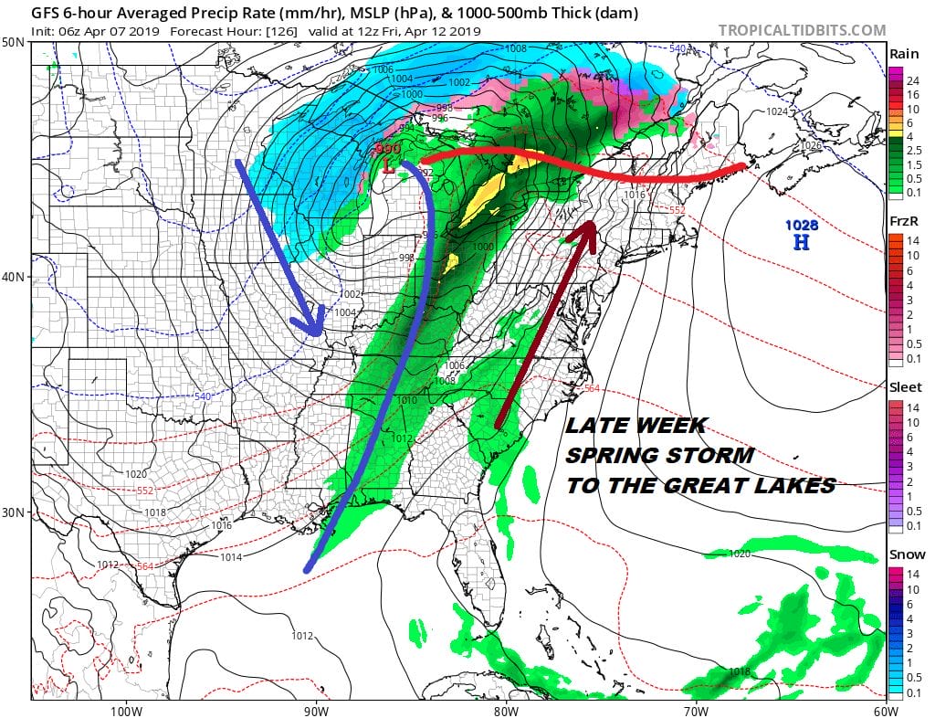
The end of this week will likely come with a cold front and a rather strong southerly flow. Also look for the chance for showers later Friday into Friday night before drier cooler air arrives next weekend. We just seem to be moving along with a typical spring pattern this year which is good for stretches of nice weather with warmer temperatures and the occasional round of showers which helps bring nature to life. Enjoy your Sunday.
MANY THANKS TO TROPICAL TIDBITS FOR THE USE OF MAPS
Please note that with regards to any tropical storms or hurricanes, should a storm be threatening, please consult your local National Weather Service office or your local government officials about what action you should be taking to protect life and property.


