DOWNLOAD MY NEW FREE JOESTRADAMUS WEATHER APP FOR ALL DEVICES
THE APP IS ABSOLUTELY FREE TO ALL BUT CONSIDERING SUBSCRIBING TO PATREON FOR A WEATHER EXPERIENCE FREE OF ADS, EXCLUSIVE VIDEOS FOR MEMBERS ONLY AND MUCH MORE…STARTS AT $2 A MONTH..MESSAGE ME AT ANY TIME
Developing Sunshine Today Sunshine Warm Sunday Rain Monday Morning
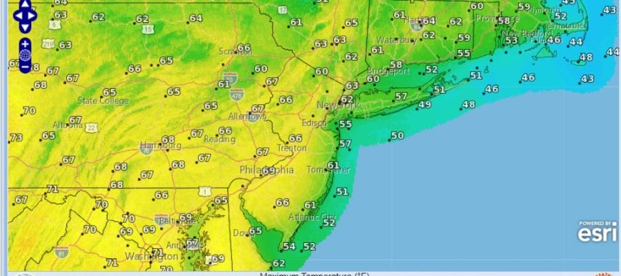
Last night’s weather system and rain has moved away to the east and now we will spend Saturday with slowly improving weather conditions. We have lots of leftover clouds around this morning but gradually the clouds should get ripped a part and we will go over to some sunshine by midday. This afternoon looks to be no worse than partly sunny. The low pressure and frontal boundary has moved off the coast and slowly way to the east.
SATELLITE

REGIONAL RADAR

Radars are going to be silent right into Sunday night so it will be a matter of how much sun we get that will determine how high temperatures get. All the chilly air was ahead of yesterday’s weather system. There was none behind it. Highs should have no problem making it into the 60s to day. Whether it get so low end of high of the 60s will depend on how much sun you get and wind direction. Local sea breezes should be confined mainly right along the immediate coast today.
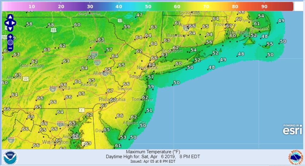
Tonight should be nice and clear with most lows in the 30s and lower 40s. Some patchy fog could develop along immediate coast overnight. That should burn off to sunshine Sunday and it will be another nice day. Some clouds could arrive from west to east later in the afternoon but much of the day should be fine. It will be another day of highs in the 60s.

Sunday night into Monday brings a warm front and cold front combination and ahead of the warm front Sunday night we will see some showers develop after midnight and linger into Monday morning. Then after that once again it will be a matter of how much sun breaks through the clouds.
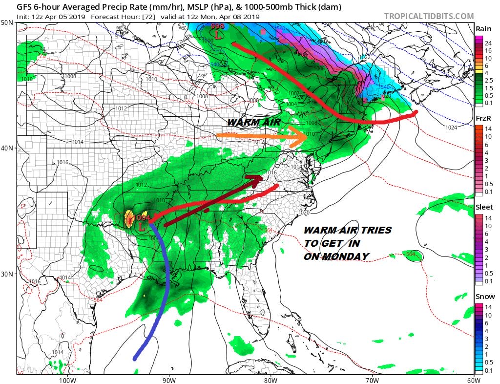
If sunshine successfully breaks through the clouds then you can expect temperatures to rise up into the 70s with relative ease. There is no real cold air behind this system and we will have to wait until late Tuesday when a second cold front arrives with the chance for a passing shower or two.

There isn’t much change in the overall outlook for next week. It is all about the block and how models handle it. Right now we have models moving weather systems around a bit and last night’s model runs seemed less impressed with the blocking pattern. We aren’t going to change our views about it today and just let things roll along for another day or two until models can settle on how to handle weather systems for later next week.
MANY THANKS TO TROPICAL TIDBITS FOR THE USE OF MAPS
Please note that with regards to any tropical storms or hurricanes, should a storm be threatening, please consult your local National Weather Service office or your local government officials about what action you should be taking to protect life and property.


