DOWNLOAD MY NEW FREE JOESTRADAMUS WEATHER APP FOR ALL DEVICES
THE APP IS ABSOLUTELY FREE TO ALL BUT CONSIDERING SUBSCRIBING TO PATREON FOR A WEATHER EXPERIENCE FREE OF ADS, EXCLUSIVE VIDEOS FOR MEMBERS ONLY AND MUCH MORE…STARTS AT $2 A MONTH..MESSAGE ME AT ANY TIME
Week Begins Warm 70s Sunshine Later Today
Overnight we had a warm front move through which produced some showers. Those showers are done now and the satellite that front moving through Southeast New England and low pressure is moving across Southeastern Canada and New England. To the southwest is another low moving across the Tennessee Valley to the Carolinas with some showers. We sit in between those systems today and that puts us with a developing west wind and some sunshine. This should send temperatures climbing into and in some cases through the 70s (depending on how much sun) and it is conceivable that warm spots could reach 80 in some places.
SATELLITE

REGIONAL RADAR

Regional and local radars show the showers moving off the New England coast and the dry gap between that and the appearance of new showers in parts of West Virginia. Gradually the regional radar will see some showers developing across Virginia and North Carolina. We should be in good shape for the rest of the day though an isolated shower or thunderstorm can’t be ruled out later this afternoon and evening.
LOCAL RADAR NEW YORK CITY

LOCAL RADAR PHILADELPHIA


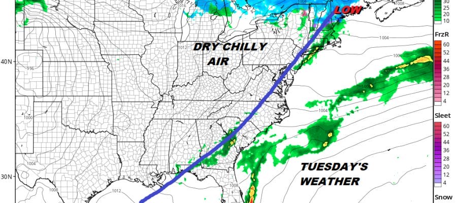
Moving ahead to tonight we should just see some clouds around with lows in the 40s to lower 50s. Tuesday we see a cold front that will be approaching which could trigger off mid to late afternoon showers. Highs will be in the 50s to lower 60s until the front goes by.

Much of the week looks dry other than the chance for showers late Tuesday. The next weather system looks to arriving slower and later which keeps things dry possibly through Friday. Certainly Wednesday and Thursday look dry and chilly with some sunshine both days and highs in the 50s to near 60. It appears the issue of a south wind developing ahead of a cold front holds off until Friday so then we could see clouds arriving and the chance for showers later Friday into Friday night. Hopefully everything moves along and we see decent weekend before another weather system approaches possibly late in the weekend or early next week. We still don’t see any big storms around and the blocking pattern has proven to be weak and not conducive for long stretches of gloomy weather. We will examine the long range later today.
MANY THANKS TO TROPICAL TIDBITS FOR THE USE OF MAPS
Please note that with regards to any tropical storms or hurricanes, should a storm be threatening, please consult your local National Weather Service office or your local government officials about what action you should be taking to protect life and property.


