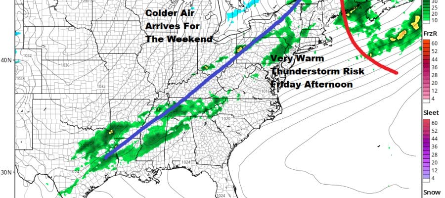
Warm Front Approaching Severe Weather Possible Friday Weekend Chilly
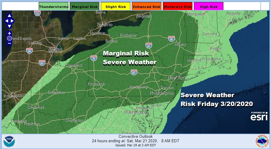
We all patiently wait for the warm front that lies to our south along the Maryland Pennsylvania border. South of there today temperatures reached into the 70s and as low pressure heads to the Great Lakes tonight and Southeast Canada on Friday, the warm front should push on through Friday morning. This will also set us up for the possibility of severe weather on Friday. The Storm Prediction Center has much of the Northern Middle Atlantic to Western New England at a marginal risk for severe weather on Friday.
SATELLITE

REGIONAL RADAR

There are some showers developing on the regional radar back in West Virginia and there is heavier shower activity to the west of there. Most of these showers should pass north and west of the coast tonight. For tonight look for clouds and some dense fog developing along with patchy light rain or drizzle. Temperatures will hold in the upper 40s to mid 50s. For now the local radars are quiet.
LOCAL RADAR NEW YORK CITY

LOCAL RADAR PHILADELPHIA


Friday is on course to be a warm day for the first day of spring. We still think highs will reach the 70s from NYC south and west with 60s north and east in Southern New England and Long Island. During Friday afternoon a cold front will approach and move through.

We don’t expect widespread severe weather with this cold front as there may not be much for the front to work with so anticipate some scattered thunderstorms and showers when the front passes. Behind the front a cold high will be building into the Eastern US this weekend. Skies should clear out Friday night. Saturday will see some sunshine but it will be colder with highs in the upper 40s and lower 50s.

Sunday will be a cold day for this time of year and while we will have sunshine, Temperatures will start the day in the 20s to near 30 and highs will just reach the low and middle 40s. The cold high will be moving out to the east rather quickly as the next storm system heads our way early next week.

There is some debate among the weather models with some of the global models showing the high hanging on over New England a bit longer as moisture arrives. We are leaning away from the colder and yes snowier solutions of the European and Canadian models and going with the less developed GFS idea of low pressure moving east as the high moves out and cold air diminishes. It is hard to go against a winter where every system even remotely hinted by the models to produce winter weather in the I-95 corridor has either under performed or not occurred at all. We don’t see why this should be any different.

This would set us up for rain arriving early Monday morning. Colder areas north and west of the coast could start as some wet snow or sleet. We might see more in the way of snow in upstate NY and New England mainly north of Route 84. Next week looks to be busy as a second system comes in right behind the Monday system and that could bring another round of rain and cold conditions for midweek.
BE SURE TO DOWNLOAD THE FREE METEOROLOGIST JOE CIOFFI WEATHER APP &
ANGRY BEN’S FREE WEATHER APP “THE ANGRY WEATHERMAN!
MANY THANKS TO TROPICAL TIDBITS FOR THE USE OF MAPS
Please note that with regards to any severe weather, tropical storms, or hurricanes, should a storm be threatening, please consult your local National Weather Service office or your local government officials about what action you should be taking to protect life and property.


