
Very Warm Afternoon Front Arrives Friday Night
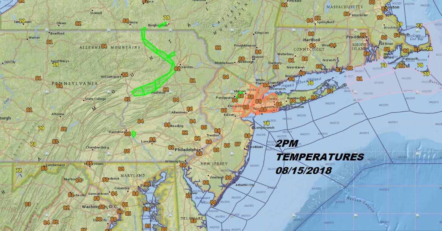
We are enjoying a very warm summer afternoon. Humidity levels are still a bit on the uncomfortable side but they are better than we have seen over the last two weeks. Northwest winds are helping to dry things and also heat things up. We could nudge up another degree or two in the next 2 hours before we fall off a bit tonight but not much. Tonight will be a very warm and humid night with most lows between 68 and 74 degrees. Nothing much is happening on the satellite loop this afternoon and the radars remain quiet.
EASTERN SATELLITE

REGIONAL RADAR

The next 2 days will be hot and humid with sunshine on Thursday and clouds with some sun on Friday. Highs both days will reach the upper 80s and lower 90s. All the rain of the last few weeks is actually helping to knock a degree or two off the temperatures. Late Friday a cold front approaches. We are not too concerned with showers and thunderstorms popping up until late Friday and Friday night.
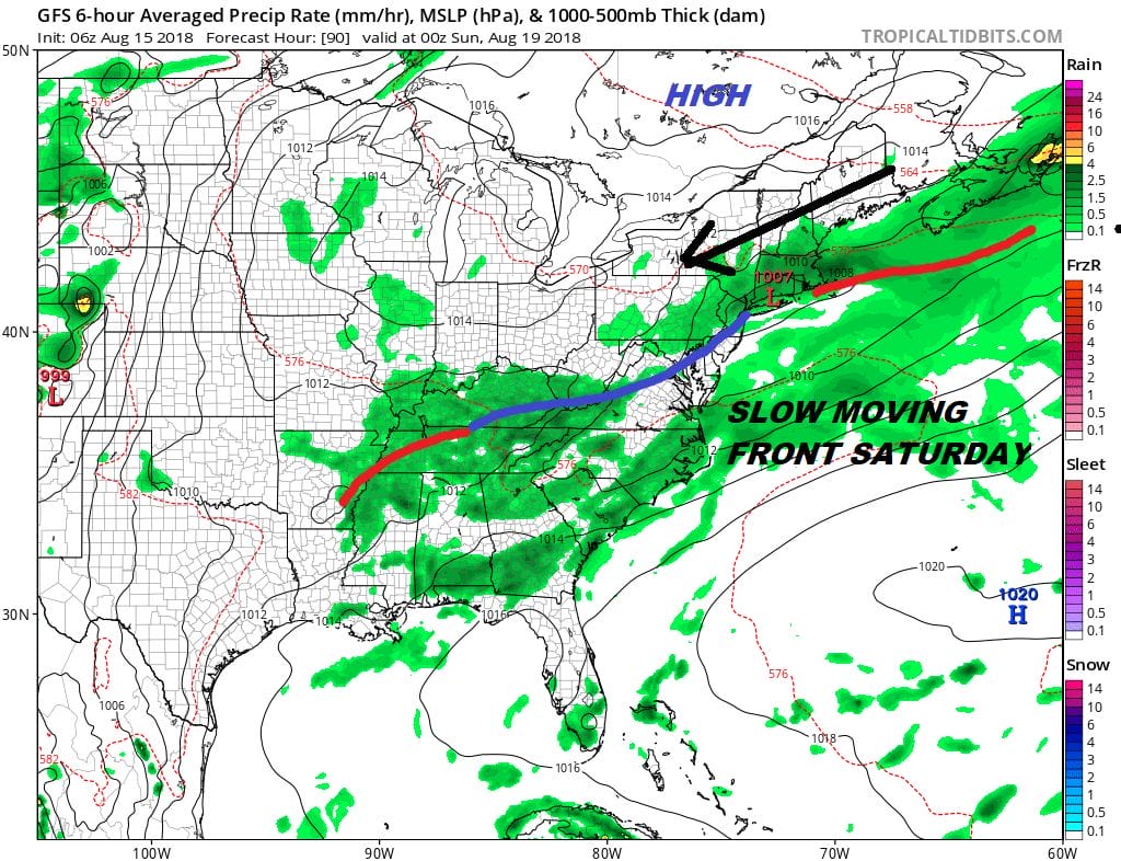
The weekend has some issues with the front moving slowly. This will probably linger showers and thunderstorms into Saturday afternoon before the front sinks to the south. High pressure to the northeast of us will build on Sunday but this puts us in an onshore flow. It is likely that we will see a lot of clouds on Sunday with just some limited sun. Showers could be as close as Southern New Jersey but most of the area will be rain free. Temperatures Saturday will be in the 80s. Sunday’s highs will only be in the 70s to near 80. We will examine the long range outlook for next week later today.
MANY THANKS TO TROPICAL TIDBITS FOR THE USE OF MAPS
Please note that with regards to any tropical storms or hurricanes, should a storm be threatening, please consult your local National Weather Service office or your local government officials about what action you should be taking to protect life and property.
LATEST JOESTRADAMUS ON THE LONG RANGE


