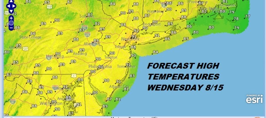
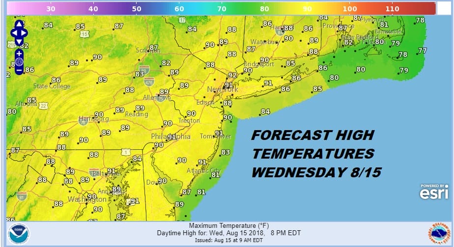
BAD HAIR WEATHER THUNDERSTORM FREE 90 DEGREES
We are finally done with the rain for the next 2 days. What remains behind however is heat and humidity since it is all fine and dandy that we got rid of the upper trough to the west however there wasn’t any cool Canadian air around behind it so we are left with hot humid conditions today with sunshine. The dew points actually came down a bit but they are still high and it is still somewhat uncomfortable.
Nothing much is going on regarding the satellite loop. The upper low is now off the New England coast and you can see the western edge of the cloud rotation behind it. Since it is pulling away to the northeast, clouds from New England should not be an issue for us today.
EASTERN SATELLITE

REGIONAL RADAR

We do not have to bother with the radars today as we should be thunderstorm and downpour free just about everywhere within range. Thursday should be a repeat performance of today with sunshine and highs reaching into the 90s with bad hair weather humidity again. We are leaving thunderstorms and downpours out of the forecast for Thursday as well.

The next cold front begins its approach on Friday. This front will take its time which means that showers and thunderstorms while scattered around during the day Friday will likely be more numerous at night with the front nears. Much of the day Friday won’t be raining so it will be very warm to hot and humid with highs in the upper 80s to a few lower 90s for a third day. The front may take all day Saturday to move through which means warm humid conditions and the likelihood of showers and thunderstorms before winds shift to the northeast and an onshore flow begins. Highs will reach into the 80s before the wind shift.
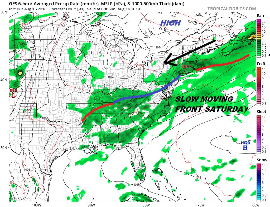
Sunday is tricky. Will the onshore flow keep us in clouds all day long with a few showers running around? If it does then temperatures will likely be in the 70s to near 80. If the high to the northeast can push southward by a bit we could see some breaks of sun. Sunday either way is no washout and it is likely to be the better of the two weekend days. At least the humidity will ease for the second half of the weekend. Next brings another front late Tuesday.
MANY THANKS TO TROPICAL TIDBITS FOR THE USE OF MAPS
Please note that with regards to any tropical storms or hurricanes, should a storm be threatening, please consult your local National Weather Service office or your local government officials about what action you should be taking to protect life and property.
LATEST JOESTRADAMUS ON THE LONG RANGE


