DOWNLOAD MY NEW FREE JOESTRADAMUS WEATHER APP FOR ALL DEVICES
THE APP IS ABSOLUTELY FREE TO ALL BUT CONSIDERING SUBSCRIBING TO PATREON FOR A WEATHER EXPERIENCE FREE OF ADS, EXCLUSIVE VIDEOS FOR MEMBERS ONLY AND MUCH MORE…STARTS AT $2 A MONTH..MESSAGE ME AT ANY TIME
Very Cold Weather Continues Into Friday Warmer Weekend
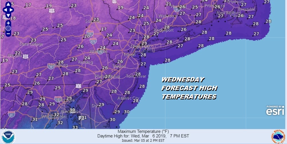
The weekend storms are all responsible for bringing a very cold air mass into the Eastern US. The extend of the cold is all the way down into Northern Florida where freeze warnings are up tonight across the south. Many of these areas are swinging from extremes lately with 70s and even 80s not uncommon just a few days ago with severe weather and now temperatures are headed for the 20s. We here are just very cold. In fact it is unusually cold for early March when daytime highs should average in the mid to upper 40s. The cold air mass from Canada combined with the deep snow cover in some areas (hard to believe) will send temperatures tonight down to the teens and upper single digits and daytime highs on Wednesday barely out of the 20s. At least it comes with a strong March sun which takes the sting out of the air.
At least this is all coming with no snow for us with all this cold air. Another very cold night is ahead of us Wednesday night with lows again in the teens to single digit. Thursday’s highs will be in the upper 20s and lower 30s with sunshine and some afternoon high clouds.
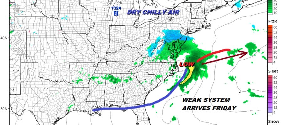
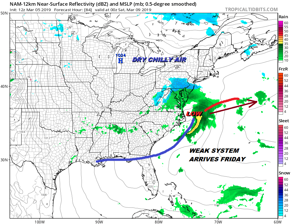
Friday brings the first of two weather systems our way. As has been the pattern for much of the winter there is a lead weaker system followed by a stronger system a day or two later. The first low doesn’t have much upper air support. There will be a weak area of snow with this and there could be a little wet snow on Friday. This system should move along and not produce very much as we see it from this point.
After this low pulls away Friday night Saturday will be dry and chilly but temperatures will be much closer to average for this time of year. We should see some sunshine with late day arriving clouds and highs back into the 40s.
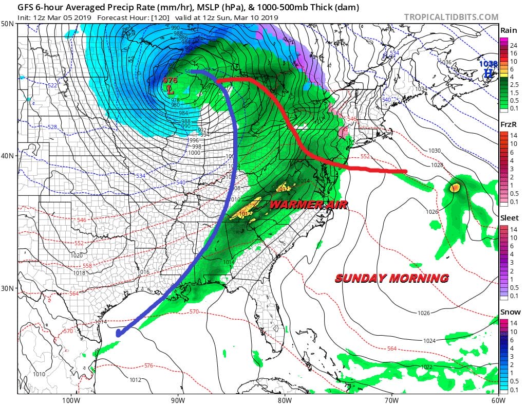
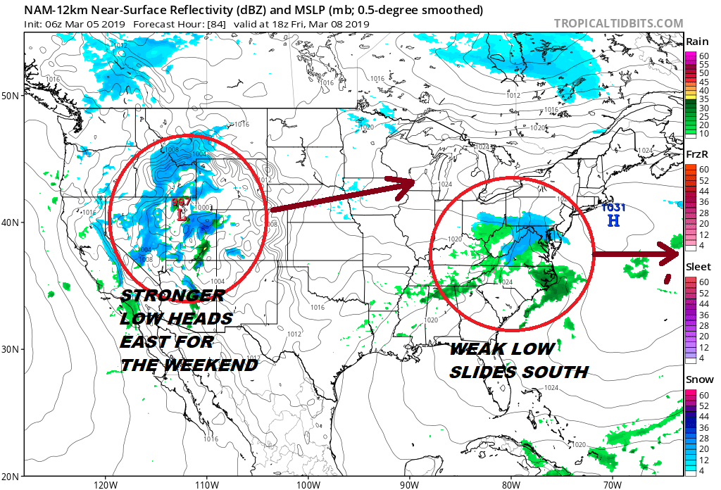
Models are showing a storm to the Great Lakes on Sunday of varying strength depending on which model you look at. The bottom line is that Sunday looks like we will get some rain or shower with this. How warm it gets depends on whether that warm front gets by or not. 50s certainly seem plausible if the front gets through but these things are always a struggle. Dry chilly air follows for the start of next week though it won’t be as cold as what we are experiencing now. Another Great Lakes system follows later next week so prepare for more volatility going forward.
MANY THANKS TO TROPICAL TIDBITS FOR THE USE OF MAPS
Please note that with regards to any tropical storms or hurricanes, should a storm be threatening, please consult your local National Weather Service office or your local government officials about what action you should be taking to protect life and property.


