DOWNLOAD MY NEW FREE JOESTRADAMUS WEATHER APP FOR ALL DEVICES
THE APP IS ABSOLUTELY FREE TO ALL BUT CONSIDERING SUBSCRIBING TO PATREON FOR A WEATHER EXPERIENCE FREE OF ADS, EXCLUSIVE VIDEOS FOR MEMBERS ONLY AND MUCH MORE…STARTS AT $2 A MONTH..MESSAGE ME AT ANY TIME
January Weather In March Continues Snow Chance Friday
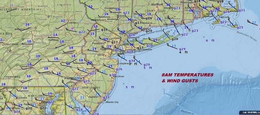
Temperatures in the teens to near 20 this morning combining with gusty winds up to 30 mph are making for a very cold morning and a very cold day ahead. Wind chills right now are in the single digits and it does look and feel like a day in January. Temperatures today will not get out of the 20s and typically this time of year we should be running to the mid to upper 40s. If you want to Seasonally adjust this air mass for January it would be a day in that month where the high temperature couldn’t make it back to 20.

Other than the cold & the wind, there are no other real issues today. We will see some patchy clouds developing from time to time and from place to place. While the radars are quiet right now an odd snow shower or two could pop up in one or two isolated spots. Otherwise it is just wind and cold as the core of the cold air mass moves overhead.
REGIONAL RADAR

Tonight is going to be another very cold night with mainly clear skies and lows that will be in the teens and single digits. Thursday brings some sunshine and high clouds with highs trying to get back to the upper 20s and lower 30s.
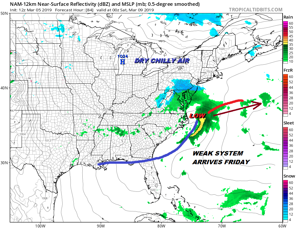
WEAK SYSTEM FRIDAY BRINGS A PERIOD OF SNOW
The first of 2 weather systems heads our way for Friday and there will sill be some cold air around. It has been the signature this winter to see 2 lows come back to back with a weaker first and a stronger second. That trend holds here and there could be a period of snow Friday into Friday night. There is the chance we could see a coating to an inch or so from this but what ever falls during the day will likely stick more to the coldest surfaces rather than roadways due to the time of year and the lack of intensity. Temperatures Friday should make it into the 30s.
System number two arrives for late Saturday night into Sunday so Saturday looks okay with sunshine for much of the day before we get some late day arriving clouds. Highs Saturday will be back into the 40s. Rain arrives early Sunday morning but I think that inland areas north, northwest, and northeast of the coast could start off as wintry mix of precipitation. It is looking as if this will be a chilly rain for Sunday with a struggling warm front trying to get through but not succeeding. At least the very cold nature of the pattern with us now breaks down and we transition to something more typical of March and a lot more reasonable with respect to temperatures.
MANY THANKS TO TROPICAL TIDBITS FOR THE USE OF MAPS
Please note that with regards to any tropical storms or hurricanes, should a storm be threatening, please consult your local National Weather Service office or your local government officials about what action you should be taking to protect life and property.


