Tropical Storm Warning Bermuda Great Weather Next 6 Days Eastern US
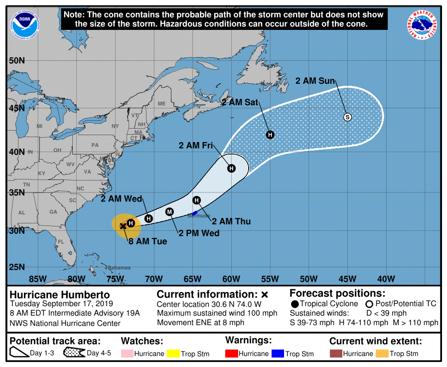
Satellite and latest Air Force Recon reports show that Humberto continues to strengthen and the storm is growing large in coverage. Maximum winds are now 100 mph and gales extend outward about 150 miles from the center. Tropical Storm Warnings are now posted for Bermuda as Humberto is forecast to pass about 100 miles to the northwest of the island. This should put Bermuda in an area of Gales Wednesday night into early Thursday but they should just miss the core of the hurricane.
SATELLITE

The only impact from Humberto for us will be rough ocean seas and rip currents that will develop over the next several days along our shoreline so exercise caution if you are beach bound or doing some late summer boating. We will likely see small craft advisories up later this week for rough ocean seas.
EAST COAST SATELLITE

Otherwise our weather is about as nice as it gets with a long dry streak ahead of us. The upper flow is northerly along the east coast into the weekend. The only complication will be Wednesday when some clouds will come in from the east along coast areas but even here it will be no worse than partly sunny. Radars are silent today and will remain on hiatus probably through this coming weekend.
LOCAL RADAR NEW YORK CITY

LOCAL RADAR PHILADELPHIA 

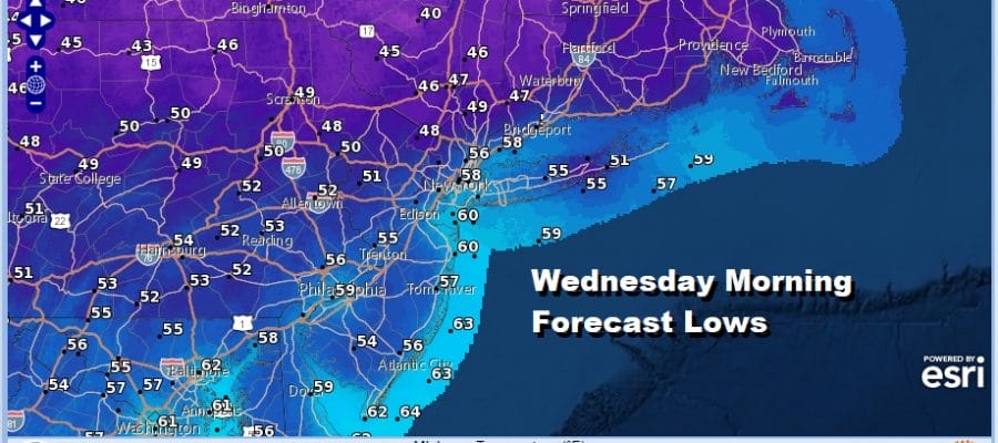
Look for lots of sunshine all day long today with highs reaching the low to mid 70s. Tonight looks nice and clear. Temperatures by morning will be quite cool. Many inland areas will see lows in the mid to upper 40s. Coastal and warmer urban centers will settle in the low to mid 50s.
Wednesday again will be no worse than partly sunny at the coast with mostly sunny skies inland. Highs will be in the upper 60s to lower 70s. Another cool night Wednesday night followed by mostly sunny skies on Thursday with highs again in the upper 60s to lower 70s. Starting Friday high pressure settles to our south. We will see sunshine with highs in the 70s.
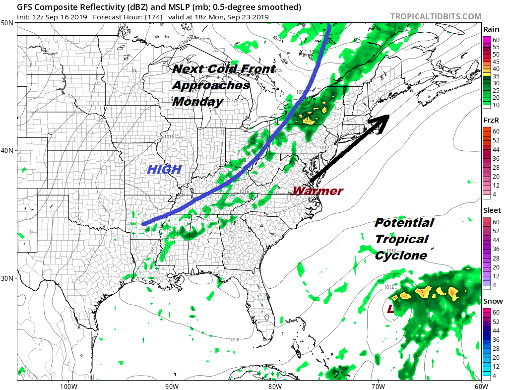 Over the weekend we will be warming up a bit with sunshine. Highs should reach the upper 70s and lower 80s. Sunday highs will be a bit higher. Highs will reach 80 to 85. The next cold front arrives on Monday and right now this front doesn’t have much to work on. Highs will be in the upper 70s to lower 70s before it turns a little cooler afterwards. This is the last weekend of the summer season and Monday is the first day of Autumn.
MANY THANKS TO TROPICAL TIDBITS FOR THE USE OF MAPS
Please note that with regards to any tropical storms or hurricanes, should a storm be threatening, please consult your local National Weather Service office or your local government officials about what action you should be taking to protect life and property.


