Tropical Storm Development Eastern Atlantic Possible Over The Weekend
Tropical Storm Development Eastern Atlantic
Possible Over The Weekend
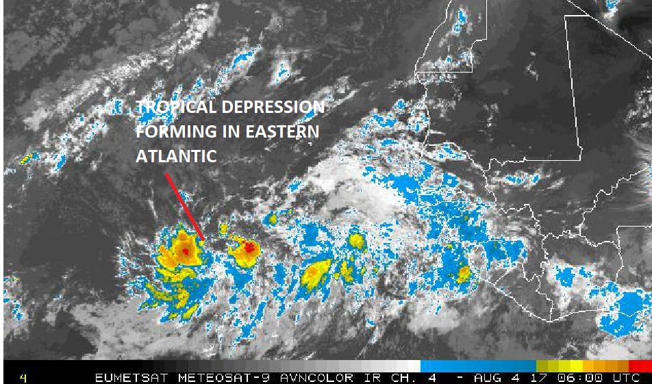
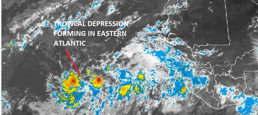
Overnight the strong tropical wave that emerged from the African coast continues to move westward and remains well defined on the satellite pictures and loops this morning. Above is the picture from 2am and you can see the the large area of thunderstorms. It remains a bit elongated but there at least on the loop appears to be a mid level circulation and possibly even a low level circulation is beginning to develop. The National Hurricane Center raises the probability of development to 50 percent in the next 48 hours. The vast majority of eather models overnight actually develop this system rather quickly into a tropical storm by Sunday. However it should be noted that the European model doesn’t do much with this system and just carries it westward as a weak system.

The water vapor loop shows low wind shear conditions in the tropical Atlantic and much less dry air which has been present for the last month or so. Upper air conditions would suggest this system will track westward and gradually strengthen as it moves across the Atlantic over the next 5 to 7 days. Weather models will continue to do what they do with this in the long term however we would rather focus on whether this develops first before getting to wrapped up in where it might be going.

We also have a tropical wave in the Eastern Caribbean that remains disorganized however when it reaches the Northwest Caribbean conditions will become more favorable for development.
MANY THANKS TO TROPICAL TIDBITS FOR THE WONDERFUL USE OF THE MAPS
Weather App

Don’t be without Meteorologist Joe Cioffi’s weather app. It is really a meteorologist app because you get my forecasts and my analysis and not some automated computer generated forecast based on the GFS model. This is why your app forecast changes every 6 hours. It is model driven with no human input at all. It gives you an icon, a temperature and no insight whatsoever.
It is a complete weather app to suit your forecast needs. All the weather information you need is right on your phone. Android or I-phone, use it to keep track of all the latest weather information and forecasts. This weather app is also free of advertising so you don’t have to worry about security issues with your device. An accurate forecast and no worries that your device is being compromised.
Use it in conjunction with my website and my facebook and twitter and you have complete weather coverage of all the latest weather and the long range outlook. The website has been redone and upgraded. Its easy to use and everything is archived so you can see how well Joe does or doesn’t do when it comes to forecasts and outlooks.
Just click on the google play button or the apple store button on the sidebar for my app which is on My Weather Concierge. Download the app for free. Subscribe to my forecasts on an ad free environment for just 99 cents a month.
Get my forecasts in the palm of your hand for less than the cost of a cup of Joe!
![]()
![]()