Thunderstorms Popping Well Inland
Thunderstorms Popping Well Inland
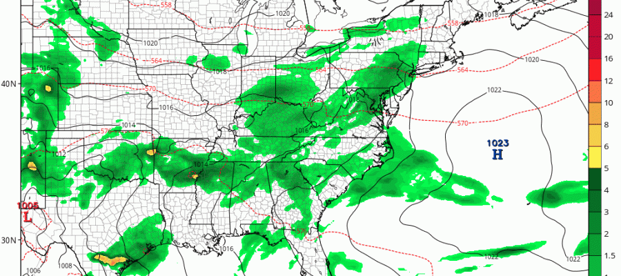
We are seeing thunderstorms popping up this afternoon noon but that is happening well inland so for much of the area you will not see much if any activity this evening or for that matter the first part of tonight. Late tonight and early Saturday morning a cold front will be moving through. The satellite loop shows a swirling low in the Great Lakes with a trailing cold front moving across the Ohio Valley and into Western Pennsylvania. Those thunderstorms will move through during the morning hours on Saturday. In the meantime whatever cells that pop up from now through this evening could be locally strong and produce heavy rains.
SATELLITE LOOP

REGIONAL RADAR

LOCAL RADAR NEW YORK CITY

LOCAL RADAR PHILADELPHIA


Saturday morning the thundertstorms will move through Eastern Pennsylvania the Hudson Valley and New Jersey and will be done before noon followed by mostly sunny skies Saturday afternoon. If the front moves a little faster the sunshine will come sooner. For Long Island and Connecticut it might have to wait until 1 or 2pm before the sun breaks out. Temperatures overnight will be in the mid 60s to lower 70s and Saturday afternoon highs will have time to reach the low to mid 80s. Humidity levels will drop making for a nice Saturday night with lows in the upper 50s to mid 60s. Sunday will be beautiful with mostly sunny skies and highs reaching the upper 70s and lower 80s.

This front is going to stall to our south and a wave developing on it will bring clouds back Sunday night with some rain or showers on Monday into Monday night. An onshore flow means temperatures in the low to mid 70s at best. By Tuesday morning the rain will be gone and its back to mostly sunny skies with highs into the 80s.
The tropics are getting busy and JOESTRADAMUS has more on this in his latest post.
 GET JOE A CIGAR IF YOU LIKE


