Tropical Storm Beryl Disorganized Weakening Warnings Leeward Islands
Tropical Storm Beryl Disorganized Weakening
Warnings Leeward Islands
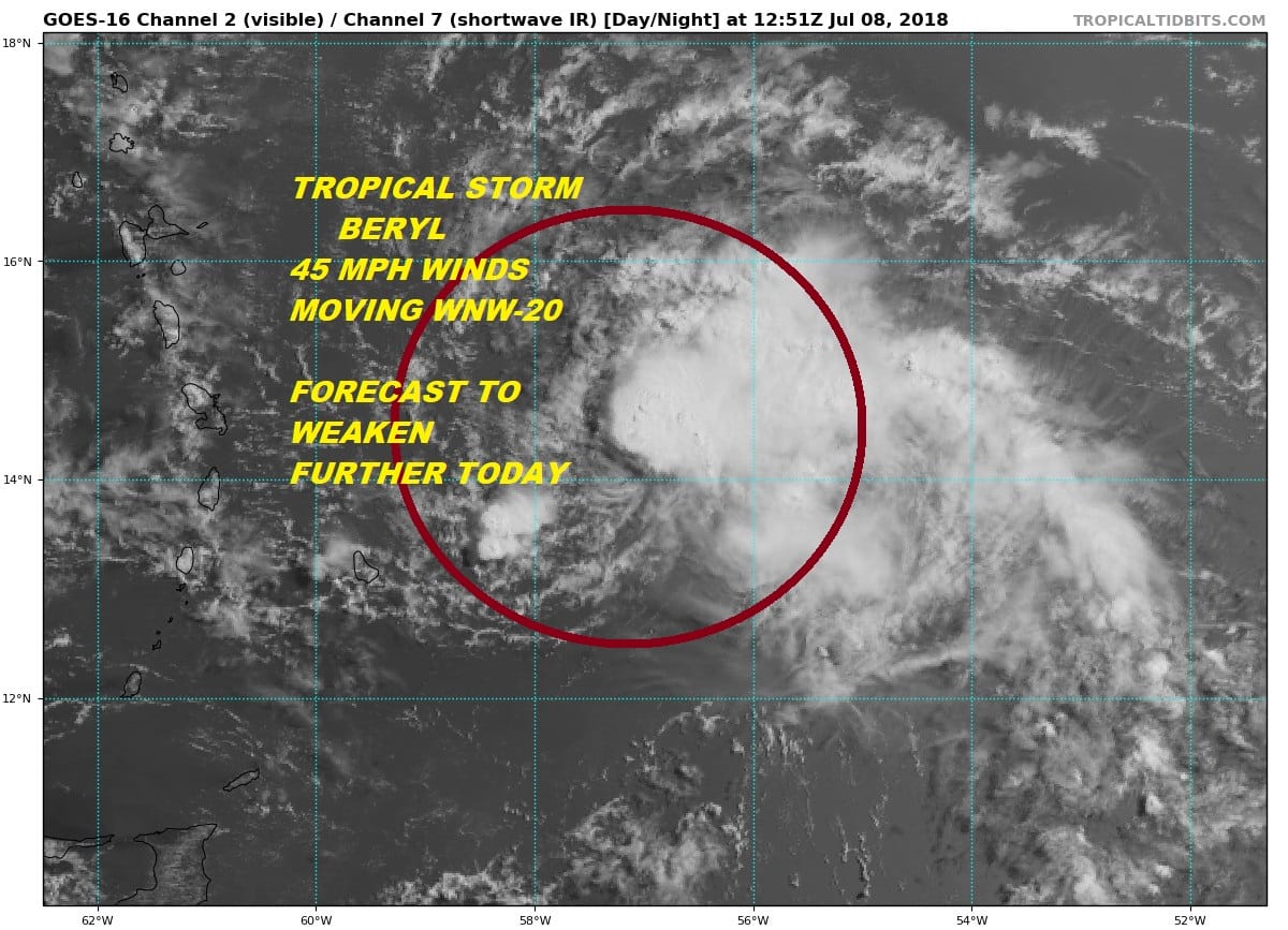
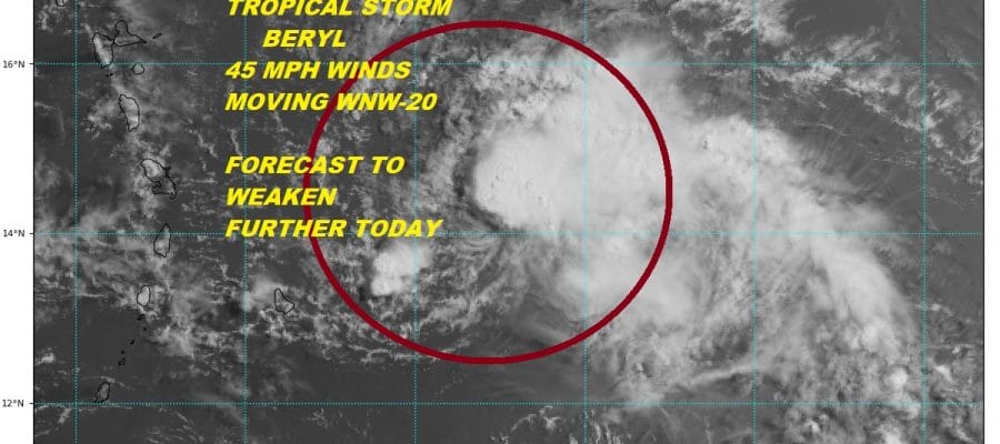
Very small Tropical Storm Beryl remains very small indeed with the system barely 70 miles across. The center of circulation remains mostly exposed though some convection seems to be developing on the eastern side. Top winds are 45 mph and Tropical Storm Warnings remain in effect for some of the Leeward Islands. Upper air conditions remain very hostile and likely to become even more hostile as Berly nears the islands. On the wide loop below you can see clouds from South America moving rapidly northward over the Leewards. This is indicative of very strong winds aloft creating wind shear. As Beryl continues further west it will be encountering these stronger winds aloft and it will likely shear what ever is left of the tropical storm completely apart.
WIDE ATLANTIC TROPICAL SATELLITE

...BERYL MOVING WEST-NORTHWESTWARD TOWARD THE LESSER ANTILLES...
...RECONNAISSANCE AIRCRAFT FINDS BERYL DISORGANIZED...


SUMMARY OF 800 AM AST...1200 UTC...INFORMATION
----------------------------------------------
LOCATION...14.0N 56.8W
ABOUT 190 MI...310 KM ENE OF BARBADOS
ABOUT 285 MI...455 KM E OF MARTINIQUE
MAXIMUM SUSTAINED WINDS...45 MPH...75 KM/H
PRESENT MOVEMENT...WNW OR 290 DEGREES AT 20 MPH...31 KM/H
MINIMUM CENTRAL PRESSURE...1007 MB...29.74 INCHES


WATCHES AND WARNINGS
--------------------
CHANGES WITH THIS ADVISORY:

None.

SUMMARY OF WATCHES AND WARNINGS IN EFFECT:

A Tropical Storm Warning is in effect for...
* Dominica
* Guadeloupe

A Tropical Storm Watch is in effect for...
* Barbados
* Martinique, St. Martin, and St. Barthelemy
* Saba and St. Eustatius
* St. Maarten

A Tropical Storm Warning means that tropical storm conditions are
expected somewhere within the warning area.

A Tropical Storm Watch means that tropical storm conditions are
possible within the watch area.

Interests elsewhere in the Leeward Islands, the Virgin Islands,
Puerto Rico, and the Dominican Republic should monitor the progress
of Beryl.

For storm information specific to your area, please monitor
products issued by your national meteorological service.


DISCUSSION AND OUTLOOK
----------------------
At 800 AM AST (1200 UTC), the poorly defined center of Tropical
Storm Beryl was located near latitude 14.0 North, longitude 56.8
West.  Beryl is moving toward the west-northwest near 20 mph (31
km/h), and this motion with an increase in forward speed is expected
during the next couple of days.  On the forecast track, the center
of Beryl or its remnants will approach the Lesser Antilles today,
cross the island chain tonight, and move near or south of the Virgin
Islands and Puerto Rico on Monday.

Maximum sustained winds are near 45 mph (75 km/h) with higher
gusts.  Gradual weakening is anticipated during the next 48 hours,
and Beryl is forecast to degenerate into a trough of low pressure as
it moves across the Lesser Antilles and into the eastern Caribbean
Sea by Monday.

Tropical-storm-force winds extend outward up to 45 miles (75 km)
from the center.

The estimated minimum central pressure is 1007 mb (29.74 inches).


HAZARDS AFFECTING LAND
----------------------
WIND:  Tropical storm conditions are expected in Dominica and
Guadeloupe tonight.  Tropical storm conditions are possible
in the watch areas of the Lesser Antilles by later today or Monday.
Strong gusty winds are also possible in the Virgin Islands and
Puerto Rico on Monday.

RAINFALL:  Beryl is expected to produce total rain accumulations
of 1 to 3 inches through Monday across the southern Leeward and
northern Windward Islands.  Across Puerto Rico, rainfall amounts
of 1 to 4 inches are expected.  Across the remainder of the Leeward
and Windward Islands and the Virgin Islands, rainfall amounts of
1 to 2 inches are expected, with locally higher amounts possible.
Tropical Storm Chris has formed off the North Carolina coast overnight and is likely to become a hurricane in the next few days. JOESTRADAMUS has the latest on this including any forecast impacts.
FiOS1 News Weather Forecast For Long Island
FiOS1 News Weather Forecast For New Jersey
FiOS1 News Weather Forecast For Hudson Valley