Tropical Depression 9 Forms In Florida Straits
TROPICAL DEPRESSION 9 FORMS IN FLORIDA STRAITS
Satellite loops, observation data and reports from an Air Force plane investigating INVEST 99L indicate that a well defined center of circulation has formed and we now (finally) have a tropical depression out of this after days of watching it.

...NEW TROPICAL DEPRESSION FORMS IN THE FLORIDA STRAITS...
...EXPECTED TO MOVE INTO THE GULF OF MEXICO...


SUMMARY OF 500 PM EDT...2100 UTC...INFORMATION
----------------------------------------------
LOCATION...23.7N 81.7W
ABOUT 55 MI...90 KM NE OF HAVANA CUBA
ABOUT 60 MI...100 KM S OF KEY WEST FLORIDA
MAXIMUM SUSTAINED WINDS...35 MPH...55 KM/H
PRESENT MOVEMENT...W OR 270 DEGREES AT 9 MPH...15 KM/H
MINIMUM CENTRAL PRESSURE...1009 MB...29.80 INCHES


WATCHES AND WARNINGS
--------------------
There are no coastal watches or warnings in effect.


DISCUSSION AND 48-HOUR OUTLOOK
------------------------------
At 500 PM EDT (2100 UTC), the center of Tropical Depression Nine
was located by a NOAA Hurricane Hunter aircraft near latitude 23.7
North, longitude 81.7 West.  The depression is moving toward the
west near 9 mph (15 km/h) and this motion is expected to continue
through tonight.  On the forecast track, the depression will be
moving away from the Florida Keys and into the Gulf of Mexico
overnight.  A turn toward the west-northwest and a decrease in
forward speed are expected on Monday followed by a turn toward the
northwest on Tuesday.

Maximum sustained winds are near 35 mph (55 km/h) with higher gusts.
Some strengthening is forecast during the next 48 hours, and the
depression is forecast to become a tropical storm on Monday.

The latest minimum central pressure reported by the NOAA Hurricane
Hunter aircraft was 1009 mb (29.80 inches).


HAZARDS AFFECTING LAND
----------------------
RAINFALL:  The depression is expected to produce total rain
accumulations of 1 to 4 inches over the southern half of the Florida
peninsula and the Florida Keys through Wednesday.  Isolated maximum
amounts of 6 inches are possible over coastal areas of southern
Florida and the Keys.  This rainfall may cause flooding and flash
flooding.

WIND:  Gusts to tropical storm force are possible in a few squalls
in the lower Florida Keys through tonight.
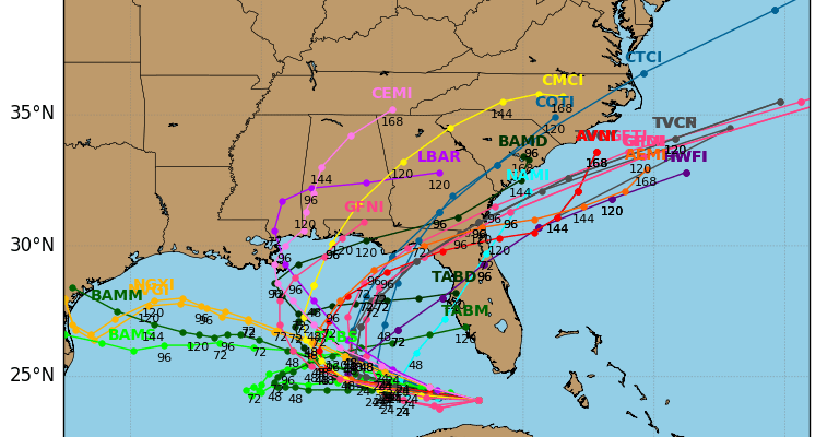
Tropical Depression 9 Forecast Next Few Days
Hurricane models are much more aggressive than the global models today with this system, Most take it into the North Central Gulf of Mexico before turning it northeast although some models keep it moving northwestward.

Today’s European model (unlike last night’s) does very little with this and meanders it in the Gulf of Mexico before it dies out. Global models have been highly volatile and inaccurate with this for days now as have the more aggressive hurricane models. The best approach is to see what it does in the next 36 to 48 hours as the system moves into the Southeast Gulf of Mexico. Conditions there are forecast to become more favorable for development.
FiOS1 News Weather Forecast For Long Island
FiOS1 News Weather Forecast For New Jersey
FiOS1 News Weather Forecast For Hudson Valley
NATIONAL WEATHER SERVICE SNOW FORECASTS
LATEST JOESTRADAMUS ON THE LONG RANGE
Weather App

Don’t be without Meteorologist Joe Cioffi’s weather app. It is really a meteorologist app because you get my forecasts and my analysis and not some automated computer generated forecast based on the GFS model. This is why your app forecast changes every 6 hours. It is model driven with no human input at all. It gives you an icon, a temperature and no insight whatsoever.
It is a complete weather app to suit your forecast needs. All the weather information you need is right on your phone. Android or I-phone, use it to keep track of all the latest weather information and forecasts. This weather app is also free of advertising so you don’t have to worry about security issues with your device. An accurate forecast and no worries that your device is being compromised.
Use it in conjunction with my website and my facebook and twitter and you have complete weather coverage of all the latest weather and the long range outlook. The website has been redone and upgraded. Its easy to use and everything is archived so you can see how well Joe does or doesn’t do when it comes to forecasts and outlooks.
Just click on the google play button or the apple store button on the sidebar for my app which is on My Weather Concierge. Download the app for free. Subscribe to my forecasts on an ad free environment for just 99 cents a month.
Get my forecasts in the palm of your hand for less than the cost of a cup of Joe!
![]()
![]()