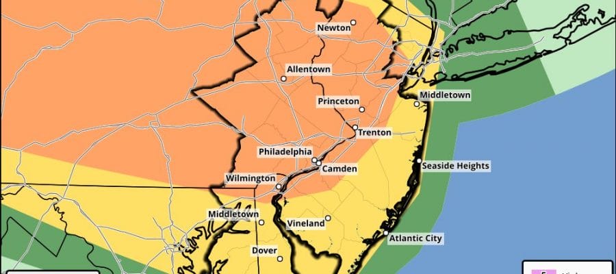
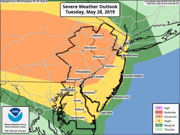
Tornado Watch Eastern Pennsylvania New Jersey
The NWS Storm Prediction Center has issued a
* Tornado Watch for portions of
Western New Jersey
Extreme east central Ohio
Pennsylvania
The extreme northern West Virginia Panhandle
* Effective this Tuesday afternoon and evening from 145 PM until
1000 PM EDT.
* Primary threats include…
A few tornadoes possible
Scattered large hail likely with isolated very large hail events
to 2 inches in diameter possible
Scattered damaging wind gusts to 70 mph likely
. NEW JERSEY COUNTIES INCLUDED ARE
BURLINGTON CAMDEN GLOUCESTER
HUNTERDON MERCER WARREN
SUMMARY…Scattered severe thunderstorm development is expected this
afternoon from Ohio into Pennsylvania, and storms will spread
generally eastward through this evening. The storm environment will
be favorable for supercells capable of producing large hail and
damaging winds. A more favorable environment for tornadoes is
expected across northern and eastern Pennsylvania into western New
Jersey as the low levels destabilize.
The tornado watch area is approximately along and 60 statute miles
north and south of a line from 40 miles west southwest of Franklin
PA to 35 miles north northeast of Trenton NJ. For a complete
depiction of the watch see the associated watch outline update
(WOUS64 KWNS WOU4).
The Storm Prediction Center has placed Western New Jersey & Eastern Pennsylvania under a Tornado watch. The warm front is moving through New Jersey. North Jersey as of 2pm is still not in the warm sector yet with temperatures in the 60s and light rain but some sun is breaking out across Central and South Jersey as temperatures rise into the 70s. The atmosphere is getting destabilized rather quickly and conditions are ripe for strong to severe thunderstorms to develop as we head into the evening hours. Temperatures in Pennsylvania are in rising through the 70s setting the table for severe weather there as well.
SATELLITE
REGIONAL RADAR
Across the Hudson Valley to NYC & Long Island we are seeing the cool ocean flow and rain that is moving east southeast with a few heavier downpours in the mix as well. Temperatures here are in the lower 60s in most areas and the warm front will likely have a tough time getting through.
LOCAL RADAR NEW YORK CITY
LOCAL RADAR PHILADELPHIA

Keep a close watch on the radars into this evening. Use the zoom radar feature on the app and add the warning options so you can keep abreast with the latest developments.
MANY THANKS TO TROPICAL TIDBITS FOR THE USE OF MAPS
Please note that with regards to any tropical storms or hurricanes, should a storm be threatening, please consult your local National Weather Service office or your local government officials about what action you should be taking to protect life and property.


