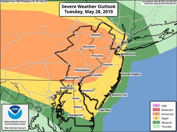
Severe Weather Moving Across Pennsylvania Into Western New Jersey
The Tornado Watch continues this evening and the western counties of New Jersey including Warren, Hunterdon, Mercer, Camden, Burlington, & Gloucester counties. In Northeast New Jersey & the coastal counties of Monmouth & Ocean, the wind off the ocean has created a bit of stabilizing effect which extends into the Hudson Valley Long Island & Connecticut which lessens the risk for severe weather in those areas. Notice on the satellite picture that New Jersey from 195 South has broken out into sunshine and this warm tropical air is forcing its way northwestward. This continues to destabilize the atmosphere in the area where the tornado watch is posted.
SATELLITE
REGIONAL RADAR
Many of the thunderstorms in Pennsylvania are strong to severe and we have seen multiple severe thunderstorm and tornado warnings already. Judging from the local radars most of these storms are moving southeastward and look to play out south of Route 195 in the counties currently under a watch.
LOCAL RADAR NEW YORK CITY
LOCAL RADAR PHILADELPHIA

We are also watching thunderstorms approaching the Catskills and Poconos that are actually holding together quite well. These could impact Northern New Jersey to Southern New England and Long Island though I don’t think we will get widespread severe weather from these thunderstorms as they move southeastward. I have added the radar view from the Binghamton NY Radar so we can watch the progress of the northern band of storms.
LOCAL RADAR BINGHAMTON NY

Once all the thunderstorms move through this evening we should see weather conditions improve with leftover clouds overnight and a mix of sun and clouds developing for Wednesday. Temperatures will climb to the mid 70s to lower 80s and there is the chance for thunderstorms again late in the afternoon and evening. We will do it all over again on Thursday with a stronger cold front coming through late in the day before weather conditions generally improve for Friday and the start of the weekend.
MANY THANKS TO TROPICAL TIDBITS FOR THE USE OF MAPS
Please note that with regards to any tropical storms or hurricanes, should a storm be threatening, please consult your local National Weather Service office or your local government officials about what action you should be taking to protect life and property.


