Thunderstorms Tapering Off Shortly Central NJ Marginal Risk Severe Weather Sunday
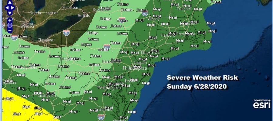
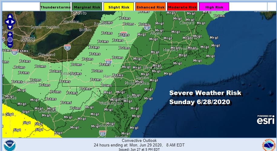
The Storm Prediction Center has New England to Virginia at a marginal risk for severe weather Sunday. We will be dealing with scattered thunderstorms and some isolated severe thunderstorms in the mix Sunday afternoon with a hot humid day otherwise. Highs will reach the mid 80s to near 90.
This evening’s severe weather shifted southward as the warm front had trouble getting through and for some areas the lack of daytime heating weakened storms. However plenty of daytime heating in Central and South Jersey as well as parts of Eastern Pennsylvania resulted in some severe thunderstorms late this afternoon and evening and now they are moving southeast and offshore.
SATELLITE

REGIONAL RADAR

Regional and local radars are still showing some thunderstorms around with one area moving off the coast of Southeastern New England and scattered now in Central New Jersey. Other storms are in Southwestern Pennsylvania moving eastward. The activity should be winding down in the next several hours across the region.
LOCAL RADAR NEW YORK CITY

LOCAL RADAR PHILADELPHIA


Moving to Sunday as we mentioned earlier we have a hot humid day ahead with highs in the mid 80s to near 90 and some scattered thundertorms that will pop up in the afternoon. I don’t expect lines of storms to develop but rather some isolated cells and perhaps a few small clusters in the mix. Then it is on to the week ahead where we will be dealing with an upper low in New England that will be sitting there most of the week. This will put us in a slow downtrend in temperatures and humidity through the week. It will still be on the warm side with highs most days in the 80s and lows in the 60s to near 70. I would watch late Tuesday or Wednesday as an upper air disturbance rotates around the New England low and triggers off a few pop up showers. Other than that the week should be on the dry side.
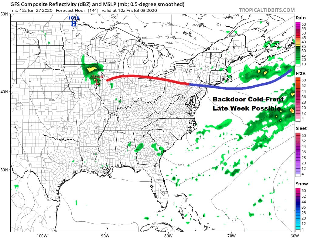
A change in the outlook at the end of the week involves that upper low as it moves east and strengthens east of Newfoundland. This will drive a cold front southward on Friday in backdoor fashion. This could mean cooler weather for New England down into the Middle Atlantic states for Friday and Saturday before the high moves offshore and it warms up on Sunday. The days look to be dry however which is a plus and front or no front, no significant rain is in the forecast either way. We will have more on the week ahead and next weekend which includes the 4th of July holiday over the next few days.
BE SURE TO DOWNLOAD THE FREE METEOROLOGIST JOE CIOFFI WEATHER APP &
ANGRY BEN’S FREE WEATHER APP “THE ANGRY WEATHERMAN!
MANY THANKS TO TROPICAL TIDBITS FOR THE USE OF MAPS
Please note that with regards to any severe weather, tropical storms, or hurricanes, should a storm be threatening, please consult your local National Weather Service office or your local government officials about what action you should be taking to protect life and property.


