THUNDERSTORMS CENTRAL NEW JERSEY DOWNPOURS TONIGHT
THUNDERSTORMS CENTRAL NEW JERSEY DOWNPOURS TONIGHT
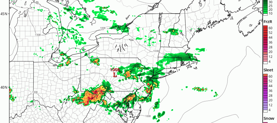
We are seeing some thunderstorms moving across Central New Jersey at the moment and some of those individual cells have turned severe briefly. That area is passing mainly south of New York City. This is where the warm sector set up today. From NYC north, northwest, and northeast radar is showing some rain and a few heavier downpours but we don’t see any thunderstorms in the mix at the moment.
SATELLITE LOOP

Across the Hudson Valley and Connecticut we are seeing rain with a few heavier downpours moving through but no thunderstorms are evident on the radar in these regions at the moment. We think thunderstorm development here will be minimal tonight.
REGIONAL RADAR

LOCAL RADAR NEW YORK CITY

LOCAL RADAR PHILADELPHIA


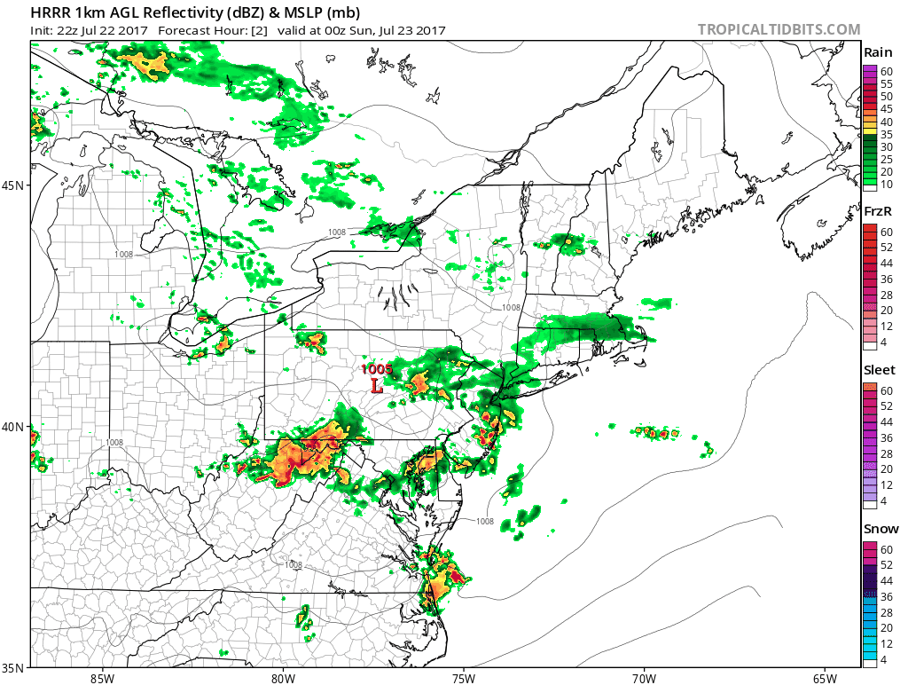
The HRRR model does show the area moving out of Eastern Pennsylvania firing up some in the next few hours and the loop of the model into the early morning hours does suggest that some areas could see some heavy rains.
HRRR MODEL 8PM SATURDAY TO 2AM SUNDAY CLICK TO ANIMATE
Sunday to me looks okay with only some scattered showers or thunderstorms popping up but there will be clouds around for a good part of the day and that will hold temperatures down as well as a wind off the ocean. Highs will be in the upper 70s to middle 80s
 GET JOE A CIGAR IF YOU LIKE

LANDSCAPE COMPANIES FOR YOUR NEEDS
LONG ISLAND ROCKLAND COUNTY Connecticut

![]()

ROCKLAND COUNTY TRI STATE SNOW REMOVAL JOHNSTOWN PA


FiOS1 News Weather Forecast For Long Island
FiOS1 News Weather Forecast For New Jersey
FiOS1 News Weather Forecast For Hudson Valley
NATIONAL WEATHER SERVICE SNOW FORECASTS
LATEST JOESTRADAMUS ON THE LONG RANGE
Weather App

Don’t be without Meteorologist Joe Cioffi’s weather app. It is really a meteorologist app because you get my forecasts and my analysis and not some automated computer generated forecast based on the GFS model. This is why your app forecast changes every 6 hours. It is model driven with no human input at all. It gives you an icon, a temperature and no insight whatsoever.
It is a complete weather app to suit your forecast needs. All the weather information you need is right on your phone. Android or I-phone, use it to keep track of all the latest weather information and forecasts. This weather app is also free of advertising so you don’t have to worry about security issues with your device. An accurate forecast and no worries that your device is being compromised.
Use it in conjunction with my website and my facebook and twitter and you have complete weather coverage of all the latest weather and the long range outlook. The website has been redone and upgraded. Its easy to use and everything is archived so you can see how well Joe does or doesn’t do when it comes to forecasts and outlooks.
Just click on the google play button or the apple store button on the sidebar for my app which is on My Weather Concierge. Download the app for free. Subscribe to my forecasts on an ad free environment for just 99 cents a month.
Get my forecasts in the palm of your hand for less than the cost of a cup of Joe!


