
Thunderstorm Chance Late Today Beautiful Tuesday Severe Weather Risk Wednesday

Weather in 5/Joe & Joe Weather Show Latest Podcast
Thunderstorm Chance Late Today Beautiful Tuesday Severe Weather Risk Wednesday
The new work week begins and it will be an interesting week with some volatility and a little bit of everything for everyone. Today we have partly sunny skies as temperatures rise to the mid and upper 60s. An upper trough coming out of the Ohio Valley could trigger off a few scattered showers or a thunderstorm late this afternoon or evening. It is probably a fair bet that many of you won’t see much from this so we mention the risk and then we keep an eye on the radar late today into tonight.
SATELLITE

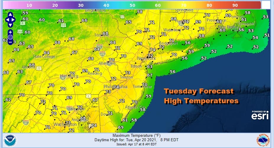
Once the trough moves through it leaves us in a rather good place for Tuesday. Weak high pressure to the south and a southwest flow means highs in the low to mid 70s. We should enjoy partly to mostly sunny skies. Tuesday no question will be the best day of the week.
Now let us move to Wednesday which will be the day of change. A strong cold front will approach as low pressure heads out of Kentucky and moves into New York State. Eventually this storm intensifies into a powerful system once it reaches Canada.

We indicated yesterday that this could be a situation where we might see the Storm Prediction Center show a marginal risk for severe weather on Wednesday and indeed on their latest forecast they have done that as the map shows above.
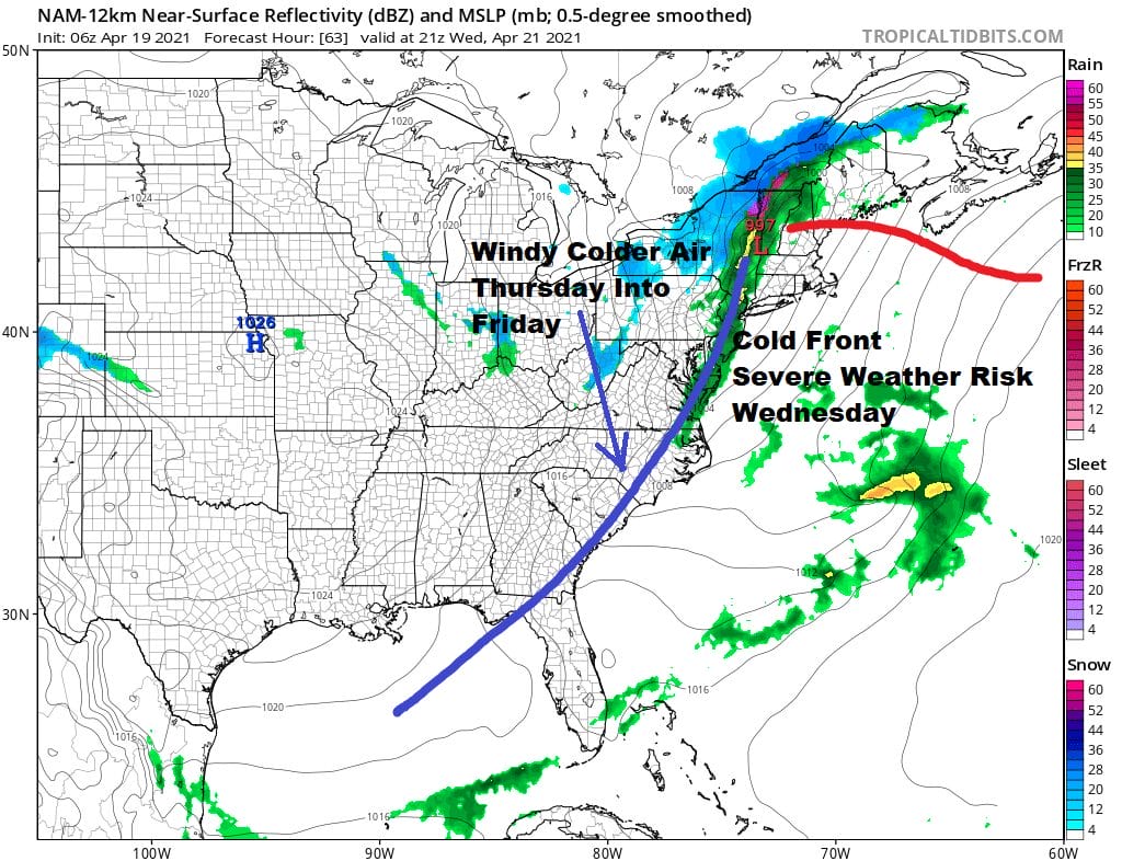
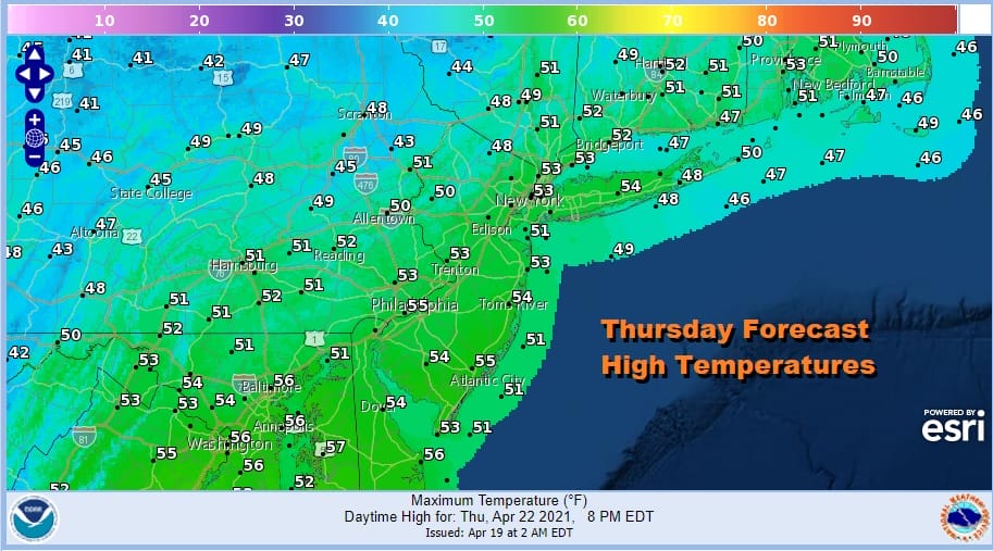
Wednesday morning should start with sun before clouds arrive around midday and showers and thunderstorms roll through during the afternoon. Highs will be in the 60s to around 70. Once the front passes and winds go to the northwest, temperatures will drop off. Winds will increase sharply Wednesday night and Thursday. Winds will gust 30 to 40 mph at times but I’m still thinking just below wind advisory criteria. Thursday sees a mix of sun and clouds and high just in the low to mid 50s at best.
Friday will still be on the windy side with some sunshine and highs back into the upper 50s and lower 60s. The weekend is looking more and more at risk for rain. Saturday looks to be the better of the two weekend days with sunshine giving way to arriving clouds. Low pressure heads out of the Gulf States and moves to the Mid Atlantic Coast. This sets us up for a raw soaking rain late Saturday night and Sunday as the low passes to our south. This should be a system that keeps on moving and that will allow weather conditions to improve next week.

BE SURE TO DOWNLOAD THE FREE METEOROLOGIST JOE CIOFFI WEATHER APP &
ANGRY BEN’S FREE WEATHER APP “THE ANGRY WEATHERMAN!
MANY THANKS TO TROPICAL TIDBITS FOR THE USE OF MAPS
Please note that with regards to any severe weather, tropical storms, or hurricanes, should a storm be threatening, please consult your local National Weather Service office or your local government officials about what action you should be taking to protect life and property.


