
Thundersnow Blizzard 2018 Moving Northeast
Thundersnow Blizzard 2018 Moving Northeast
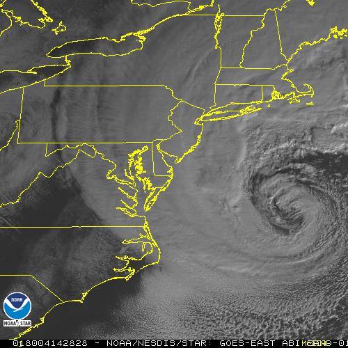
Suffolk County getting reports of thundersnow which is not a big surprise here as this major East Coast storm continues to rage from Delaware to New England. Blizzard warnings continue for Coastal New Jersey & Suffolk County on Long Island. Near Blizzard conditions extend westward to New York City, Northeast New Jersey and Southern & Eastern areas of the Hudson Valley. Winds are gusting to over 50 mph in some coastal locations. Snow and blowing snow are reducing visibility down to near zero. You can see the well defined cyclone on the satellite loop below and the radar echos are all backing northwestward and that will continue into this afternoon. The storm is heading right for the 40N 70W beanchmark.
SATELLITE LOOP

REGIONAL RADAR

LOCAL RADAR NEW YORK CITY

LOCAL RADAR PHILADELPHIA


This storm is going to be moving to the northeast at a pretty good clip. Coastal areas will wind up with a foot plus in some areas..less as you go north and west. At this point we are just going to let it ride along. Areas north and west of the coast in Northwest New Jersey will wind up with far less.
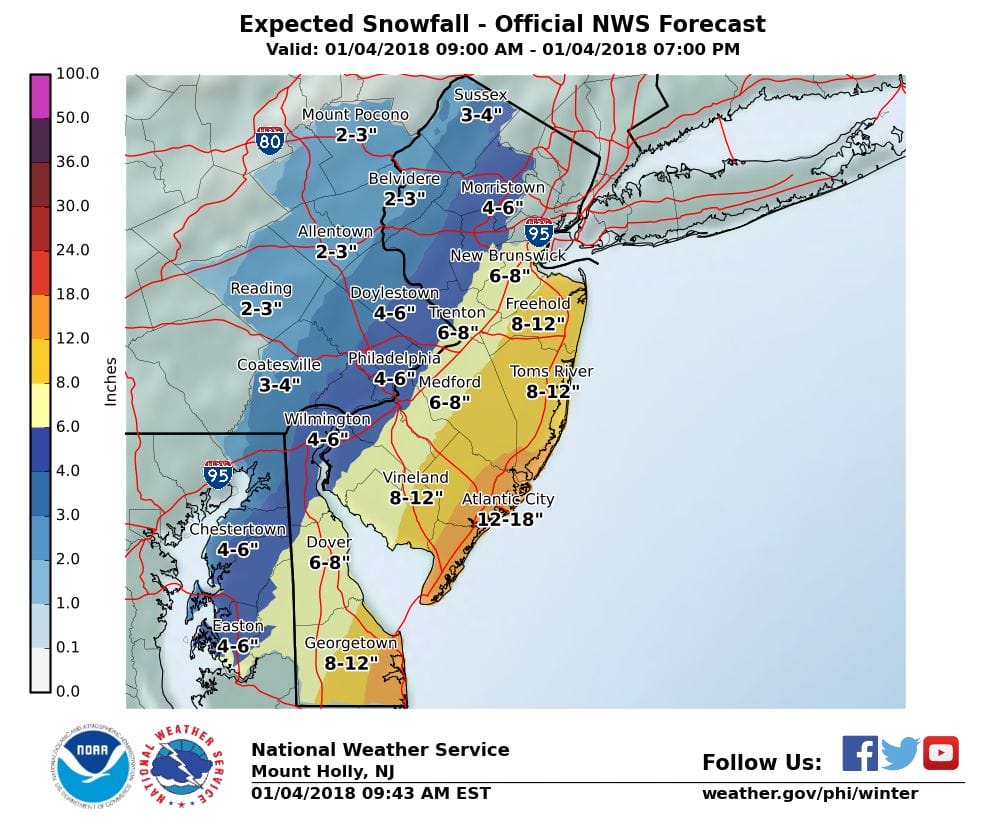
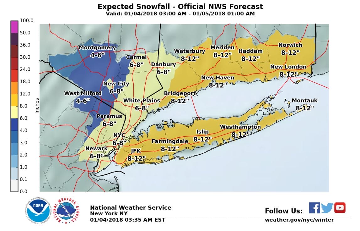
National Weather Service snowfall forecast maps remain unchanged. All of this will wind down later this afternoon and evening from west to east. Then its brutal cold tonight with lows in the single digits to near 10 by morning and highs tomorrow only in the low teens at best. Wind chills will be well below zero right through Saturday and by Saturday morning actual air temperatures will be sub zero in much of the area.
 GET JOE A CIGAR IF YOU LIKE

FiOS1 News Weather Forecast For Long Island
FiOS1 News Weather Forecast For New Jersey
FiOS1 News Weather Forecast For Hudson Valley


