
Blizzard Ends Record Arctic Cold Arrives
Blizzard Ends Record Arctic Cold Arrives
Blizzard 2018 is ending as far as the accumulating snow is concerned but it will look like the vast Arctic wasteland tonight through Saturday as now we will be dealing with strong winds gusting to 40 to 50 mph and blowing snow. This will reduce visibility to near zero at times and snow cleared roads could easily become snow covered again so exercise caution if you are driving anywhere especially over the weekend. Temperatures are headed south in a big way and it will be in the single digits by Friday morning.
The intense cyclone is an obvious standout on the satellite loop with an “eye” that stands out. The storm center is heading toward Nova Scotia.
SATELLITE LOOP

REGIONAL RADAR

The radars are rapidly winding down this evening and they should go silent before too long. We don’t have any additional snow in the forecast through the weekend.
LOCAL RADAR NEW YORK CITY

LOCAL RADAR PHILADELPHIA


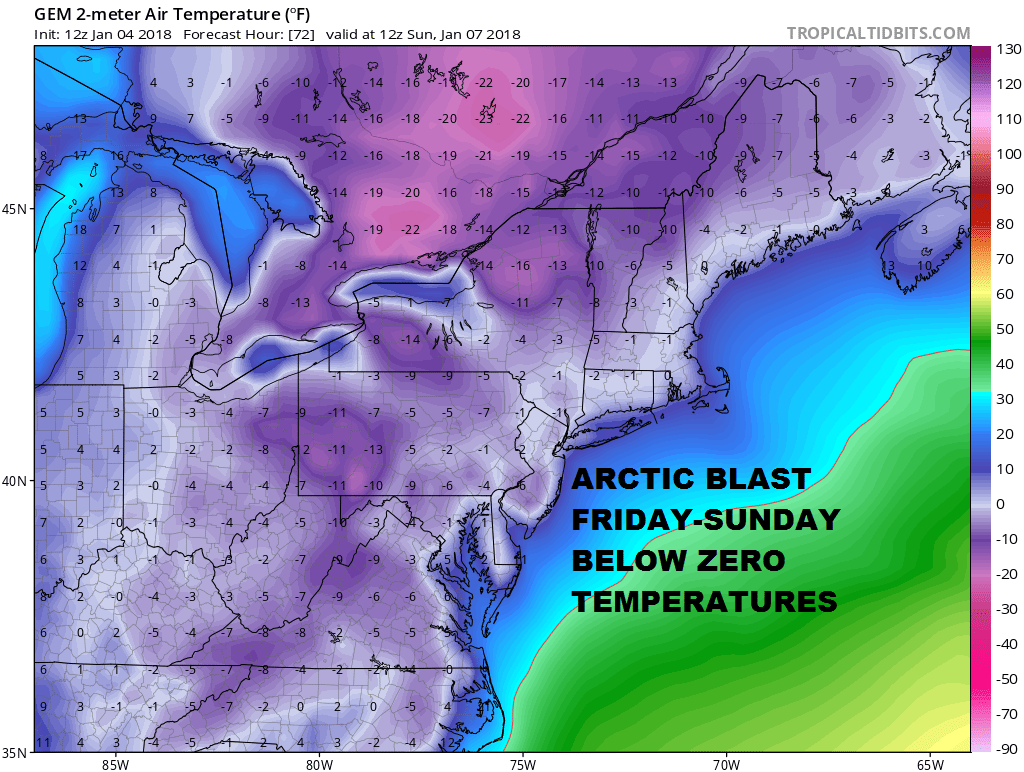
Cold Cold Cold. That is what we will be dealing with through Sunday. Bitter cold conditions will feature wind chills of -10 to -20, daytime temperatures barely in the lower teens and nights will be near or below zero. Sunday morning looks to be the coldest morning and some areas with the deep snow cover, clear skies, and light winds, could see some lows down to -10 or -15 away from warmer urban areas. At least we will have sunshine Friday and over the weekend though it will be ineffective. Sunday we could see temperatures reach the upper teens and lower 20s.
The longer range pattern looks to be relaxing as far as the Arctic connection is concerned and we should see temperatures get back to average or a perhaps slightly above average next week on a few days. This will at least give us a much needed break in this record Arctic cold.
 GET JOE A CIGAR IF YOU LIKE

FiOS1 News Weather Forecast For Long Island
FiOS1 News Weather Forecast For New Jersey
FiOS1 News Weather Forecast For Hudson Valley


