The Last Winter Weekend Arriving Clouds Rain or Snow Shower Tonight Sun Returns Sunday
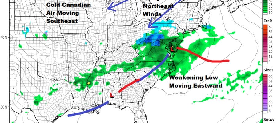
We are enjoying a beautiful start to the day as the satellite picture shows us in cloud free skies at least for now but to the west we have clouds that are pushing eastward. This is due to low pressure moving quickly eastward across the lower Ohio Valley. There is an area of precipitation with this (mainly rain) and this system will be weakening as it moves east. This will keep precipitation to a minimum tonight and some places, especially as you go north of NYC & Philadelphia won’t see much of anything other than clouds. There is a chilly breeze working today and temperatures will reach the upper 40s and low 50s for highs.
SATELLITE

REGIONAL RADAR

Tonight look for an area of light rain that might even have a few snowflakes in the mix as the low moves east and continues to weaken. The highest changes for a few hours of light rain will be in areas from Southern New Jersey (south of 195), Southern Pennsylvania (south of Route 76) down into Maryland and Virginia.
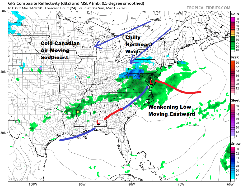
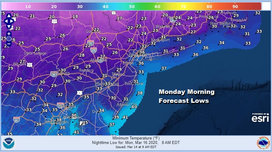
Two things that stand out on tonight’s GFS forecast for 2am Sunday are the weak nature of the low and the colder high that is pressing southeast from Canada. The low weakens because an upper high is building to the east effectively ripping this system apart. Then the high builds in and we will see morning clouds Sunday giving way to sunshine but it will be chilly with highs in the 40s to near 50. This leads us to a cold Sunday night into Monday morning with lows in the 20s to lower 30s in warmer urban settings.
Monday looks to be a sunny but cold day with highs just in the low to mid 40s. The cold high moves out and the next cold front arrives Tuesday with some showers late Monday night into early Tuesday. Then another cold high builds in for Wednesday into Thursday followed by another cold front and showers for Thursday night into Friday. This is the last weekend of winter and the season looks to end uneventful this week as these minor systems play out. Next week at this time it will be spring!
BE SURE TO DOWNLOAD THE FREE METEOROLOGIST JOE CIOFFI WEATHER APP &
ANGRY BEN’S FREE WEATHER APP “THE ANGRY WEATHERMAN!
MANY THANKS TO TROPICAL TIDBITS FOR THE USE OF MAPS
Please note that with regards to any severe weather, tropical storms, or hurricanes, should a storm be threatening, please consult your local National Weather Service office or your local government officials about what action you should be taking to protect life and property.


