DOWNLOAD MY NEW FREE JOESTRADAMUS WEATHER APP FOR ANDROID
THE APP IS ABSOLUTELY FREE TO ALL BUT CONSIDERING SUBSCRIBING TO PATREON FOR A WEATHER EXPERIENCE FREE OF ADS, EXCLUSIVE VIDEOS FOR MEMBERS ONLY AND MUCH MORE…STARTS AT $2 A MONTH..MESSAGE ME AT ANY TIME
Temperatures Plunge Single Digits Monday Morning

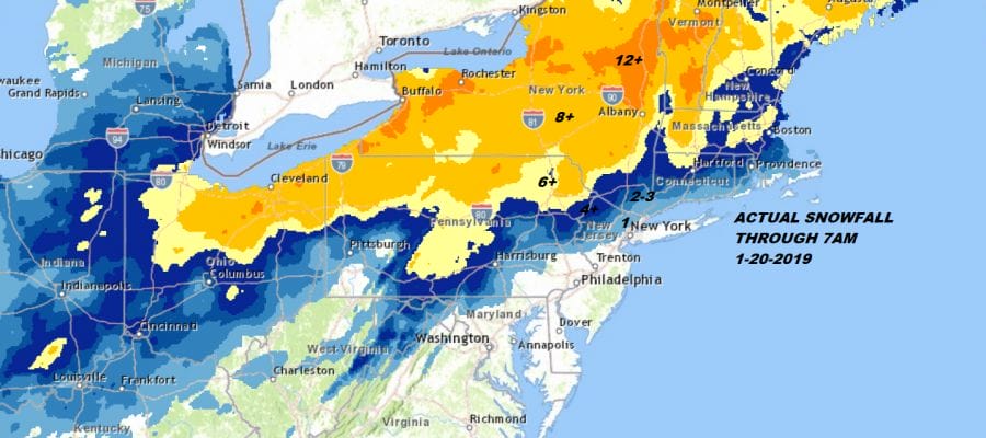
Snow totals lined up the way they should given an inland low track. Where weather models failed was trying to push temperatures above freezing up the Middle Hudson Valley. Many areas north and west of the Hudson didn’t quite make it above 32 and are sitting with ice covering everything.
For much of our area the precipitation is over with however it still goes on in New England with heavy snow from Central and Northern New England back to Northeastern NY. Tomorrow’s snow map will have all the final totals from this storm.
REGIONAL RADAR

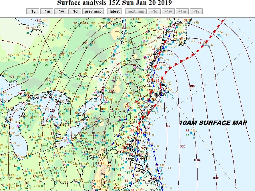
The low is moving to the northeast so the temperature plunge begins as bitter cold from Northeastern Canada has no where to go but south. By morning we will be waking up to temperatures in most place at 10 or less and wind chills below zero.

Monday and Tuesday will be brutally cold with highs just in the teens Monday and back into the single digits to near zero Monday night. We should recover back to the mid 20s on Tuesday. You would think that with all this cold air we would get some snow from the next weather system arriving on Wednesday but temperatures will hold Tuesday night and Wednesday afternoon many areas will be reaching into the 40s.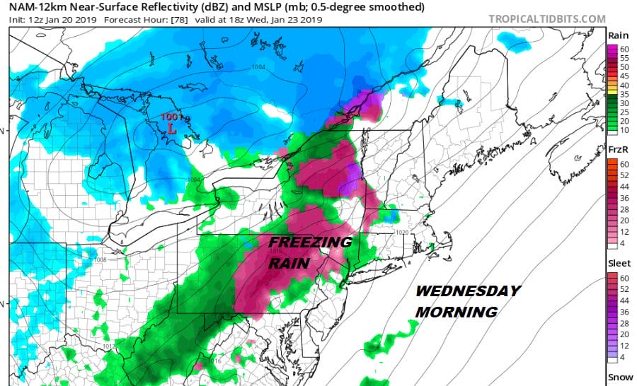
Inland areas Wednesday morning will be cold enough for at least a few hours that if precipitation arrives fast enough after daybreak, there could be some freezing rain thanks to the bitter cold air of the last few days. It will take time for surfaces to warm up enough but they should eventually so that we get into some plain rain shower later in the day Wednesday.
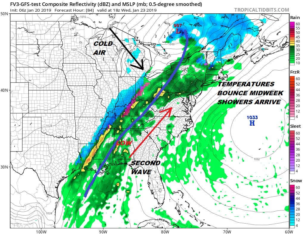
The front is going to slow down as it passes through us as it waits for a second wave to develop and go by on Thursday. There is cold air behind the front but it will likely have to wait for that wave to go by which will produce mostly rain along the coast. Next weekend weather models are indecisive but there will be another system that could threaten the Eastern US later next weekend or early next week but it is sort of pointless to speculate on it at this point. The upper air pattern suggests something could dive down from the Great Lakes and create a low off the East Coast with cold air around but this falls into the “who knows” category at this point.
MANY THANKS TO TROPICAL TIDBITS FOR THE USE OF MAPS
Please note that with regards to any tropical storms or hurricanes, should a storm be threatening, please consult your local National Weather Service office or your local government officials about what action you should be taking to protect life and property.