DOWNLOAD MY NEW FREE JOESTRADAMUS WEATHER APP FOR ANDROID
THE APP IS ABSOLUTELY FREE TO ALL BUT CONSIDERING SUBSCRIBING TO PATREON FOR A WEATHER EXPERIENCE FREE OF ADS, EXCLUSIVE VIDEOS FOR MEMBERS ONLY AND MUCH MORE…STARTS AT $2 A MONTH..MESSAGE ME AT ANY TIME
Bitter Cold Strong Winds
Midweek Temperature Bounce
We are starting the day in the midst of a brutally cold air mass. This air is coming down from Northeastern Canada which is how we see some of the coldest temperatures in the Northeast. This morning lows were all in the single digits and we even had a few spots hovering around the zero mark in Northwest New Jersey (Andover -2) and in the Hudson Valley (numerous spots at zero). The wind is insane with gusts over 50 mph along some coastal areas. Wind chills are running between -10 and -20.

There won’t be much improvement this afternoon and highs will be only in the upper single digits to lower teens in most places. This could be one of the coldest day in many years. The satellite loop this morning is showing some clouds that are developing as the upper trough moves by. The core of the cold air will be moving overhead today. Some areas might see a passing brief snow shower into this afternoon. Otherwise it is a wind and brutally cold stay by the fireplace kind of day.
EASTERN SATELLITE

REGIONAL RADAR

Tonight will be clear and bitter cold with less wind but temperatures might be a shade higher than they were this morning. Lows will be in the single digits to lower teens. Tuesday looks better with sunshine and less wind with highs reaching 20s.
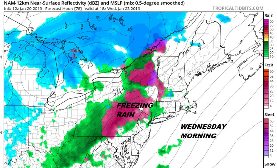
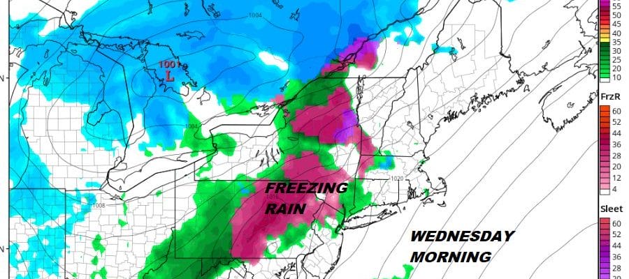
Wednesday we see a cold front approaching and believe it or not with all this cold air around, no snow is forecast. What we will have to watch for is the possibility of freezing rain at the start of day if precipitation comes in fast enough. We will look at this closer later today otherwise we should see some rain showers. The front will stall and we will see some rain Wednesday night into Thursday.
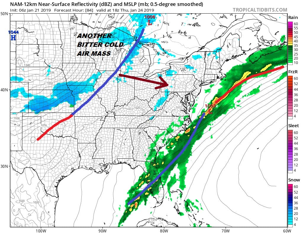
Long range another bitter cold shot of air will be moving in late in the week as an arctic front passes late Friday setting us up for a very cold weekend. There isn’t much on the models to really excite my interest regarding the next stor threat. Cold and dry pattern overall seems to be the dominating feature at the moment.
MANY THANKS TO TROPICAL TIDBITS FOR THE USE OF MAPS
Please note that with regards to any tropical storms or hurricanes, should a storm be threatening, please consult your local National Weather Service office or your local government officials about what action you should be taking to protect life and property.


