Warm Up Limited Sun Today More Sun Monday, Showers Tuesday Colder Mid Late Week Day two of the holiday weekend

Warm Up Limited Sun Today More Sun Monday, Showers Tuesday Colder Mid Late Week Day two of the holiday weekend
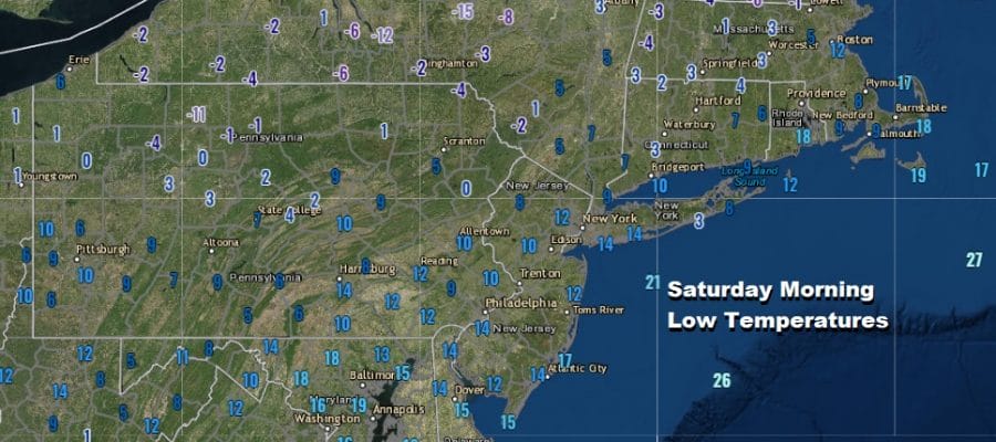
Temperatures Bounce Higher Next Chance for Rain or Showers Tuesday This morning we woke up to the coldest temperatures of
Coldest Night Of The Month & Winter Temperatures Rebound Sunday Monday Up until tonight, the coldest temperatures occurred way back
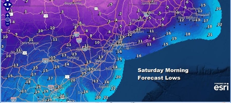
Rain Ends Very Cold Air Follows Into Holiday Weekend Warmer Sunday Monday We are starting the day off with some