Sunshine Sunday Monday As Next Storm Arrives Tuesday
Sunshine Sunday Monday As Next Storm Arrives Tuesday
Finally we are seeing some sunshine after the rain of the last 2 days. Following the recent trends its been a storm system every 2 to 3 days and 2 days of dry. We are in the 2 days of dry with sunshine out there today. Temperatures will reach the 50s which this time of year is sort of an atmospheric no brainer. The strong sun sends temperatures higher pretty much on cue. Enjoy the day. Other than a bit of a breeze there are no serious weather issues.
SATELLITE LOOP

REGIONAL RADAR

LOCAL RADAR NEW YORK CITY

LOCAL RADAR PHILADELPHIA


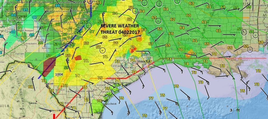
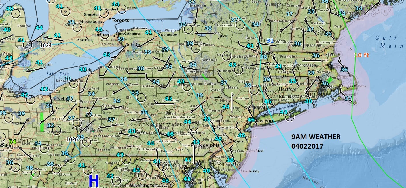
Radars are nice and quiet through Monday. Tonight looks nice and clear with most lows in the 30s..some 20s in cold spots. Sunshine on Monday will give way to afternoon arriving clouds and highs again in the 50s. The next storm system is already organizing today in the Western Gulf States where a serious severe weather outbreak is underway.
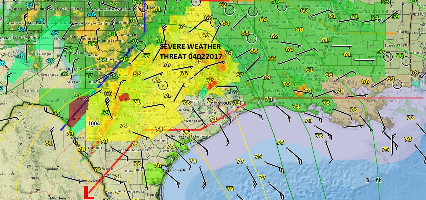
There are already Severe Thunderstorm Watches and Flood Watches up as low pressure develops in East Texas. This is going to bring another round of rain here beginning overnight Monday night into Tuesday night on the order of a couple of inches. The ground is actually saturated so flood watches might be in order as that system plays through here.
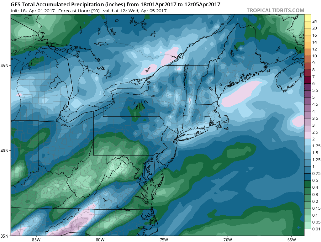
Wednesday into Thursday is the next break and then more rain is coming for later Thursday and Thursday night as the next storm brings a cold front through. This one may bring some severe weather into the Middle Atlantic states. GET JOE A CIGAR IF YOU LIKE
LANDSCAPE COMPANIES FOR YOUR NEEDS
LONG ISLAND ROCKLAND COUNTY Connecticut

![]()

ROCKLAND COUNTY TRI STATE SNOW REMOVAL JOHNSTOWN PA


FiOS1 News Weather Forecast For Long Island
FiOS1 News Weather Forecast For New Jersey
FiOS1 News Weather Forecast For Hudson Valley
NATIONAL WEATHER SERVICE SNOW FORECASTS
LATEST JOESTRADAMUS ON THE LONG RANGE
Weather App

Don’t be without Meteorologist Joe Cioffi’s weather app. It is really a meteorologist app because you get my forecasts and my analysis and not some automated computer generated forecast based on the GFS model. This is why your app forecast changes every 6 hours. It is model driven with no human input at all. It gives you an icon, a temperature and no insight whatsoever.
It is a complete weather app to suit your forecast needs. All the weather information you need is right on your phone. Android or I-phone, use it to keep track of all the latest weather information and forecasts. This weather app is also free of advertising so you don’t have to worry about security issues with your device. An accurate forecast and no worries that your device is being compromised.
Use it in conjunction with my website and my facebook and twitter and you have complete weather coverage of all the latest weather and the long range outlook. The website has been redone and upgraded. Its easy to use and everything is archived so you can see how well Joe does or doesn’t do when it comes to forecasts and outlooks.
Just click on the google play button or the apple store button on the sidebar for my app which is on My Weather Concierge. Download the app for free. Subscribe to my forecasts on an ad free environment for just 99 cents a month.
Get my forecasts in the palm of your hand for less than the cost of a cup of Joe!


