
Sunshine Starts A Mostly Quiet Week Late Week System Looking Suppressed
Another nice day is ahead of us with lots of sunshine. We have a chilly air mass overhead today and highs will be back into the low and middle 50s. Just about everyone except the warmest urban centers bottomed at 32 or less this morning so that takes care of the growing season just about everywhere. Skies are clear on the satellite though there are high clouds out to the west that will be moving east as the day wears on but they should not be any big deal.
SATELLITE

REGIONAL RADAR

Tonight won’t be a chilly as winds go southwest and we wait for a weak cold front to approach on Tuesday. Lows will be in the 30s inland and mostly 40s along the coast and warmer urban centers. Tuesday look for clouds with some breaks of sun. A couple of passing showers are possible with highs reaching in the upper 50s and lower 60s.

Wednesday brings the next high and the next round of chill in this up and down week. We should see some sunshine Wednesday with highs in the upper 40s to lower 50s. Thursday brings the next front that will usher in an even colder air mass for Friday into the weekend. We have been thinking that there could be a period of precipitation but that it will be more suppressed and south.

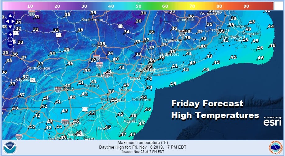
I still want to see how this evolves over the next couple of days. This obviously is not a major system regardless. The time frame for any precipitation would be Thursday night into early Friday morning. Cold air follows this system with highs Friday just into the 40s and inland areas won’t be getting out of the 30s.
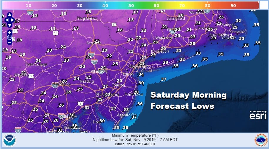
The air mass behind the the Thursday night Friday morning weather system is going to bring the coldest air of the season so far and that will bring widespread 20s for lows Saturday morning with teens in many colder inland areas.
The weekend will be dry but we could be setting up for a more important weather risk of rain and snow early next week. That system looks like it has more potential to it than the one for Thursday night.
BE SURE TO DOWNLOAD THE FREE METEOROLOGIST JOE CIOFFI WEATHER APP &
ANGRY BEN’S FREE WEATHER APP “THE ANGRY WEATHERMAN!
MANY THANKS TO TROPICAL TIDBITS FOR THE USE OF MAPS
Please note that with regards to any severe weather, tropical storms, or hurricanes, should a storm be threatening, please consult your local National Weather Service office or your local government officials about what action you should be taking to protect life and property.


