Sunshine Finishes Week Showers Saturday into Sunday Snow Risk Next Week Increases

Weather in 5/Joe & Joe Weather Show Latest Podcast
Sunshine Finishes Week Showers Saturday into Sunday Snow Risk Next Week Increases
We are at the end of the week and we probably saved the best day of the week for today. After a chilly start (especially away from warmer urban settings) we are going to see plenty of sunshine and temperatures should rebound nicely. High pressure is to our south, we have a mostly west wind, and very little in the way of cloud cover on the satellite. Highs today will reach into the low and even some middle 50s. Radars are nice and quiet and should remain so into Saturday morning. Skies tonight should be clear though some clouds will start increase overnight. Most lows will be in the 40s
SATELLITE

REGIONAL RADAR

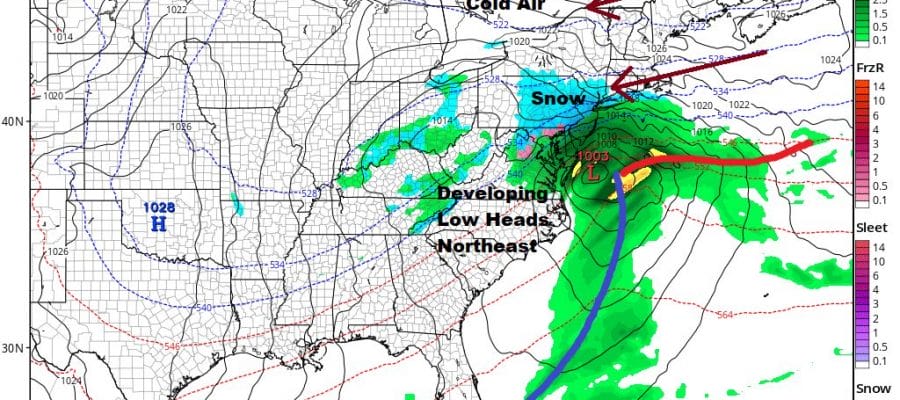
Attention turns Saturday to a storm coming out of the Plains and headed to the Great Lakes and eventually into Southeastern Canada. We have a cold front moving east, a southerly flow ahead of it, and some moisture so we are looking for showers for Saturday. It should not be a continuous rain. Highs will be in the mid 50s to near 60 or so in areas across Southern Pennsylvania and Southern New Jersey southward. Meanwhile north of NYC in the Hudson Valley and Southern New England, upper 40s and lower 50s will be more common.
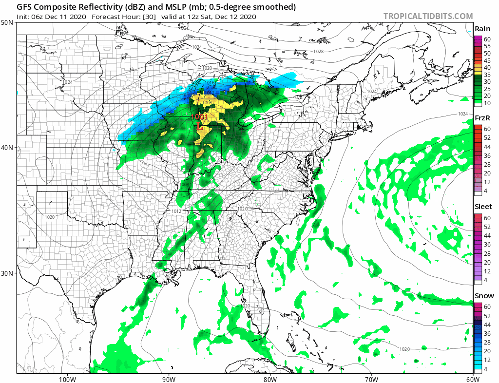
Saturday night into Sunday morning we will see some showers before the front moves offshore. Weather should attempt to improve from west to east Sunday but there is a problem. The front is going to stall to the south and east as it waits for another wave of low pressure to develop on it. Sunday’s highs will be in the 50s early on and then settle in the 40s later in the day.
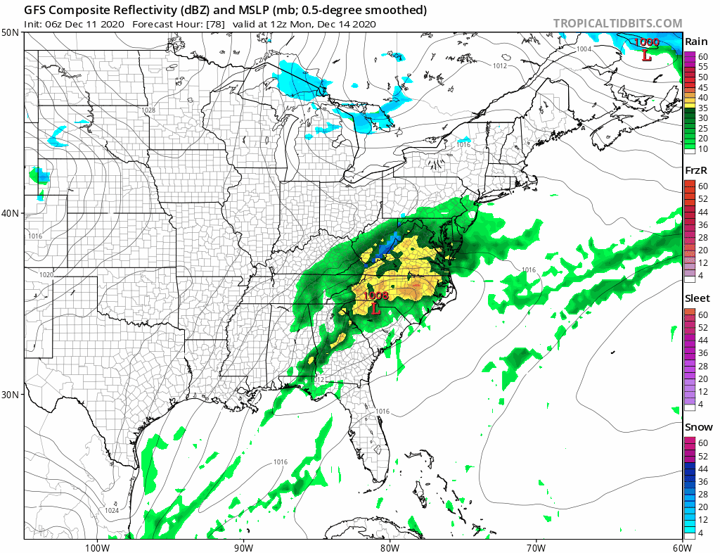
It appears that we will certainly see clouds and probably some rain late Sunday night into Monday afternoon from a line from NYC to Philadelphia south and east. This low has been coming further north over the last few days and it may not be done coming further north. Monday’s highs will be in the 40s. Cold high pressure coming in behind it builds across the Great Lakes, Southeastern Canada, and New New England Tuesday and it sets up the next storm for Wednesday.

For the first time in the last 2 years we actually have a block set up for this system on Wednesday. A large high builds into Eastern Canada and New England. Cold air bleeds southward from New England into the Northern Mid Atlantic. It is a near perfect set up for some accumulating snow including the coast. Watch for the block to hold stronger and the possibility it forces the system further south. This to me looks like a system that could produce several to maybe 6 inches for somebody. That would be a VERY EARLY GUESS for what its worth 5 days out. Temperatures Tuesday and Wednesday will be no higher than the 30s. Weather conditions improve once the low moves away early Thursday
Complete Winter Weather Coverage is available all winter season long on my weather platform on Patreon. It costs $2 a month and annual subscribers get 15% off or 2 months free.
BE SURE TO DOWNLOAD THE FREE METEOROLOGIST JOE CIOFFI WEATHER APP &
ANGRY BEN’S FREE WEATHER APP “THE ANGRY WEATHERMAN!
MANY THANKS TO TROPICAL TIDBITS FOR THE USE OF MAPS
Please note that with regards to any severe weather, tropical storms, or hurricanes, should a storm be threatening, please consult your local National Weather Service office or your local government officials about what action you should be taking to protect life and property.


