Sunshine Developing This Afternoon No Major Changes Through the Weekend
Humidity levels have dropped this afternoon into the 50s and that has made things more comfortable. We have also seen increasing amounts of sunshine. A cold front has passed through and offshore and this is actually left us in a nice spot. We will enjoy sunshine for the rest of the day, temperatures in the 80s and much more comfortable areas of humidity. Skies are mostly sunny or no worse than partly sunny judging by the latest satellite picture. The regional radar loop is showing very little with regards to showers and thunderstorms though a small line of storms is now moving east across Southeastern New England. Other than that no showers are forecast for the rest of today and tonight.
SATELLITE

REGIONAL RADAR

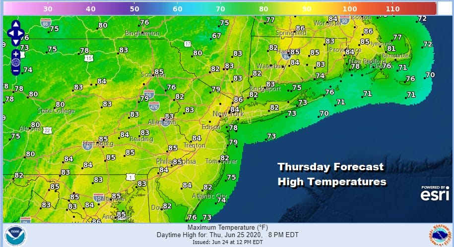
Moving on to tonight we should see clear skies. Warmer urban areas will bottom out close to 70 while 60s will be the lows everywhere else and even a few 50s in coolest spots well inland and north.Thursday looks nice with sunshine and reasonable humidity. Highs will be in the low to mid 80s.
Friday we will see another day with some sunshine and I will throw in the chance for a pop up shower or thunderstorm well inland. Highs will be in the mid to upper 80s. Humidity levels will nudge a little bit higher but they won’t be off the wall.

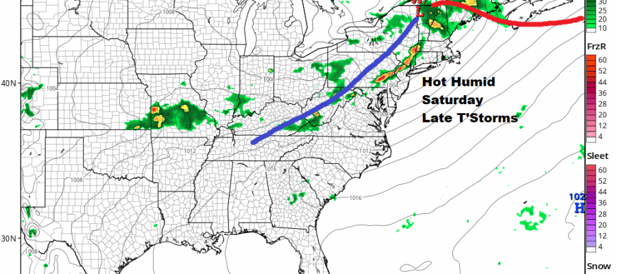
Let us now move on to the weekend which will start off with a hot and humid Saturday with some sunshine. Highs will reach the upper 80s to lower 90s. We do have a cold front coming through Saturday and that will trigger off a line of thunderstorms late in the day into Saturday evening.
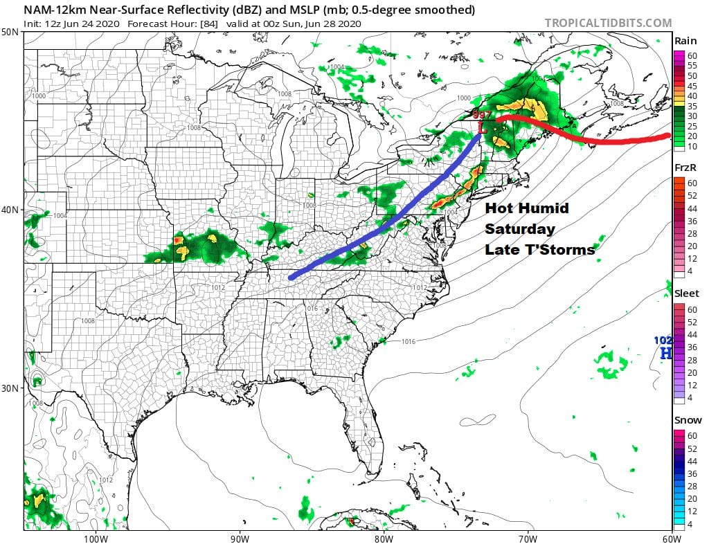
Sunday will be a partly sunny day and still on the humid side with highs in the mid to upper 80s. Another weak front will push through Sunday night into Monday and this sets us up for a change next week. Higher pressures across the Great Lakes and Southeastern Canada will build and that will create a flow from the northeast. It seems that the frontal boundary will push to our south leaving us in a mostly positive place weather wise next week.
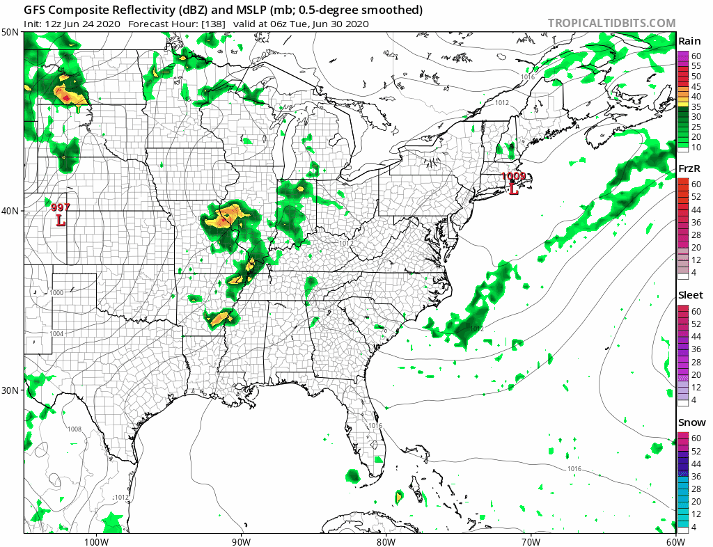
Temperatures will be lower, humidity will be somewhat lowever. The complication could come from a disturbance dropping south from New England around midweek putting us at risk for some scattered showers but no widespread rain is indicated here. You will see on the GFS loop above the frontal boundary sets up across the Mid Atlantic states where a couple of waves go by well to our south. As long as this remains the case it will mean most days highs will be just into the 80s with nights mostly in the 60s.

The upper air pattern for next week shows a strengthening upper low in Southeastern Canada/Northern New England that lingers all week and that keeps the heat and humidity away. Again we will see if something tries to swing around that upper low to create some minor issues at some point. As long as the upper low holds. heat and humidity can’t make it back into the Northeast. This might actually keep temperatures in check into Saturday the 4th of July before the trough pulls out. That might bring humidity and some heat back for a day or two next Sunday and Monday. Right now it would seem that Friday Saturday and Sunday (July 3-5) look to be rain free unless some sort of pop up isolated shower or downpour shows up.
BE SURE TO DOWNLOAD THE FREE METEOROLOGIST JOE CIOFFI WEATHER APP &
ANGRY BEN’S FREE WEATHER APP “THE ANGRY WEATHERMAN!
MANY THANKS TO TROPICAL TIDBITS FOR THE USE OF MAPS
Please note that with regards to any severe weather, tropical storms, or hurricanes, should a storm be threatening, please consult your local National Weather Service office or your local government officials about what action you should be taking to protect life and property.


