Sunshine Continues Rain Arrives Wednesday Into Thursday Colder Friday Saturday Rain Sunday
Weather in 5/Joe & Joe Weather Show Latest Podcast
Sunshine Continues Rain Arrives Wednesday Into Thursday Colder Friday Saturday Rain Sunday
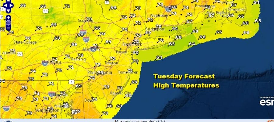
Judging from the satellite pictures this morning, it looks like we will squeeze out one more nice day of sunshine . Other than a few clouds coming into the mix today the major difference will be the wind direction which turns from the west to the south. That will hold temperatures down from the record levels of the last few days. Highs however will still be above average and reach into the 70s inland and remain in the 60s along the coast. This marks the end of our winning streak as a cold front plus a bit of tropical moisture from Tropical Storm Eta moves in on Wednesday.
SATELLITE
REGIONAL RADAR
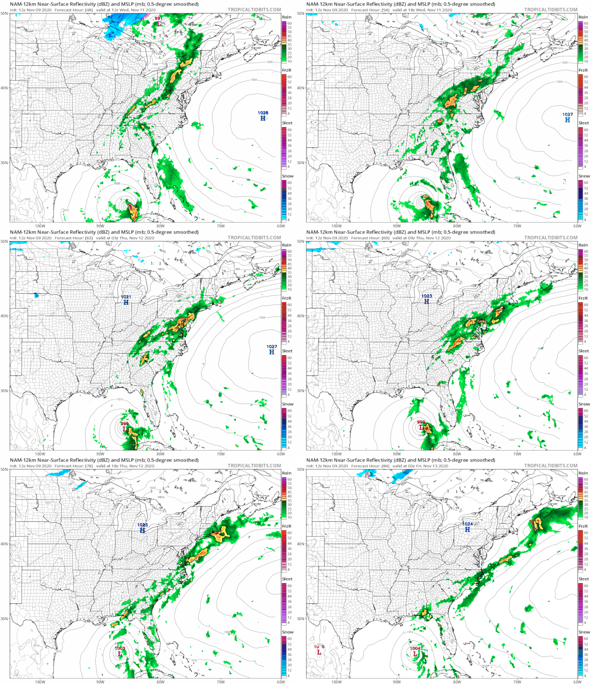
There are no issues tonight other than clouds rolling in overnight. Lows will be in the 50s to low 60s. Wednesday clouds thicken up and rain begins to approach. Initially the rain will move into Eastern Pennsylvania and it may not reach coastal areas until later in the day as the NAM models indicate.
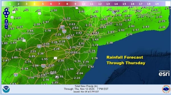
Timing has changed slightly. Rain arrives a little later on Wednesday so it will continue Wednesday night into Thursday morning but it should be gone by midday. Wednesday’s highs will be in the 60s to near 70. Thursday afternoon leftover clouds should give way to some improving sky conditions. Highs will be in the lower end of the 60s. The front will stall for a bit and another weak wave will keep us in clouds into Thursday night. There is some debate over whether there could be another round of showers into Friday however for now we will leave this out of the forecast. Rainfall amounts from the Wednesday/ Thursday system should be in the 1 to 2 inch range.
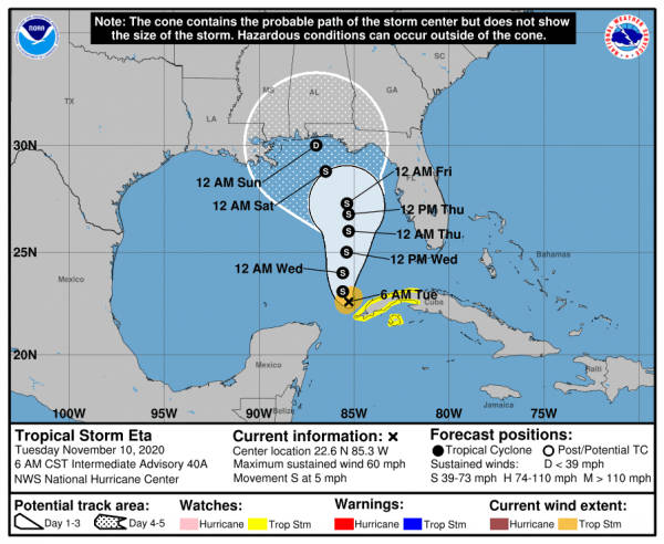
Friday and Saturday will be colder but we will have sunshine Friday and sunshine giving way to arriving clouds on Saturday with highs in the 50s. Saturday night and Sunday will hinge on Tropical Storm Eta in the Gulf of Mexico and whether the moisture from eta gets drawn up the east coast. There is some uncertainty here due to the erratic movement forecast for Tropical Storm Eta.
The National Hurricane Center forecast is for a slow northward drift and only some marginal strengthening as it does so. If it takes all week and into the weekend before the center approaches land, it is quite possible that Sunday could wind up being dry and that we will have to wait until Sunday night or Monday for the next round of rain. Behind this cold front it will turn cold for a couple of days next week.
BE SURE TO DOWNLOAD THE FREE METEOROLOGIST JOE CIOFFI WEATHER APP &
ANGRY BEN’S FREE WEATHER APP “THE ANGRY WEATHERMAN!
MANY THANKS TO TROPICAL TIDBITS FOR THE USE OF MAPS
Please note that with regards to any severe weather, tropical storms, or hurricanes, should a storm be threatening, please consult your local National Weather Service office or your local government officials about what action you should be taking to protect life and property.


