One More Nice Day Before Rain Arrives Wednesday Into Thursday More Rain Sunday

Weather in 5/Joe & Joe Weather Show Latest Podcast
One More Nice Day Before Rain Arrives Wednesday Into Thursday More Rain Sunday
We had another winner of a day across the Northeast and Middle Atlantic states with record highs in the mid to upper 70s across much of the area. There was hardly a cloud in the sky which has been the signature of the last 3 days. We have one more day left of good weather before we get a cold front, some tropical moisture and some rain which will arrive during Wednesday. In the meantime we will see another round of clear skies tonight with light winds. Temperatures will bottom in the 40s and even a few 30s in cold spots with 50s to near 60 everywhere else. Skies are clear on the satellite and the radars are silent.
SATELLITE

REGIONAL RADAR

Tuesday we will see some sunshine but there will also be a few clouds in the mix especially later in the day. Also we will see winds turn from the west to the south as the day wears on and this will likely hold temperatures down, though they still should reach into the 70s in most locations away from the ocean.

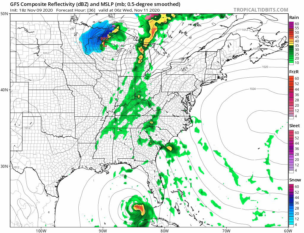
Low pressure in the Plains heads to the Great Lakes and a cold front begins to swing eastward. Tropical Storm Eta will be left behind in the Gulf of Mexico but some of the tropical moisture that extends from off the Southeast US coast southward will be pulled northward and that sets us up for rain arriving during Wednesday.
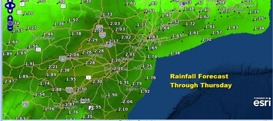
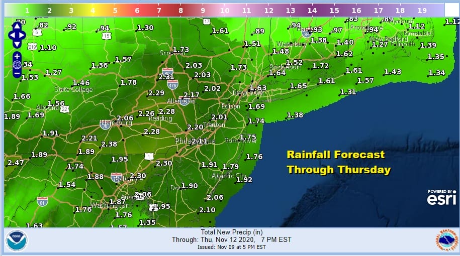
The rain should move in from west to east Wednesday afternoon and end from west to east Thursday morning around or shortly after daybreak. Rainfall amounts could be in the range of 1 to 2 inches which at least makes up for the dry conditions of the last week. Wednesday’s highs will be in the 60s to near 70 or so.
Cooler air moves in during Thursday and we will see a stair step decline in temperatures with highs in the leftover 60s Thursday. Some sunshine will be back for Friday into Saturday with highs both days just in the 50s.

The cool high to the north heads for Maine and points east and that sets us up with an onshore flow for Sunday. Low pressure over the Western Great Lakes moves east with a rather long warm front moving northward. That brings more rain and that too will have some leftover moisture from Tropical Storm Eta. This is probably going to be another 1 to 2 inch rain producer. Rain ends early on Monday and then it will gradually turn drier and colder for the first half of next week.
BE SURE TO DOWNLOAD THE FREE METEOROLOGIST JOE CIOFFI WEATHER APP &
ANGRY BEN’S FREE WEATHER APP “THE ANGRY WEATHERMAN!
MANY THANKS TO TROPICAL TIDBITS FOR THE USE OF MAPS
Please note that with regards to any severe weather, tropical storms, or hurricanes, should a storm be threatening, please consult your local National Weather Service office or your local government officials about what action you should be taking to protect life and property.


