Sunshine Chilly Tuesday Rain Wednesday Night Thanksgiving Rain Free Through The Weekend

Weather in 5/Joe & Joe Weather Show Latest Podcast
Sunshine Chilly Tuesday Rain Wednesday Night Thanksgiving Rain Free Through The Weekend
High pressure is building into the Northeast today and that will mean a mostly sunny but chilly day ahead. Temperatures today won’t get out of the 40s. The satellite picture morning shows mainly clear skies with some scattered to broken clouds well inland and those should diminish as the day wears on. The radars are nice and silent so enjoy this late fall day.
SATELLITE

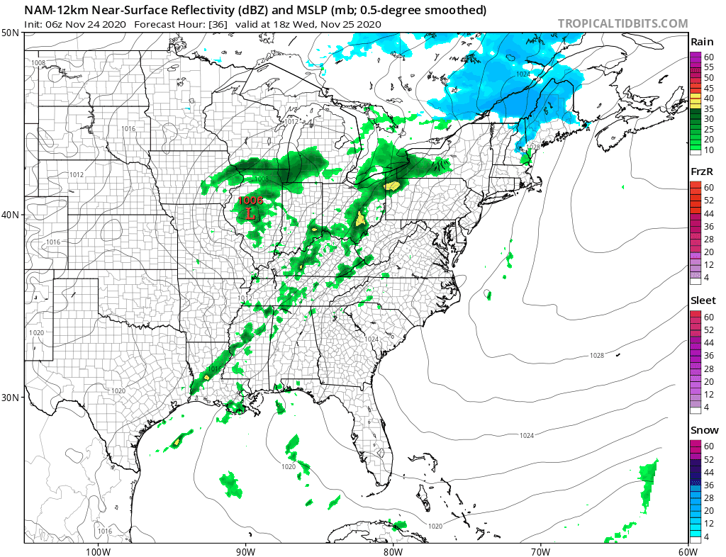
REGIONAL RADAR

Tonight will start clear with little wind and we will see temperatures radiate down to the upper 20s and lower 30s in many places away from warmer urban centers. Those warmer areas will bottom in the mid to upper 30s. Clouds will develop later tonight and that will prevent temperatures from dropping too low.
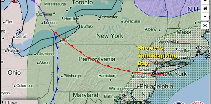
Much how we saw things set up back on Sunday into Monday, the same thing is happening this time around for Wednesday into Thanksgiving day. The difference is that the approaching cold front will be weakening instead of strengthening as it goes by. Wednesday look for a mostly cloudy day with highs reaching up into the 50s. There will be some showers around later Wednesday night into Thanksgiving Day afternoon but the rain should not amount to much. Otherwise Thanksgiving will be cloudy with highs in the 50s to near 60.

The Friday through Monday time frame brings two systems. There are no issues for Friday as we should see sunshine return with highs in the 50s. The GFS model shows a weak cold front moving through Saturday. There are some scattered showers indicated when the front passes but they seem few and far between and more to the south as it goes by. We will throw in the chance for a shower Saturday otherwise we will have clouds around along with limited sun. Highs will be in the 50s. The southern part of the front stalls in the Gulf of Mexico where low pressure develops and starts to turn northward on Sunday. Look for increasing clouds Sunday with highs just in the 40s to near 50. Rain and some of it could be heavy will move in later Sunday night into Monday. Monday’s highs will be just in the upper 40s to mid 50s.
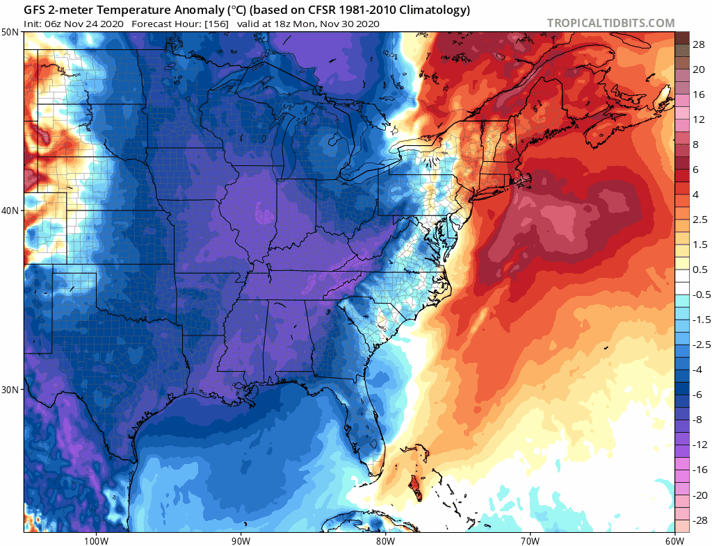
This storm strengthens as it heads into New England Monday and it will pull down cold air from Canada for Tuesday into Thursday of next week with below normal temperatures. Tuesday will be an especially windy day putting a bite into the cold. Tuesday and Wednesday highs probably won’t get out of the 30s.
BE SURE TO DOWNLOAD THE FREE METEOROLOGIST JOE CIOFFI WEATHER APP &
ANGRY BEN’S FREE WEATHER APP “THE ANGRY WEATHERMAN!
MANY THANKS TO TROPICAL TIDBITS FOR THE USE OF MAPS
Please note that with regards to any severe weather, tropical storms, or hurricanes, should a storm be threatening, please consult your local National Weather Service office or your local government officials about what action you should be taking to protect life and property.


