Sunshine Chilly Temperatures Back Into Saturday
Showers Sunday Night into Monday Thanksgiving Week Outlook

Weather in 5/Joe & Joe Weather Show Latest Podcast
Sunshine Chilly Temperatures Back Into Saturday
Showers Sunday Night into Monday Thanksgiving Week Outlook
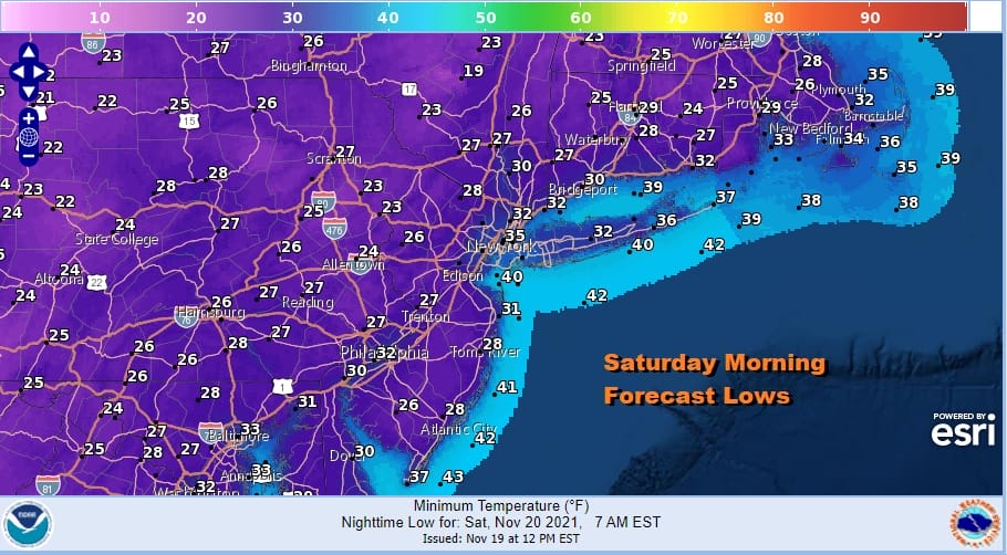
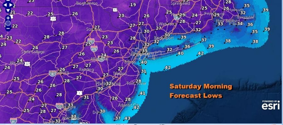
With last night’s cold front long gone we are enjoying a nice day of sunshine but it is coupled with a gusty northwest wind. Temperatures are in the mid to upper 40s and we will probably finish there or nudge up another degree or two before the afternoon is done. The satellite shows sunshine along the coastal plain and some clouds inland. The lake effect snow machine is on in Upstate NY as the regional radar is showing streamers of snow showers coming off the Great Lakes. Those bands will diminish this evening and skies will be partly to mostly clear tonight. It will be cold overnight with lows in the mid 20s to lower 30s.
SATELLITE

WEATHER RADAR

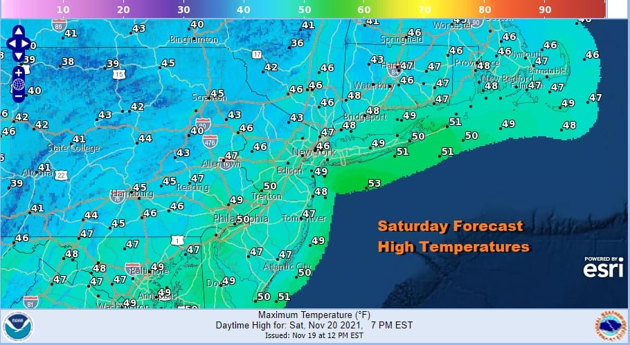
Saturday will be the better from the two weekend days from the standpoint of sunshine. We should have plenty of it. The core of this cold air mass will be slowly moving out on Saturday so temperatures will be slow to recover. Highs should reach the mid to upper 40s.
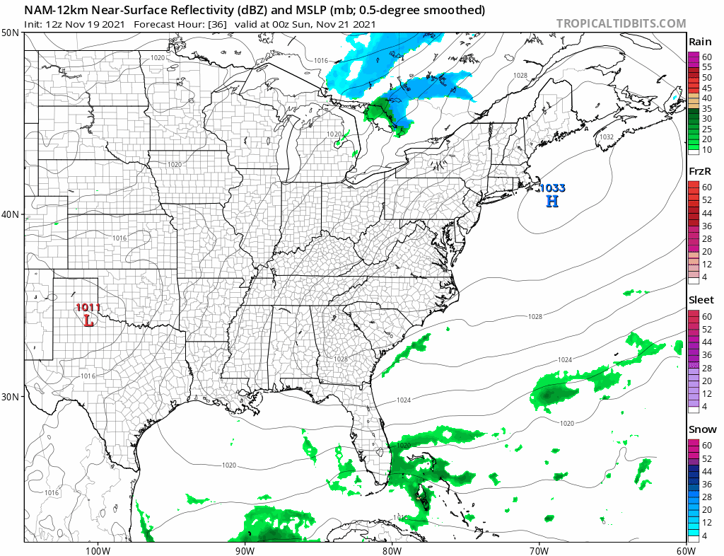
Now we move on to Sunday. A cold front from the Midwest and Ohio Valley will approach. Clouds will increase but so will the southwest flow ahead of the front and that will allow temperatures to move higher. We will be in the 50s though it will be closer to the lower end inland and to the higher end along the coast. This is due to clouds coming in faster to the west and maybe some early sun to the east that helps to boost temperatures a bit.
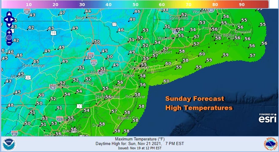
We will avoid showers during the day Sunday but they will come in Sunday night into Monday morning as the front moves through. Later Monday we will see leftover clouds with some breaks of sun develop along with a gusty wind. Temperatures Monday will probably be in the 50s but then ease later in the day as colder air gains an upper hand.
The cold front will be the only real weather maker of the week and that comes first thing Monday so the rest of the week will be dry. Wind will be a bigger issue along the coast as we see a blocking pattern to the east. A coastal low well offshore will be rotating around all week long and that will occasionally cause winds to become gusty along the coast.
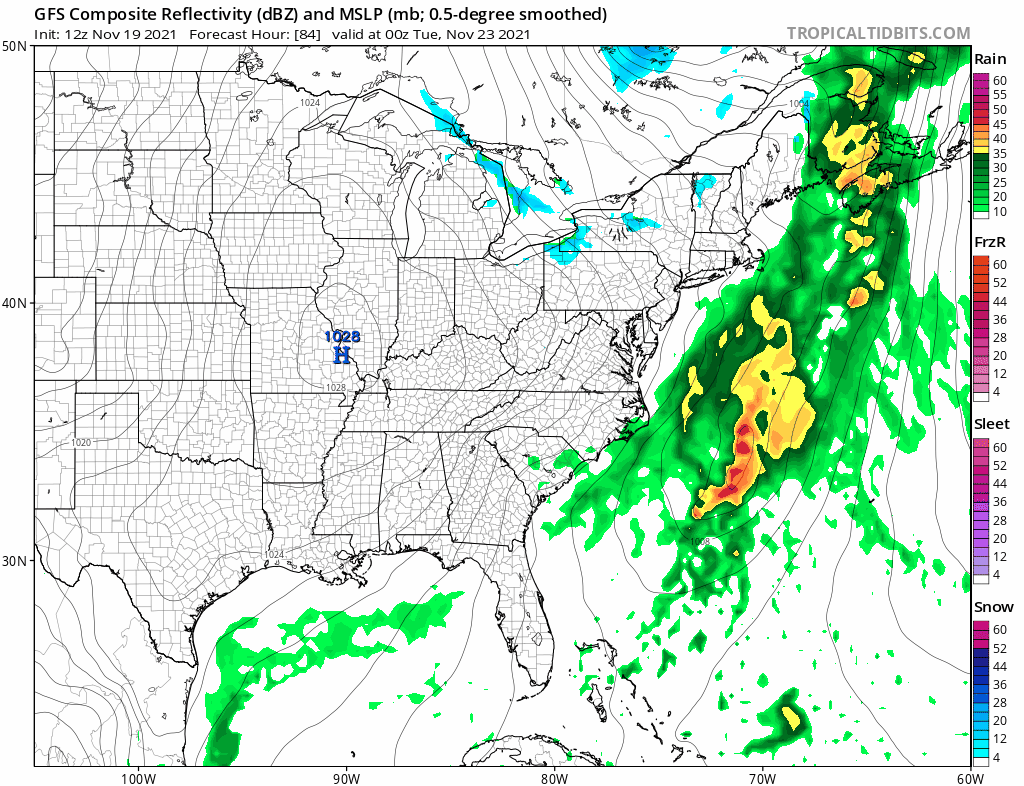
It will also be cold Tuesday and Wednesday. Tuesday highs will just be in the upper 30s and lower 40s. Wednesday highs will be in the low to mid 40s. There won’t be any weather issues as far as rain or snow are concerned for the entire week. There will be some sun and clouds for Tuesday and Wednesday. Thursday Thanksgiving day will be breezy with some sunshine. Highs should reach upper 40s and lower 50s. Another cold front comes through late in the week and brings colder air into the Northeast next weekend. We continue to watch for signs of low pressure coming out of the Gulf States late next weekend with the block to the east determining track and how far north that low gets. More on this in the long range outlook.
BE SURE TO DOWNLOAD THE FREE METEOROLOGIST JOE CIOFFI WEATHER APP &
ANGRY BEN’S FREE WEATHER APP “THE ANGRY WEATHERMAN!

MANY THANKS TO TROPICAL TIDBITS & F5 WEATHER FOR THE USE OF MAPS
Please note that with regards to any severe weather, tropical storms, or hurricanes, should a storm be threatening, please consult your local National Weather Service office or your local government officials about what action you should be taking to protect life and property.


