Sunshine Warm Afternoon Showers Tonight Breezy Colder Friday Into Weekend
Weather in 5/Joe & Joe Weather Show Latest Podcast
Sunshine Warm Afternoon Showers Tonight Breezy Colder Friday Into Weekend
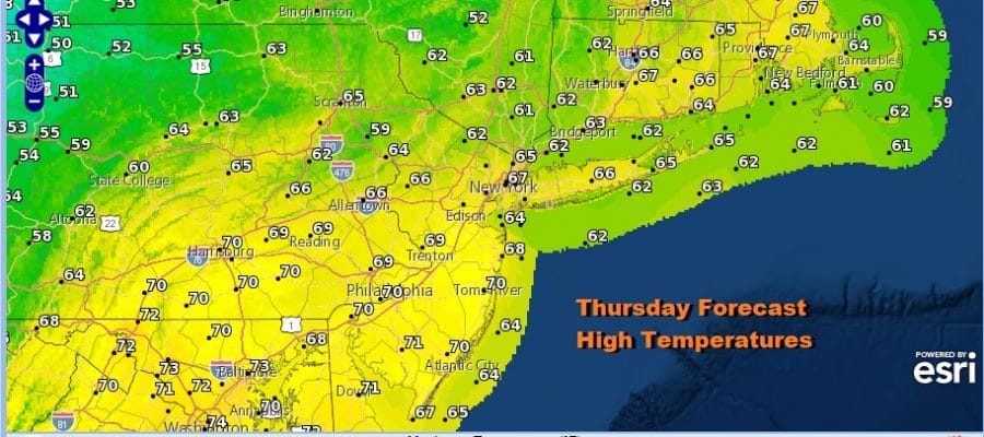
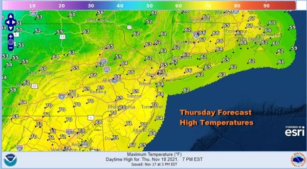
We are watching an approaching cold front to the west but we still have a lot of time before it reaches the coast. The satellite shows mostly cloud free skies into Central Pennsylvania as of midday so we will warm up nicely this afternoon. Perhaps some clouds will approach late today but that won’t stop temperatures from reaching the mid 60s to lower 70s for afternoon highs. No rain is forecast through sunset.
SATELLITE
WEATHER RADAR
The regional radar is beginning to pick up on showers in Western NY and Western Pennsylvania but they have a long way to go before they reach us. Look for showers to move in from west to east after 7pm and they should be mostly gone by 1am. The Nam loop below is from 5pm this evening until 7am Friday.
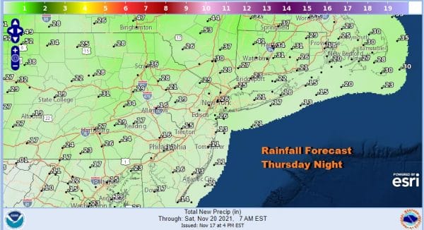
The showers and cold front are running well ahead of the upper trough which won’t be passing until early Saturday morning so the front and showers actually weaken as they approach. Rainfall amounts will be under a quarter of an inch and in some places even under a tenth of an inch.
Skies should clear out quickly tonight after 1am and that is good news regarding being able to see the almost total lunar eclipse which reaches peak around 4am. Lows by morning will be in the upper 30s and lower 40s. Friday look for partly sunny breezy and cold conditions with highs in the mid to upper 40s. The weekend will dry through Sunday afternoon. Saturday we will see sunshine with diminishing winds and highs in the low to mid 40s. Then as the next front approaches Sunday, look for sun and arriving clouds with highs in the 50s.
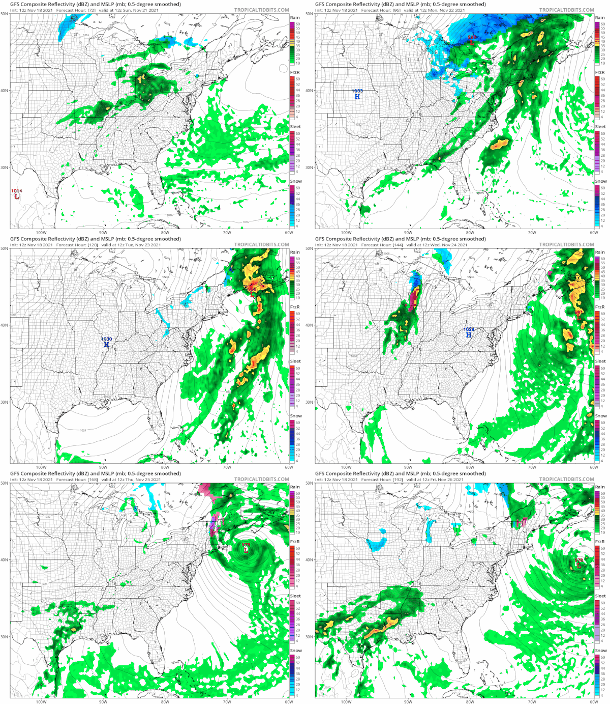
We are going to see rain from the cold front Sunday night into Monday afternoon. Normally that would be it as weather systems move along from west to east. However we have a strong blocking pattern that will be rapidly strengthening early next week and that complicates the forecast for the entire week. I don’t the precipitation is going to be the issue. Rather it will be the wind. The front will slow down to a crawl and a coastal low develops southeast of New England. It can’t move east because of the block so it will retrograde westward for a couple of days. This is going to keep us in a rather tight pressure gradient beginning late Monday and then tightening further Tuesday and Wednesday. Even Thursday Thanksgiving day will be a windy day. As the storm reacts to the block it might throw some precip, mostly rain, back to the coast Wednesday into Thursday but that is a tough call at this point. I’m thinking we will see winds gusting 20 to 30 mph into early Tuesday and then strengthen to 30 to 40 mph later Tuesday and lasting into at least early Thanksgiving day.
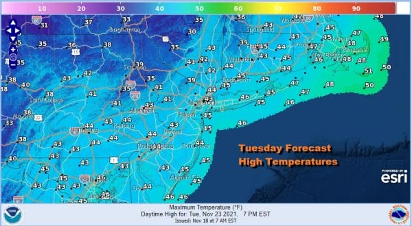
It will also turn sharply colder. Highs Monday will be in the leftover 50s but Tuesday and Wednesday will be quite cold for this time of year. Highs will be just into the 40s on those two days and we will also have changeable sky conditions. Winds will make it feel colder of course. Other than the risk for something coming in from the East most of next week should be dry. Below average temperatures will be with us all week long. Winds will only ease slightly Friday into Saturday as the low offshore moves away (slowly) and another cold front moves in with a re-enforcement of chilly air for the rest of Thanksgiving weekend. We will also need to watch low pressure coming out of the Gulf States. If the block remains strong that will likely be suppressed to the south. If the block weakens some, it could open the door for some precipitation next Sunday or Monday. Other than the wind, I think travelling around to get from point A to B this Thanksgiving should be manageable.
BE SURE TO DOWNLOAD THE FREE METEOROLOGIST JOE CIOFFI WEATHER APP &
ANGRY BEN’S FREE WEATHER APP “THE ANGRY WEATHERMAN!
MANY THANKS TO TROPICAL TIDBITS & F5 WEATHER FOR THE USE OF MAPS
Please note that with regards to any severe weather, tropical storms, or hurricanes, should a storm be threatening, please consult your local National Weather Service office or your local government officials about what action you should be taking to protect life and property.

