
DOWNLOAD MY NEW FREE JOESTRADAMUS WEATHER APP FOR ALL DEVICES
THE APP IS ABSOLUTELY FREE TO ALL BUT CONSIDERING SUBSCRIBING TO PATREON FOR A WEATHER EXPERIENCE FREE OF ADS, EXCLUSIVE VIDEOS FOR MEMBERS ONLY AND MUCH MORE…STARTS AT $2 A MONTH..MESSAGE ME AT ANY TIME
Sunshine Ahead Warmer Weather Late Week Weekend
Now that yesterdays weak little low has moved offshore and taken clouds out to sea we are in for a sunny couple of days here. The air is bone dry and cold. Temperatures this morning bottomed in the upper 20s and lower 30s and there is a bit of a breeze out there as well. This all leads to a cold day by late March standards with sunshine and highs in the 40s. The March sun continues to strengthen and that should take some of the sting out of the air. There are no issues regarding the radar today into Thursday.
SATELLITE

REGIONAL RADAR

Tonight & Wednesday we wash rinse repeat. Tonight is another clear cold night. Wednesday is another sunny chilly day with highs in the 40s to near 50. Thursday we should head into the 50s with sunshine and arriving clouds. There is a weather front to the north that will drop south but probably not make it. A shower or two is possible later Thursday night into Friday morning north of NYC, otherwise the front goes back the other way Friday and that sets us up for two warm days Friday and Saturday.
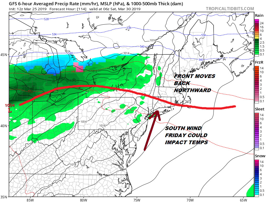
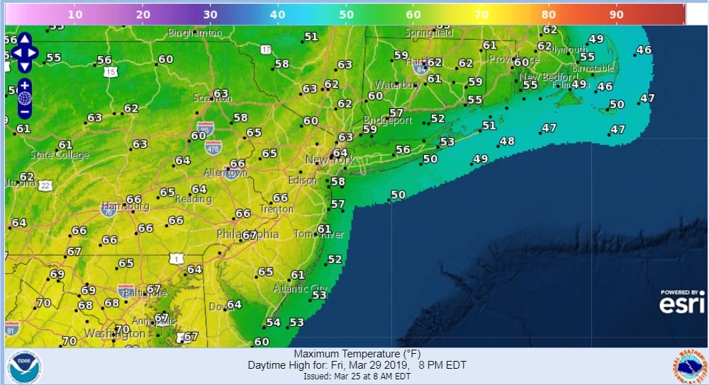
In the spring it is all about wind direction. If you are a south facing shoreline (Southern New England, Long Island, to some extent Coastal New Jersey) you struggle in the 50s. If you are inland with enough sun you get to see 60s. This is how we are playing it for Friday with clouds and some sun.
As for Saturday the wind will be more southwest which will mean higher temperatures both inland and the coast as long as there is enough sun. If there is then 70s are possible inland. The next cold front approaches Sunday with some showers but here too it will depend on timing. If the front can pass through late in the day we could squeeze out one more day of warmth before the front passes. We will address this more later today and look ahead to the first week of April.
MANY THANKS TO TROPICAL TIDBITS FOR THE USE OF MAPS
Please note that with regards to any tropical storms or hurricanes, should a storm be threatening, please consult your local National Weather Service office or your local government officials about what action you should be taking to protect life and property.


