DOWNLOAD MY NEW FREE JOESTRADAMUS WEATHER APP FOR ALL DEVICES
THE APP IS ABSOLUTELY FREE TO ALL BUT CONSIDERING SUBSCRIBING TO PATREON FOR A WEATHER EXPERIENCE FREE OF ADS, EXCLUSIVE VIDEOS FOR MEMBERS ONLY AND MUCH MORE…STARTS AT $2 A MONTH..MESSAGE ME AT ANY TIME
Better Weather Ahead Warmer Late Week Away From The Ocean
This evening we have a low moving off the Middle Atlantic states this evening with a narrow east west band of rain. This should move right along to the east. The northern fringe could reach just south of Route 78 and the south shore of Long Island for a couple of hours this evening and then the system pulls out to the east and good bye.
SATELLITE

REGIONAL RADAR

We are seeing the rain area enter the views of the local radars now as we head into the evening commute. Areas north of NYC will see nothing and actually have seen some breaks of sunshine during the mid to late afternoon. Once we are through the evening the low moves out, the rain ends and skies will start to clear. Colder air comes in and by morning lows will be in the 20s to lower 30s.
LOCAL RADAR NEW YORK CITY

LOCAL RADAR PHILADELPHIA


There are no important changes to the weather outlook going forward. Tuesday and Wednesday will be dry and cold with sunshine and highs in the 40s. Tuesday night into Wednesday morning it will be clear and cold with lows again in the 20s to lower 30s. We will start to warm things up on Thursday.
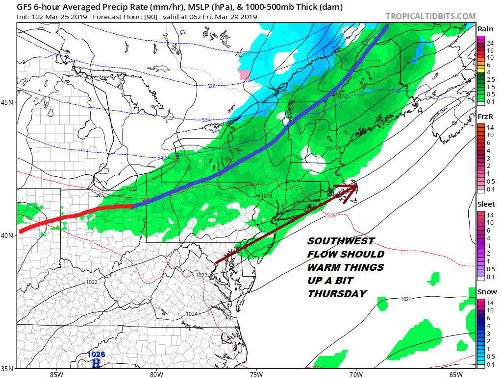
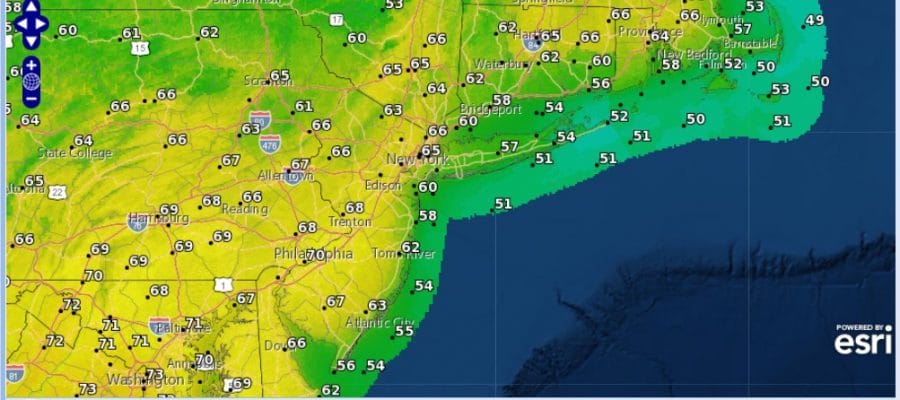
Two cold fronts are on the table this week. The first one is late Thursday and this one weakens and stalls pretty much over NYC before it starts backing up northward. There is a question of whether there might be a few showers ahead of the front Thursday night. It is quite possible that the GFS is overdone here and that most of the shower activity just falls apart. Ahead of it Thursday winds will be from the southwest which should allow temperatures to warm up into the 50s and 60s provided there is enough sunshine.
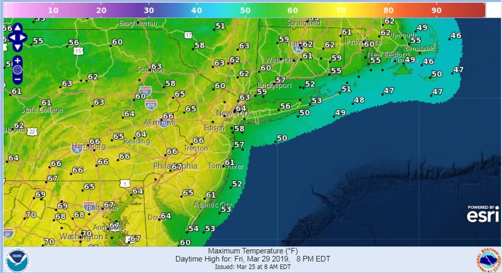
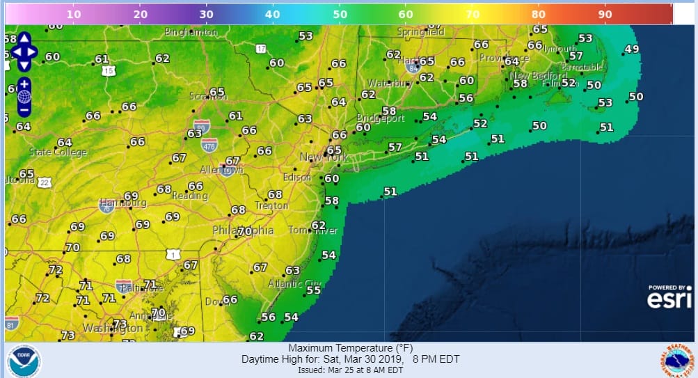
The front then backs up northward on Friday which keeps the inland areas in warmer air but along the coast you can see how the isobars (lines of equal pressure) are more southerly or south southwesterly. This means coastal areas like the Jersey shore and especially Long Island and Southern New England sit in the 50s all day while areas inland and west reach the 60s. 70 is not out of the question Friday and Saturday depending on sunshine.
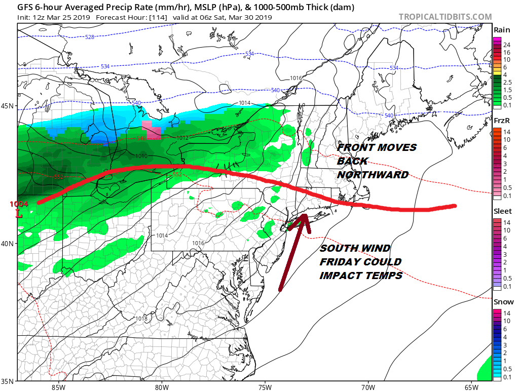
Another front moves through late Saturday night or early Sunday with a quick shot of showers and then it will be colder and dry for Sunday and into early next week. Quiet times storm wise are here for the Eastern US at least until maybe the middle of next week but that is just speculation at this point.
MANY THANKS TO TROPICAL TIDBITS FOR THE USE OF MAPS
Please note that with regards to any tropical storms or hurricanes, should a storm be threatening, please consult your local National Weather Service office or your local government officials about what action you should be taking to protect life and property.