Sunday Monday Sunshine Spring 60s Tuesday Clouds Rain
Sunday Monday Sunshine Spring 60s Tuesday Clouds Rain
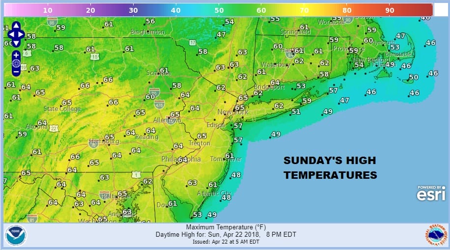
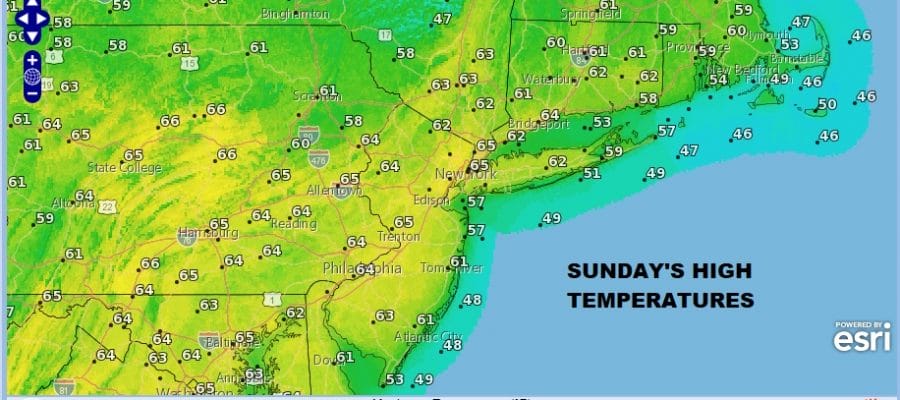
Get set for the third day of sunshine in a row as we continue to see high pressure over the Great Lakes remaining in full control of our weather. The next storm system continues to move slowly across the Gulf States with some showers and thunderstorms but there isn’t a widespread outbreak of severe weather going on. For us other than some occasional high clouds we will see sunshine both today an Monday with highs into the low and middle 60s.
US SATELLITE

REGIONAL RADAR

There really isn’t much change in the outlook from yesterday. Tuesday we will see arriving clouds with some rain developing later in the day from Southeastern Pennsylvania to Southern New Jersey and reaching NYC, Southern New England and Long Island by early evening. The rains will move out on Wednesday with leftover clouds to follow. With several weather systems on the map, models are having a tough time figuring out how they all interact with each other if at all. This could mean for some improvement on Thursday into Friday as the next system stays week. Then a cold front follows Saturday with some showers before it dries out again next Sunday. For now just carry on and enjoy the beautiful Sunday and we will worry about the rest of it on Monday.
 GET JOE A CIGAR IF YOU LIKE

FiOS1 News Weather Forecast For Long Island
FiOS1 News Weather Forecast For New Jersey
FiOS1 News Weather Forecast For Hudson Valley


