Summer Weather Sunday Sunshine Near 90 Moderate Humidity

A weak cold front is moving through the area this morning with no showers or thunderstorms. The front will take the humidity and knock it down a notch or two. In the meantime the satellite picture this morning shows mostly cloud free conditions and we will see plenty of sunshine with nothing more than a few passing clouds. No showers or thunderstorms are forecast today with highs reaching the upper 80s and lower 90s. There won’t be much of a sea breeze at area beaches today so bear that in mind if you are headed to the shore. Radars will be in silent mode across much of the Northeast and Northern Mid Atlantic into Tuesday.
SATELLITE

REGIONAL RADAR

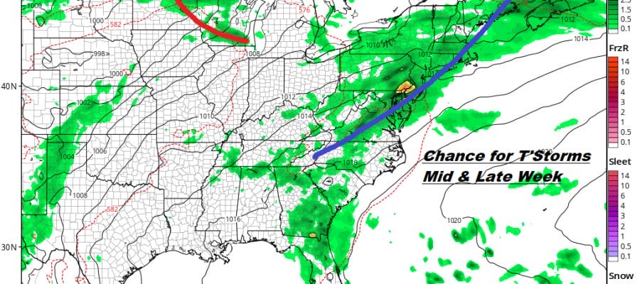
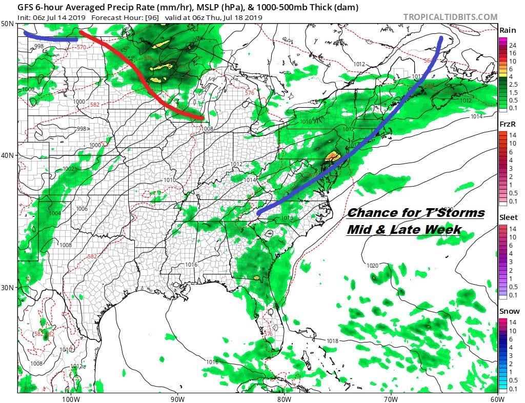
Tonight we see no issues with clear skies and most lows in the 60s to near 70. Monday will be nice and sunny with most highs in the 80s with reasonable humidity. Then we will start to see the temperatures edge higher and the humidity move higher as well beginning on Tuesday as highs reach the upper 80s to lower 90s. There is the chance for an isolated shower or thunderstorm well inland in Pennsylvania late in the day. The chance for thunderstorms will increase everywhere on Wednesday as will temperatures. The next weather front approaches which affords a good chance for late day thunderstorms. Highs could reach 90 to 95 in many areas.
The air behind this front is about as warm as the air ahead of it and we will need to wait until next weekend to see a break in the summer pattern. Honestly though when you look at the weather right now it is about as typical for mid July as you can get. We remain very close to the boundary of the jet stream which will continue to send disturbances along every couple of days. In fact the long range suggests that the jet stream will become more active in the east in the coming weeks. This will be interesting to see if this is coupled with any kind of tropical storm development as we head toward the end of the month and beginning of August.

The northern part of the jet stream flares up next weekend and this will likely bring a series of cold fronts through the Northeast and into the Middle Atlantic states. This will keep any prolonged heat and humidity in check which has been the general theme of the summer so far. Late week brings hot humid weather Thursday and Friday with the chance for late day showers and thunderstorms. There will be some shots of drier air behind each front. We are in the hottest 3 weeks of the summer climate wise and right now it doesn’t look like we will have any long duration heatwaves to worry about.
MANY THANKS TO TROPICAL TIDBITS FOR THE USE OF MAPS
Please note that with regards to any tropical storms or hurricanes, should a storm be threatening, please consult your local National Weather Service office or your local government officials about what action you should be taking to protect life and property.


