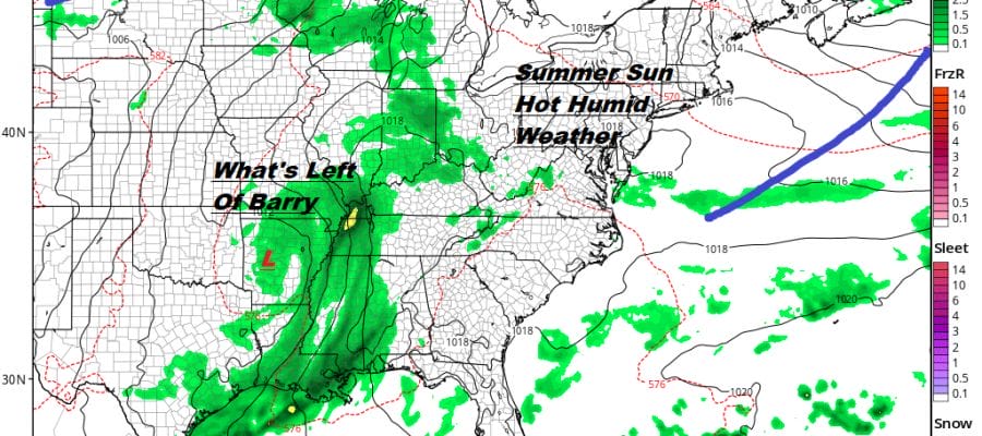
Summer Weather Continues Next Week Tropical Storm Barry Well Inland
The first half of our July summer weekend is coming to an end with no major issues and a very quiet satellite and radar for this evening and overnight. Skies for the most part are clear. We do have a weak cold front that is moving across Western NY with a few showers and thunderstorms showing on the regional radar. However those showers will die out in the next several hours and by the time the front comes through here early Sunday morning it will do nothing more than shift the winds around to the northwest. Most lows tonight will be in the upper 60s and lower 70s.
SATELLITE

REGIONAL RADAR

The front will simply knock the dew points down on Sunday by a notch or two leaving us with plenty of sunshine with slightly lower humidity. With a northwest wind and slightly lower humidity it actually could be a shade hotter on Sunday with highs in the upper 80s to lower 90s. No showers or thunderstorms are forecast for Sunday making for a perfect beach or pool day.
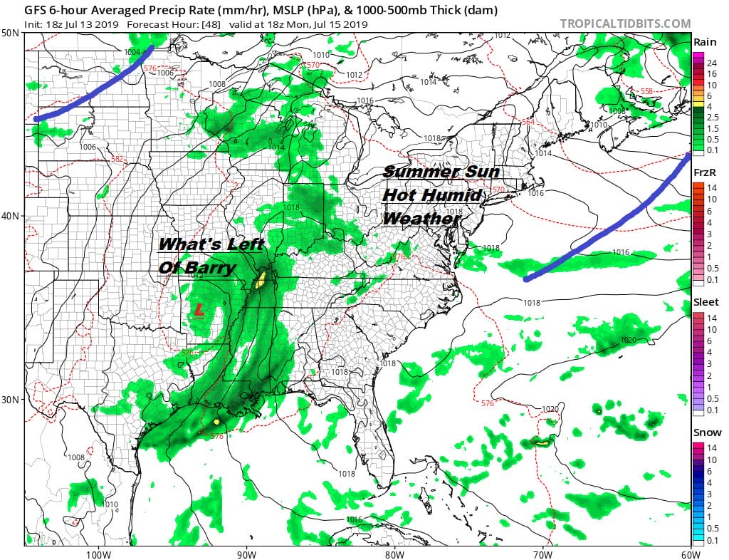
Next week brings summer heat and summer humidity but quite frankly it doesn’t look to me like it gets too out of hand. Monday and Tuesday we will see sunshine both days with highs in the upper 80s to around or just over 90. There is a slight chance for an isolated inland thunderstorms. A slightly stronger weather front approaches Wednesday making for a hot day with highs reaching into the lower 90s and perhaps a better chance for thunderstorms later in the day. We will stay very warm to borderline hot and humid into Friday when a stronger cold front approaches for a better chance for thunderstorms going into next weekend. I really don’t see anything to unusual at this point as we head into the peak of the summer season.
Barry Weakens As It Crawls Northward Through Louisiana
Barry came ashore as a minimal hurricane this afternoon and quite frankly it really looked rather pathetic in terms of the satellite structure. The system from the onset had this elongated look stretched out east west. Many areas could have seen the system move inland and not know the difference. However some areas in Southeast Louisiana did experience storm surge and heavy rain flooding. You can see the circulation center on the Lake Charles radar inching northward. Heavy rains are east and south of the circulation center and rain is going to be the issue overnight and on Sunday,
LOCAL RADAR LAKE CHARLES LA

LOCAL RADAR NEW ORLEANS


Given the upper flow across the US I don’t expect any of these rains to get involved with any system heading toward us. Barry will gradually rain itself out over the Lower or Middle Mississippi Valley over the next 4 days or so. Some areas there will see substantial flooding with 10 or more inches of rain forecast.
MANY THANKS TO TROPICAL TIDBITS FOR THE USE OF MAPS
Please note that with regards to any tropical storms or hurricanes, should a storm be threatening, please consult your local National Weather Service office or your local government officials about what action you should be taking to protect life and property.


